Maps of Czech Republic

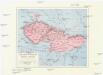
Historická mapa zemí Koruny České od XV. stol. a dnešní Slovensko

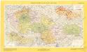
Sbírka map a diagramů použitých na mírových konferencích v Paříži v letech 1919 - 1920

Czechoslovakia.
From Czechoslovakia
Československá republika

Československo v mapách
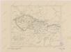
Mapa historického vývoje Československého státu (od XIV. do XIX. století)
Sbírka map a diagramů použitých na mírových konferencích v Paříži v letech 1919 - 1920
Les Pays Tchéques
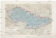
Morava (Česko) Conseil National Tschécoslovaque
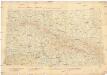
III. vojenské mapování 3959
1 : 75000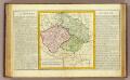
La Boheme, la Silesie.
1 : 3800000 Clouet, J. B. L. (Jean-Baptiste Louis), b. 1730
Sbírka map a diagramů použitých na mírových konferencích v Paříži v letech 1919 - 1920

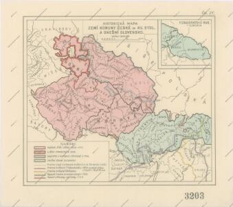
Mapa vývoje České koruny od XIV. století
1 : 3900000 Česko Hocke, Jan Kapras, Jan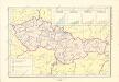
Historický atlas revolučního hnutí
Přehled kladu mapových listů měř. 1:10 000, 25 000, 50 000, 100 000
Sbírka map a diagramů použitých na mírových konferencích v Paříži v letech 1919 - 1920
Dermahliges Kriegs-Theatrum oder neue und accurate Landkarte das gantze Königreich Böheim, Herzogthum Schlesien, und die Marggrafthümer Mähren, Ober- und Nieder Lausitz, nebst einen großen Theil von Ober Sachsen, March-Brandenburg, Königreich Pohlen und Hungarn, dann Ertz-Herzogthum Oesterreich begreiffend
1 : 970000 Braniborsko (Německo) Lidl, Johann Jakob Johann Jacob Lidl
Republika Československá
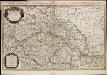
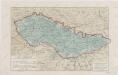
Estats de la couronne de Boheme qui comprennent le Royaume de Boheme le Duché de Silesie et les Marquisats de Moravie et de Lusace / par le Sr. Sanson, geographe ordinaire du Roy
1 : 925000 Annotatie: Auec priuilege du Roy, pour vingt ans; Koptitel: Estats de la couronne de Boheme, ou sont le Royaume de Boheme, le Duché de Silesie, les Marquisats de Moravie, et de Lusace, subdivisés en leurs principales parties, dressé sur les memoires les plus nouueaux, par le Sr. Sanson ...; Origineel is Blad 126 in atlas factice; Annotatie geografische gegevens: Met 6 schaalstokken Guillaume Sanson 1633-1703 A Paris : chez H. Iaillot, joignant les grands Augustins, aux deux globes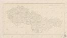
Bez titulu: Československo
Tchéco-Slovaquie
1 : 1000000 Československo Fond établi per le Service Géographique Britannique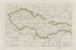
Sbírka map a diagramů použitých na mírových konferencích v Paříži v letech 1919 - 1920

Československo v mapách
Sbírka map a diagramů použitých na mírových konferencích v Paříži v letech 1919 - 1920
Reise-Charte durch das Königreich Böhmen Hertzogthum Schlesien Marggrafthum Maehren und Lausitz
1 : 296000 Lužice (Německo) Schreiber, Johann Georg J.G. Schreibern
Přehledná letecká mapa Republiky československé: Carte aéronautique d'ensemble de la République Tchécoslovaque
Vojenský zeměpisný ústav
59-60. Cecoslovacchia, Ungheria.
1 : 1500000 Touring club italiano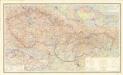
Čechoslovakija

Il Regno di Boemia la Slesia Prussiana ed Austriaca noc li Marchesati di Muravia e Lusazia
Pays Tcheques
1 : 1850000 Československo Larouse