Maps of Poland

Czechoslovakia.
From Czechoslovakia
Rand McNally Popular map of Germany and Hungary
1 : 3992000 Rand McNally & Company
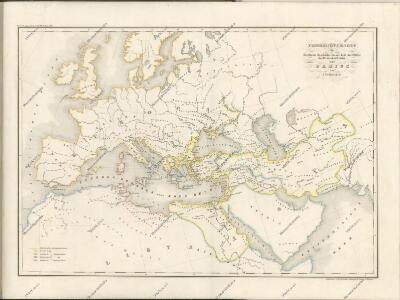
[XIII], uit: Geognostische Karte des Oesterreichischen Kaiserstaates mit einem grossen Theile Deutschland's u. Italien / hauptsachlich nach ... Haidinger's geognostischer Karte dieses Staates bearb. von Josef Scheda
1 : 3000000 titelvariant: General-Karte von Europa in 25 Blättern; Annotatie: Bijlage bij: General-Karte von Europa in 25 Blättern. - 1:2.592.000. - 1845-1847 Scheda, Joseph Wien : K.K. Militär. Geografisch. Institut
Obec českého národa
1 : 3400000 Evropa střední Kuffner, Hanuš
Die Haupt-Verkehrs-Richtungen auf deutschen Eisenbahnen hinsichtlich ihrer merkantilen Bedeutung durch Farben veranschaulicht
1 : 2000000 Loeben, W.K. von Weingartner
Mapa historického vývoje Československého státu (od XIV. do XIX. století)

Sbírka map a diagramů použitých na mírových konferencích v Paříži v letech 1919 - 1920
Bunt- und Edelmetallbergbau und Saigerhütten in Mitteleuropa 1419-1540
Mitteleuropa Bergbau, Hüttenindustrie
Prussia.
1 : 2600000 Mitchell, Samuel Augustus
Prussia.
1 : 2600000 Mitchell, Samuel Augustus
Velkoněmecká říše, Protektorát Čechy a Morava, Gen.- Guvernement, Slovensko a Švýcarsko

Die hist. Entwicklung von Brandenburg-Preussen seit 1415
Mitteleuropa, Preußen, Expansion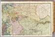
France 2.
1 : 1170000 Brue, Adrien Hubert, 1786-1832; Herisson, Eustache, b. 1759
Allemagne, Pologne, Tchecoslovaquie.
1 : 2500000 Vivien St Martin, L.
Territoriale Entwickelung des Brandenburg-Preussischen Staates
Volksschul-Atlas über alle Teile der Erde Lange, Henry Druck und Verlag von Georg Westermann
Germany, Switzerland, Holland.
1 : 6500000 Peterson, Augusts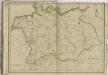

Mapa vývoje České koruny od XIV. století
1 : 3900000 Česko Hocke, Jan Kapras, Jan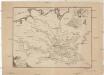
Ideal Postcharte von Boehmen
Evropa střední Berka, Jan Wenzel Schwarz
Ideal Postcharte von Boehmen
Evropa střední Berka, Jan Wenzel Schwarz
Letecká navigační mapa
Československá republika

Austrian Dominions.
1 : 5200000 Arrowsmith, Aaron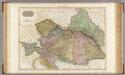
Austrian Dominions.
1 : 1930000 Pinkerton, John, 1758-1826
Austrian Dominions.
1 : 5200000 Arrowsmith, Aaron
Illustrirte politische Karte von Österreich und den angränzenden Ländern
Evropa jihovýchodní
Eastern Germany, distribution of population.
1 : 2400000 Covers Poland, East Prussia, and border areas of Germany and Czechoslovakia. "From: Atlas des deutschen Lebensraumes in Mitteleuropa, plate 27. Data as of 1930-1934." "No. A-6287." United States. Office of Strategic Services. Research and Analysis Branch. [Washington, D.C.] : R & A, OSS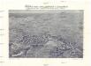
Plastická mapa zemí Sudetských a Karpatských
Evropa střední E. Šolc