Maps of Switzerland

Bern
1 : 500000 Gotha : Justus Perthes
France.
1 : 5385600 Lucas, Fielding Jr.
Composite: Sud-West Deutschland, Schweiz.
1 : 925000 Vogel, C.
Helvetia ab antiquo pars Imperii Romano-Germanici. Sed per pacem Westphalicam 1648 sui juris facta, comprehendit Status imperiales quosdam certi juris, ut Episcopatum Basileensem inter Socios, alios dubii juris, ut Episc. Chur, alios titulares tantum, ut abb. S. Galli, Pfeffers, Stein, S. Iohann, Disentis, Einsiedel; quorum in gratiam mappa haec designata exhibetur
1 : 2200000 Mollova mapová sbírka Franz, Johann Michael Homann, Johann Baptista - dědici
<<Les>> 13 cantons suisses et leurs allietz
1 : 3500000 1 Karte [Alain Manesson Mallet] [in verlegung Johann David Zunners], [Franckfurt am Mayn]
<<[Die>> gantz Eydgnoschafft]
1 : 850000 1 Karte [Johannes Stumpf] [Verlag nicht ermittelbar], [Erscheinungsort nicht ermittelbar]
Smulders' kompas van het westelijk front
1 : 570000 Annotatie: Met informatie over o.a. inwoneraantal en productiegoederen van een aantal landen in de wereld; Annotatie geografische gegevens: De kaart toont de Maginotlinie en de Siegfriedlinie 's-Gravenhage : Smulders
Théatre de la guerre, ou carte des frontières de la république française et de l'empire d'Allemagne, 2
1 Teil : Delamarche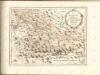

Helvetia
1 : 1900000 1 Karte [Zacharias Heyns] [pour Zacharie Heyns, à l'Enseigne des trois vertus], [Amsterdam]
<<Die>> vierdt Landtafel haltet inn die alt Helvetiam Iulii Cesaris mit iren Anstössen wie die im vierdten Buoch verzeichnet wirt
1 : 700000 1 Karte [Johannes Stumpf] [Froschauer], [Zürich]
Helvetia
1 : 1400000 1 Karte Aegidio Tschudo auctore ; Johan Bussemecher excudit [ex officina Iani Bussemechers], [Coloniae]
Helvetiae descriptio
1 Karte : Kupferdruck ; 34 x 44 cm Tschudi; Ortelius s.n.
Helvetiae descriptio
1 Karte : Kupferdruck ; 35 x 45 cm Tschudi; Ortelius s.n.
Kurtz verzeichnete Vorstellung dess alten Helvetier-Lands mit ihren Anstoessen nach Julii Caesaris Beschreibung
1 Karte [Johannes Stumpf] [Verlag nicht ermittelbar], [Erscheinungsort nicht ermittelbar]
<<Die>> dreyzehend Tafel haltet inn ein Verzeichnung der loblichen Eydgnoschafft und irer Zuogewandten sampt dem Alpgebirg und nächsten Anstössen
1 : 850000 1 Karte [Johannes Stumpf] [Wieland], [Gattikon]
[Southwest Germany]
1 : 1400000 [S.l. : s.n.]
Uebersichts-Karte der Schweiz
1 : 1050000 1 Karte für den Schulgebrauch bearbeitet von Rudolph Gross ; gestochen von Rixinger u. Graf Ch. Beyel, Frauenfeld
Karte der Schweiz mit Rücksicht auf die Post-Strassen
1 : 1350000 1 Karte nach Hrch. Keller ; Lith. von J. Kull bei J.H. Locher, Zürich
Taschen-Atlas der Schweiz
1 Atlas (25 S., 20 Taf.) gezeichnet und gestochen von Emil Wagner = Atlas de poche de la Suisse : 26 cartes en couleurs / dessinées et gravées par Émile Wagner Eggimann, Genf
Kurtz verzeichnete Vorstellung dess alten Helvetier-Lands mit ihren Anstoessen nach Iulii Caesaris Beschreibung
1 : 700000 1 Karte [Johannes Stumpf] [Verlag nicht ermittelbar], [Zürich?]
<<Die>> erst Tafel innhaltend das Schweytzerlandt mit anstossenden Ländern
1 : 750000 1 Karte [Sebastian Münster] [Henricpetri], [Basel]
Helvetiae Descriptio [Karte], in: Theatrum orbis terrarum, S. 77.
1 Karte aus Atlas Ortelius, Abraham
Helvetiae Descriptio [Karte], in: Theatrum orbis terrarum, S. 182.
1 Karte aus Atlas Ortelius, Abraham
<<Die>> dreyzehend Tafel haltet inn ein Verzeichnung der loblichen Eydgnoschafft und irer Zuogewandten sampt dem Alpgebirg und nächsten Anstössen
1 : 900000 1 Karte [Johannes Stumpf] [Froschauer], [Zürich]
Helvetiae Descriptio [Karte], in: Theatrum orbis terrarum, S. 277.
1 Karte aus Atlas Ortelius, Abraham Vrients, Jan Baptista
Helvetiae descriptio
1 : 900000 1 Karte Aegidio Tschudo auct. ; [Abraham Ortelius fecit] [apud Aegid. Coppenium Diesth], [Antverpiae]
Helvetische Republik eingetheilt in Cantone und Districte
1 : 1300000 1 Karte [Johann Jakob Scheurmann] [Orell Füssli & Co.], [Zürich]
Karte der Schweiz
1 : 1000000 1 Karte von C.G. Wenng Verlag von Caesar Schmidt, Zürich


