Maps of Germany

[Geognostische Karte von Mittel-Europa, II (Oestl.) Haelfte]
Grosser Hand-Atlas über alle Theile der Erde in 170 Karten Meyer, J. Verlag des Bibliographischen Instituts
Politische Übersicht von Central-Europa
Mitteleuropa
Austria. Prussia and Saxony.
1 : 4300000 Schonberg & Co.
Deutschland
Schul-Atlas in 36 Karten Völter, Daniel Verlag der J.M. Dannheimer'schen Buchhandlung
Mittel-Europäische Staaten
Hand-Atlas über alle Theile der Erde nach dem neuesten Zustande und über das Weltgebäude Stieler, Adolf bei Justus Perthes

Germania Augustiniana
1 : 2600000 Mollova mapová sbírka Seutter, Matthäus Seutter, Matthäus
Germany.
from A new systeme of the mathematicks: containing I. Arithmetick, as well natural and decimal, as in species, or the principles of algebra. II. Practical geometry, together with the first six books of Euclid's Elements, as also the eleventh and twelfth, symbo
Empire of Germany.
1 : 2450000 Johnson, A.J.
Fluss- und Gebirgs-Karte von Mittel-Eüropa
1 : 4900000 Evropa střední Handtke, Friedrich C. Flemming
Neueste Post und Reise Karte der wichtigsten und besuchtesten Theile Europa's
1 : 3700000 Evropa střední Kliewer, Friedrich Wilhelm Heymann, Carl Carl Heymann
Post- und Eisenbahn-Reisekarte, Deutschland Holland, Belgien, die Schweiz, Italien bis Neapel, der größte Theil von Frankreich, Ungarn, Polen etc
Belgie Hanser, Gustav Serz & C.ie
Post- und Eisenbahn-Reisekarte, Deutschland Holland, Belgien, die Schweiz, Italien bis Neapel, der größte Theil von Frankreich, Ungarn, Polen etc
Belgie Hanser, Gustav Serz
Post- und Eisenbahn-Reisekarte
Belgie Hanser, Gustav Serz & C.ie
Post- und Eisenbahn-Reisekarte, Deutschland Holland, Belgien, die Schweiz, Italien bis Neapel, der größte Theil von Frankreich, Ungarn, Polen etc
Belgie Hanser, Gustav A. Paterno's W.we & Sohn
Post- und Eisenbahn-Reisekarte, Deutschland Holland, Belgien, die Schweiz, Italien bis Neapel, der größte Theil von Frankreich, Ungarn, Polen etc
Belgie Hanser, Gustav A. Paterno's W.we & Sohn
Mittel-Europäische Staaten
Stieler's Hand-Atlas Stieler, Adolf bei Justus Perthes
VIII. Charte für die allgemeine Geschichte von Rudolph von Habsburg bis auf Carl V : d.i. von 1273-1519 nach Christus
Entworfen von F.W. Benicken gez. von C.F. Weiland ; in Stein gravirt v. Ant. Falger Weimar : im Verlage des L. Industrie-Comptoirs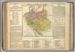
German Empire.
1 : 6200000 Lavoisne, M.
Sbírka map a diagramů použitých na mírových konferencích v Paříži v letech 1919 - 1920

Neueste Eisenbahn-Karte von Central-Europa
Evropa střední Hendschel, U. Carl Jügel
Der Deutsche Bundesstaat in 23 Republiken nach Struve's Grundrechten des deutschen Volks
1 : 4500000 Lithogr. von F. Bruder in Basel Basel : [s.n.]
Neue Ausgabe von Schulz's praktischer Reise-Karte mit Angabe der Distanzen und Eisenbahnen
Evropa střední Schulz, R. A. Artaria & Co.
Deutschland
1 : 3500000 Evropa střední Handtke, Friedrich Carl Flemming
Composite Map: Map of the Central States of Europe Situate between France and Russia
1 : 1200000 Faden, William (1749-1836)
Mitteleuropa 1991
Mitteleuropa Kunz, Andreas ; Treiling, Thomas
Neueste Karte vom Deutschen Reich der Oesterreichisch-Ungarischen Monarchie, der Schweiz, den Niederlanden, Belgien, Rumänien, nebst Theilen der angrenzenden Länder.mit besonderer Rücksicht auf Handel & Verkehrs-Interessen sowie zum Hand- und Comptoir-Gebrauch
mapa VKOL Baur, Carl Friedrich A. Hartleben's Verlag
Deutschland, Niederlande, Belgien und Schweiz
Schul-Atlas über alle Theile der Erde nach dem neuesten Zustande, und über das Weltgebäude Stieler, Adolf Justus Perthes
Deutschland
[Allgemeiner Atlas über alle Theile der Erde in 29 Blättern] Ziegler, Jakob Melchior Top. Anstalt v. J. Wurster u. Comp.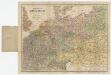
![[Geognostische Karte von Mittel-Europa, II (Oestl.) Haelfte]](https://images-2.georeferencer.com/images/iiif/121849440030/full/,300/0/native.jpg)

