Maps of Germany


Politische Übersicht von Central-Europa
Mitteleuropa
Post- und Eisenbahn-Reisekarte, Deutschland Holland, Belgien, die Schweiz, Italien bis Neapel, der größte Theil von Frankreich, Ungarn, Polen etc
Belgie Hanser, Gustav Serz & C.ie
Post- und Eisenbahn-Reisekarte, Deutschland Holland, Belgien, die Schweiz, Italien bis Neapel, der größte Theil von Frankreich, Ungarn, Polen etc
Belgie Hanser, Gustav Serz
Post- und Eisenbahn-Reisekarte
Belgie Hanser, Gustav Serz & C.ie
Post- und Eisenbahn-Reisekarte, Deutschland Holland, Belgien, die Schweiz, Italien bis Neapel, der größte Theil von Frankreich, Ungarn, Polen etc
Belgie Hanser, Gustav A. Paterno's W.we & Sohn
Post- und Eisenbahn-Reisekarte, Deutschland Holland, Belgien, die Schweiz, Italien bis Neapel, der größte Theil von Frankreich, Ungarn, Polen etc
Belgie Hanser, Gustav A. Paterno's W.we & Sohn
Post - und Eisenbahn – Reisekarte Deutschland

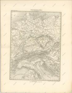
Mittel-Europäische Staaten
Hand-Atlas über alle Theile der Erde nach dem neuesten Zustande und über das Weltgebäude Stieler, Adolf bei Justus Perthes
Imperivm Romano Germanicvm sub Maximil. I.
1 : 10000000 Mollova mapová sbírka Franz, Johann Michael Homann, Johann Baptista - dědici
[Geognostische Karte von Mittel-Europa, II (Oestl.) Haelfte]
Grosser Hand-Atlas über alle Theile der Erde in 170 Karten Meyer, J. Verlag des Bibliographischen Instituts
Deutschland
Schul-Atlas in 36 Karten Völter, Daniel Verlag der J.M. Dannheimer'schen Buchhandlung
Neueste Post und Reise Karte der wichtigsten und besuchtesten Theile Europa's
1 : 3700000 Evropa střední Kliewer, Friedrich Wilhelm Heymann, Carl Carl Heymann
General-Karte von Deutschland, der batavischen und helvetischen Republik, ober und mittel Italien und dem ostlichen Theil der franzosischen Republik... nach den Bestimmungen der neuesten Friedens-Schlusse und Conventionen, ingleichen nach astronomischen Ortsbestimungen und den verzuglichsten Hulfsmitteln, auf Kosten der konig. Akad. der Wissenschaften in Berlin
1 : 2018182 Sotzmann, Daniel Friedrich 1754-1840 Berlin :
Mittel-Europäische Staaten
Stieler's Hand-Atlas Stieler, Adolf bei Justus Perthes
Germania Augustiniana
1 : 2600000 Mollova mapová sbírka Seutter, Matthäus Seutter, Matthäus

Post und Eisenbahn - Reisekarte Deutschland, Holland, Belgien...


Imperivm Francicvm vel Romano-Germanicvm svb Ottone I. & Conrado II.
1 : 11000000 Mollova mapová sbírka Homann, Johann Baptist Homann, Johann Baptista - dědici
Imperivm Romano-Germanicvm sub exitum Caroli VI Austriaci.
1 : 11000000 Mollova mapová sbírka Homann, Johann Baptist Homann, Johann Baptista - dědici
Germany.
from A new systeme of the mathematicks: containing I. Arithmetick, as well natural and decimal, as in species, or the principles of algebra. II. Practical geometry, together with the first six books of Euclid's Elements, as also the eleventh and twelfth, symbo
Neueste Eisenbahn-Karte von Central-Europa
Evropa střední Hendschel, U. Carl Jügel
Neue Ausgabe von Schulz's praktischer Reise-Karte mit Angabe der Distanzen und Eisenbahnen
Evropa střední Schulz, R. A. Artaria & Co.
Germania, Dacia.
1 : 13000000 Fenner, Rest.
Germany, Switzerland, N. Italy.
1 : 5300000 Mitchell, Samuel Augustus
Carte élémentaire et statistique de l'Allemagne
1 : 2700000 Brion de La Tour, Louis Brion & Maire
Übersichtskarte der Staaten von Mitteleuropa

Völkerkarte von Mitteleuropa
1 : 9000000 Mitteleuropa Ethnische Gruppe