Maps of Germany

Composite Map: Map of the Central States of Europe Situate between France and Russia
1 : 1200000 Faden, William (1749-1836)
Rozsah moci význačných českých panovníků do XIV. stol.
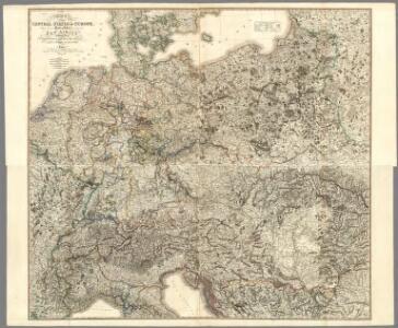
Carte Politique de L'Europe Centrale.
1 : 3600000 Jouvet et Cie.
Neueste Karte vom Deutschen Reich der Oesterreichisch-Ungarischen Monarchie, der Schweiz, den Niederlanden, Belgien, Rumänien, nebst Theilen der angrenzenden Länder.mit besonderer Rücksicht auf Handel & Verkehrs-Interessen sowie zum Hand- und Comptoir-Gebrauch
mapa VKOL Baur, Carl Friedrich A. Hartleben's Verlag
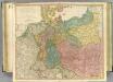
Map of the Empire of Germany.
1 : 1250000 Delarochette, Louis Stanislas d'Arcy
Sbírka map a diagramů použitých na mírových konferencích v Paříži v letech 1919 - 1920

Fluss- und Gebirgs-Karte von Mittel-Eüropa
1 : 4900000 Evropa střední Handtke, Friedrich C. Flemming
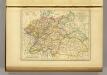
Mittel-Europäische Staaten
Hand-Atlas über alle Theile der Erde nach dem neuesten Zustande und über das Weltgebäude Stieler, Adolf bei Justus Perthes
Deutsches Reich. Niederlande, Belgien & Schweiz
Adolf Stieler's Handatlas über alle Theile der Erde und über das Weltgebäude Stieler, Adolf Justus Perthes
Nr. 8a. Die Germanisierung des Ostens
Ostmitteleuropa Deutsche, Siedlung
Germanie Ancienne.
1 : 5300000 Monin, C.V.
Mitteleuropa am Ende des 30 jährigen Krieges
Evropa střední F. Tempsky
Mitteleuropa während des 30 jährigen Krieges.
Evropa střední Benecke Bormann, E. F. Tempsky
Der Deutsche Bund samt der Helvetischen Eidgenossenschaft aft. 1828
Historisch-genealogisch-geographischer Atlas von Le Sage Las Cases, Emmanuel Auguste Dieudonné Marius Joseph de Johann Velten, Kunsthändler
Deutschland
E. von Sydow's Schul-Atlas in sechs und dreissig Karten Sydow, Emil von bei Justus Perthes
Közép-Európa
1 : 5000000 Evropa střední Állami kiadóhivatal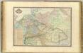
Europe Centrale.
1 : 3000000 Garnier, F. A., 1803-1863
Mitteleuropa
1 : 3500000 Evropa střední Köcher
Rozsah moci význačných českých panovníků do XIV. stol.
l'Allemagne par Cercles in 1789.
1 : 6300000 Malte-Brun, Conrad, 1775-1826
Deutschland
Allgemeiner Atlas [Walch, Johannes] im Verlag bei Johannes Walch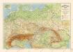
Grossdeutsches Reich und angrenzende Gebiete

R.A. Schulz's neue praktische Reise-Karte mit Angabe der Distanzen
Evropa střední Schulz, R. A. Biller, Dominik Artaria & Co.
R.A. Schulz's neue praktische Reise-Karte mit Angabe der Distanzen
Evropa střední Schulz, R. A. Artaria & Co.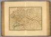
Empire d'Allemagne, Hongrie, Gallicie, Prusse, Provinces-Unies de Pays-Bas en 1789.
1 : 3500000 Picquet, C.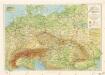
Příruční mapa střední Evropy

Mittel-Europäische Staaten
Stieler's Hand-Atlas Stieler, Adolf bei Justus Perthes
Fluss- u. Gebirgs-Karte, Mittel-Europa.
1 : 4500000 Flemming, Carl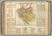
German Empire.
1 : 6200000 Lavoisne, M.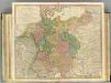
German Empire.
1 : 2150000 Faden, William, 1750?-1836