Mapa catalogado
Germany.
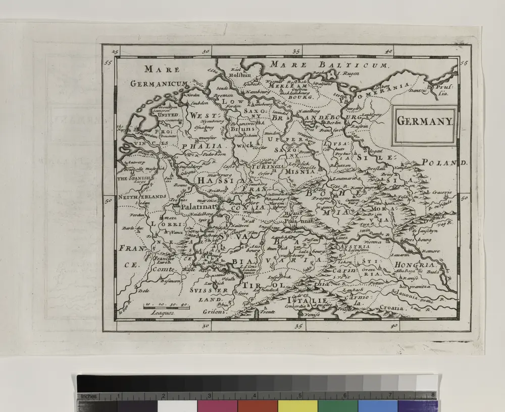

Título completo:Germany.
Año de ilustración:1681
Tamaño físico:20 x 30 cm
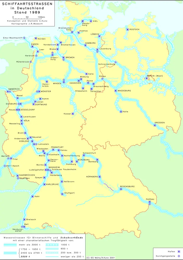
Schiffahrtsstraßen in Deutschland Stand 1989
1989
Kunz, Andreas ; Moeschl, Joachim Robert
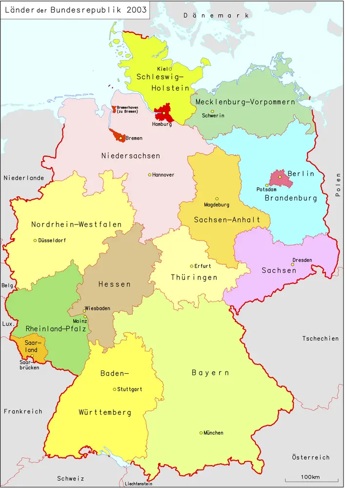
Länder der Bundesrepublik 2003
2003
Kunz, Andreas ; Moeschl, Joachim Robert
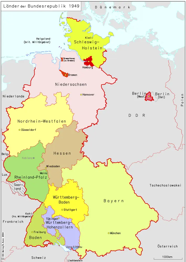
Länder der Bundesrepublik 1949
1949
Kunz, Andreas ; Moeschl, Joachim Robert
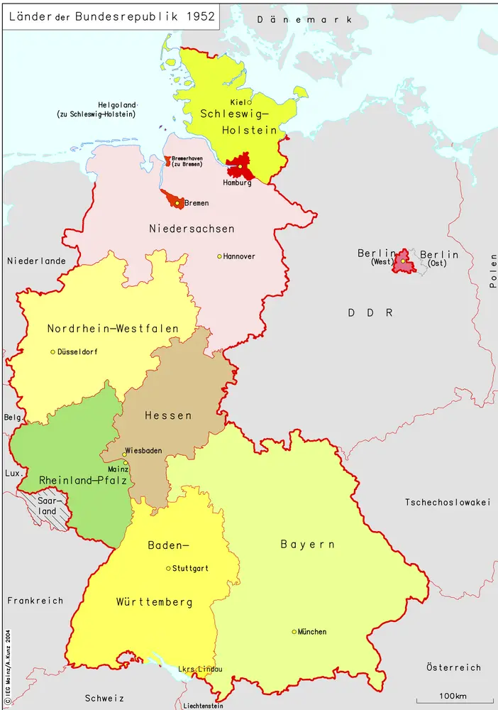
Länder der Bundesrepublik 1952
1952
Kunz, Andreas ; Moeschl, Joachim Robert
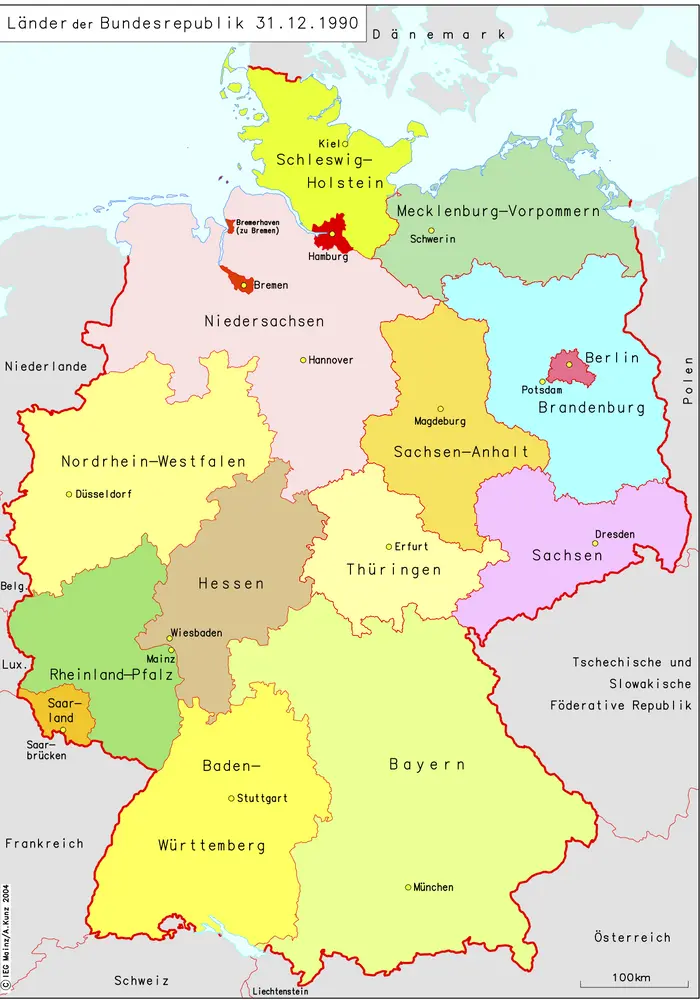
Länder der Bundesrepublik 31.12.1990
1990
Kunz, Andreas ; Moeschl, Joachim Robert
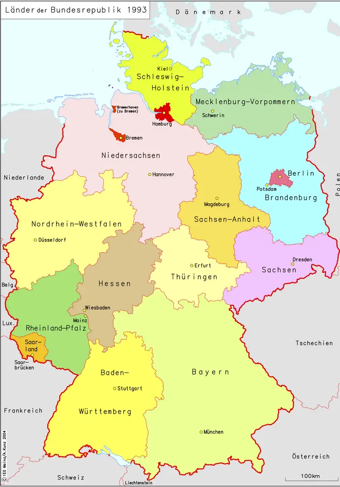
Länder der Bundesrepublik 1993
1993
Kunz, Andreas ; Moeschl, Joachim Robert
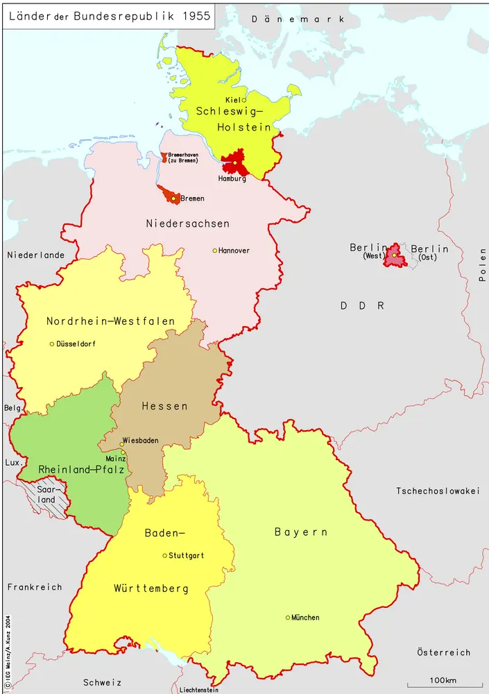
Länder der Bundesrepublik 1955
1955
Kunz, Andreas ; Moeschl, Joachim Robert
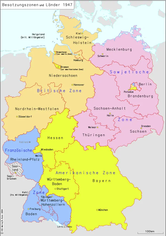
Besatzungszonen und Länder 1947
1947
Kunz, Andreas ; Moeschl, Joachim Robert
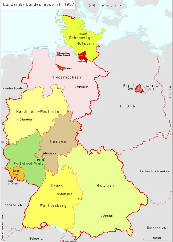
Länder der Bundesrepublik 1957
1957
Kunz, Andreas ; Moeschl, Joachim Robert
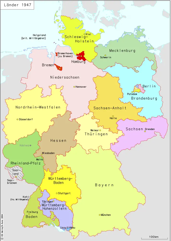
Länder 1947
1947
Kunz, Andreas ; Moeschl, Joachim Robert