Maps of Germany

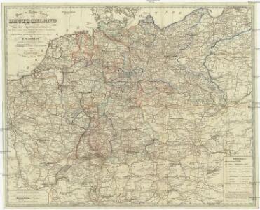
Post- u. Reise- Karte von Deutschland und den angränzenden Ländern bis Paris, Lyon, Turin, Mailand, Warschau u. Königsberg
1 : 1970000 Evropa střední Streit, Friedrich Wilhelm Stein, Johann Adam Johann Adam Stein
CHARTE von DEUTSCHLAND
1 : 3600000 Německo
Charte von Deutschland
1 : 3580000 Evropa střední
General Charte von Teutschland mit Angabe aller Post-Strassen von Paris bis Warschau, und von Triest bis Stralsund
1 : 1760000 Evropa střední Güssefeld, Franz L. Geograph. Institut
Neue und vollstaendige Post-Carte durch ganz Deutschland und die benach barten Lande
1 : 1850000 Evropa střední Güssefeld, Franz L. Heritiers de Chr. Weigel & Schneider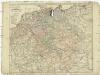
Neue und vollstaendige Post-Carte durch ganz Deutschland und die benach barten Lande
1 : 1850000 Evropa střední Güssefeld, Franz L. Heritiers de Chr. Weigel & Schneider
Neueste Generalkarte von Deutschland nach den zehn Kreisen und ihren Unterabtheilungen
1 : 2845000 Evropa střední
Deutschland, oder, Deutsche Bundesstaaten
1 : 185000 Německo Tranquillo Mollo
Deutschland und anliegende Länder zur Übersicht, d Hauptstr. u. Entfernungen zw. Paris, Mailand, Warschau u. Königsberg
1 : 3800000 Evropa střední Stieler, Adolf Justus Perthes
Neu vermehrte Post Charte durch gantz Teutschland nach Italien, Franckreich, Niederland, Preußen, Polen, und Ungarn & c
1 : 2600000 Evropa střední Nell, Johann Peter Homann, Johann Baptist Iohann Baptist Homann
Neue und vollstaendige Postkarte durch ganz Deutschland und durch die angränzenden Theile der benachbarten Länder
1 : 1465000 Evropa střední Thurn-Taxis, Karel Anselm von denen Homaennischen Erben
Neue und vollstaendige Postkarte durch ganz Deutschland und durch die angränzenden Theile der benachbarten Länder
1 : 1465000 Evropa střední Thurn-Taxis, Karel Anselm von denen Homaennischen Erben
Neue und vollständige Postkarte durch ganz Deutschland und durch die angränzende Theile der benachbarten Länder
1 : 1465000 Evropa střední Heger, Franz Joseph Emmerich Joseph von denen Homaennischen Erben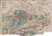
Mitteleuropa Bodenkarte
1 : 6000000 Mitteleuropa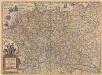
Germaniae nova et accurata delineatio [Karte], in: Novus atlas absolutissimus, Bd. 2, S. 13.
1 Karte aus Atlas Janssonius Offizin
Post Karte durch ganz Deutschland, nach den allerneusten Nachrichten entworfen
1 : 2250000 In Augsburg : zu haben bei Joh. Walch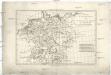
Empire d'Allemagne avec le royaume de Boheme, la Silesie, & c
1 : 5140000 Německo Bonne, Rigobert André
Germania Vindelicia Rhaetia Noricum et Pannonia
Germanien, Pannonien
GERMANIAE | VETERIS | typus.
[Amsterdam : Joan Blaeu]
Germany.
1 : 5200000 Darton, William
Deutschland nach seiner Eintheilung in zehn Kreise
Francie Pütz, Wilhelm Biecker, Aug.
Teutschland
Neuester Schul-Atlas Walch, Johann im Verlag bei Joh. Walch
Germaniae Veteris, typus. [Karte], in: Theatrum orbis terrarum, S. 473.
1 Karte aus Atlas Ortelius, Abraham Vrients, Jan Baptista

Post und Reise Karte von Deutschland und den benachbarten Ländern
Evropa střední Schmitfeldt, Georg Mollo, Eduard bey Eduard Mollo
NOVA TOTIVS GERMANIÆ DESCRIPTIO
[Amsterdam : Joan Blaeu]
Charte das Deutsche Reich nach seinen Kreisen und deren Unterabtheilungen vorstellend
1 : 2660000 Francie Güssefeld, Franz L. von den Homännischen Erben
Charte das Deutsche Reich nach seinen Kreisen und deren Unterabtheilungen vorstellend
1 : 2660000 Evropa střední Güssefeld, Franz L. von den Homännischen Erben
Imperium Romano-Germanicum in suos circulos electorat. et status
1 : 5100000 Evropa střední Seutter, Matthäus Lotter, Tobias Conrad apud Matth. Seutter
Germany.
1 : 6000000 Carey, Mathew