Maps of New Aquitaine
Carte générale des fleuves, des rivieres, et des principaux ruisseaux de la France, 2
1 Blatt : chez l'auteur Dupain-Triel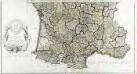
Carte de la France suivant sa nouvelle division en departements et disricts, 2
2 Blätter : 63 x 117 cm s.n.
Carte de France divisée en ses 85 departements et 550 districts
1 : 2150000 A Augsbourg : chez Joseph Carmine
France II.
1 : 1770000 Society for the Diffusion of Useful Knowledge (Great Britain)
Carte Michelin – Les Grandes Routes de France
Reisekarte von Süd - Frankreich
France 3.
1 : 1170000 Brue, Adrien Hubert, 1786-1832; Herisson, Eustache, b. 1759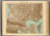
35-36. Francia sud.
1 : 1500000 Touring club italiano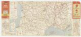
Etat des routes : hôtels, bonnes tables, mécaniciens, routes enneigées
1 : 1000000 Annotatie: Met aansluitende bijkaart van Corsica Paris : Services de Tourisme Michelin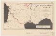
Southern France, waterways
1 : 3400000 Provisional ed. "Map no. 2344." "18 May 1943." United States. Office of Strategic Services. Research and Analysis Branch [Washington, D.C.] : R & A, OSS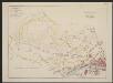
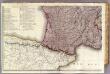
Aquitania australis Regnum Arelatense cum confiniis [Karte], in: Gerardi Mercatoris et I. Hondii Newer Atlas, oder, Grosses Weltbuch, Bd. 2, S. 125.
1 Karte aus Atlas Mercator, Gerhard und Hondius, Jodocus Jansson, Jan
Partie, la France. Europe 19.
1 : 1641836 Vandermaelen, Philippe, 1795-1869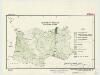
Southern France : agricultural regions
1 : 3900000 "Restricted."Dated: 15 April 1943."Map no. 2304." United States. Office of Strategic Services. Research and Analysis Branch [Washington, D.C.] : R & A, OSS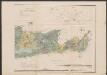
Aquitania australis Regnum Arelatense cum confiniis. [Karte], in: Gerardi Mercatoris Atlas, sive, Cosmographicae meditationes de fabrica mundi et fabricati figura, S. 226.
1 Karte aus Atlas Mercator, Gerhard Montanus, Petrus
Marche des Visigoths en Gaule
Frankreich Gallien Westgoten Völkerwanderungszeit Völkerwanderung
Aqvitania australis regnv[m] Arelatense cum confinijs
1 Karte : Kupferdruck ; 33 x 45 cm Mercator; Hondius Henricus Hondius
Aqvitania australis regnv[m] Arelatense cum confinijs
1 Karte : Kupferdruck ; 34 x 45 cm Hondius; Mercator Jodocus Hondius
Aqvitania australis regnv[m] Arelatense cum confinijs
1 Karte : Kupferdruck ; 33 x 45 cm Mercator s.n.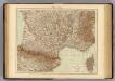
France S., Corsica.
1 : 1750000 Andree, Richard; Times (London, England)
France 3.
1 : 1774080 Letts, Son & Co.
France Régionale Bassin d’Aquitaine Massif Central - Pyrénées carte physique
Gallois, Lucien
France Régionale Bassin d’Aquitaine Massif Central - Pyrénées carte politique
Gallois, Lucien
43 Sheet B, uit: France (North West), Belgium (West and Central), Holland (part of) ; France (South West), Spain (North)
1 : 1000000 [London : MI9]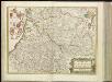
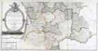
[14][14] Gouvernement de la Guienne & Gascogne, uit: Atlas sive Descriptio terrarum orbis
Annotatie: Gedigitaliseerde versie. Amsterdam. Heiloo : Picturae (vervaardiger), 2015. tiff-bestand. Gedigitaliseerd: 07-01-2015; Origineel: Universiteitsbibliotheek Vrije Universiteit (XL.05127.-) ; Netherlands; Titelpagina ontbreekt Wit, Frederik de Amsterdam : Frederick de Wit
Vorstellvng des Weges den Hannibal genom[m]en durch Gallien und über die Alpen bis in Italien
1 : 2650000 Alpy Baumgarten, Siegmund Jakob Glasser, I. F. Johann Justinus Gebauer
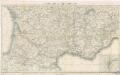
Frankreich SW.
1 : 1700000 Berghaus, Heinrich; Flemming, Carl; Handtke, Friedrich H.; Sohr, Karl
[Frankreich, Blatt 3]
Adolf Stieler's Handatlas über alle Theile der Erde und über das Weltgebäude Stieler, Adolf Justus Perthes
[Frankreich in 4 Blättern, Blatt 3]
Handatlas über alle Theile der Erde und über das Weltgebäude Stieler, Adolf Justus Perthes
Postkarte von Frankreichs südwestlichen Departements oder von Gasconien und Poitou
Gaskoňsko (Francie) Engelmann, Johann Wenzel im von Reillyschen Landkarten und Kunstwerke Verschleiss Komptoir


