Maps of Metropolitan France
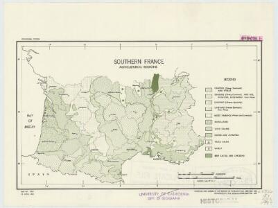
Southern France : agricultural regions
1 : 3900000 "Restricted."Dated: 15 April 1943."Map no. 2304." United States. Office of Strategic Services. Research and Analysis Branch [Washington, D.C.] : R & A, OSS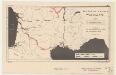
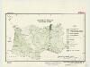
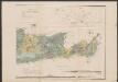
Southern France, waterways
1 : 3400000 Provisional ed. "Map no. 2344." "18 May 1943." United States. Office of Strategic Services. Research and Analysis Branch [Washington, D.C.] : R & A, OSS
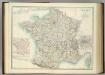
France.
Andriveau-Goujon, J.
Frankreich
Volksschul-Atlas über alle Teile der Erde Lange, Henry Druck und Verlag von Georg Westermann
Frankreich

Frankreich
E. von Sydow's Schul-Atlas in sechs und dreissig Karten Sydow, Emil von bei Justus Perthes
France.
Andriveau-Goujon, J.
Charte von Frankreich
1 : 900000 Francie Verlage des Kunst und Industrie Compoirs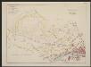
Aquitania australis Regnum Arelatense cum confiniis [Karte], in: Gerardi Mercatoris et I. Hondii Newer Atlas, oder, Grosses Weltbuch, Bd. 2, S. 125.
1 Karte aus Atlas Mercator, Gerhard und Hondius, Jodocus Jansson, Jan
Frontiere du Sud-Est de la France.
1 : 1650000 Jouvet et Cie.
Frankreich 1841
1 : 5290000 Francie Radefeld Stich, Druck und Verlag der geographischen Anstalt des Bibliographischen Instituts
Frankreich
Aquitania australis Regnum Arelatense cum confiniis. [Karte], in: Gerardi Mercatoris Atlas, sive, Cosmographicae meditationes de fabrica mundi et fabricati figura, S. 226.
1 Karte aus Atlas Mercator, Gerhard Montanus, Petrus
Frankreich
Schul-Atlas über alle Theile der Erde nach dem neuesten Zustande, und über das Weltgebäude Stieler, Adolf bei Justus Perthes
Frankreich
Schul-Atlas über alle Theile der Erde nach dem neuesten Zustande, und über das Weltgebäude Stieler, Adolf Justus Perthes
Frankreich
1 : 1150000 Francie Handtke, Friedrich Flemming, C. C. Flemming
Karte von Frankreich für den Hand- und Reisegebracht
1 : 2000000 Francie Seitz, J. B. litter. artistischen Anstalt
Frankreich mit besonderer Rücksicht auf die Unebeheiten
1 : 2000000 Francie Berghaus, Heinrich Karl Wilhelm Brose, Heinrich im Magazin für Kunst, Geographie und Musik
Frankreich.
1 : 10000000 Brudin, J. L.; Stieler, Adolf
France, departemens.
1 : 6000000 Delamarche, Charles Francois; Lattre, Jean
Frankreich
Grosser Hand-Atlas über alle Theile der Erde in 170 Karten Meyer, J. Verlag des Bibliographischen Instituts
Frankreich mit besonderer Rücksicht auf die Unebenheiten
1 : 20000000 Francie Berghaus, Heinrich Karl Wilhelm Brose, Heinr. im Magazin für Kunst, Geographie und Musik
Karte von Frankreich in XVI Blättern
1 : 1040000 Francie Sotzmann, Daniel Friedrich im Verlag der Königl. Preuss. Academischen Kunst und Buchhandlung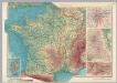
France. Pergamon World Atlas.
1 : 2500000 Polish Army Topography Service
France.
1 : 3200000 Tanner, Henry S.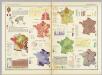
France (Republique Francaise). Pergamon World Atlas.
Polish Army Topography Service
Carte pittoresque et maritime de la France : indiquant la division politique et administrative ... / par A.M. Perrot ; revue et augm. par A. Vuillemin
1 : 1350000 Annotatie: Met aansluitende inzet van Corsica; Met afb. van bezienswaardigheden; Annotatie geografische gegevens: Grenzen en spoorlijnen gekleurd Perrot, A. M.; Vuillemin, A. Paris : Fatout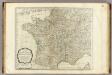
A new map of the Kingdom of France.
1 : 2170000 Kitchin, Thomas
Frankreich.
1 : 3500000 Radefeld, Carl Christian Franz, 1788-1874