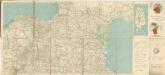
Maps of New Aquitaine
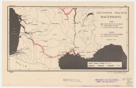
Southern France, waterways
1 : 3400000 Provisional ed. "Map no. 2344." "18 May 1943." United States. Office of Strategic Services. Research and Analysis Branch [Washington, D.C.] : R & A, OSS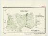
Southern France : agricultural regions
1 : 3900000 "Restricted."Dated: 15 April 1943."Map no. 2304." United States. Office of Strategic Services. Research and Analysis Branch [Washington, D.C.] : R & A, OSS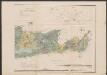
Aquitania australis Regnum Arelatense cum confiniis. [Karte], in: Gerardi Mercatoris Atlas, sive, Cosmographicae meditationes de fabrica mundi et fabricati figura, S. 226.
1 Karte aus Atlas Mercator, Gerhard Montanus, Petrus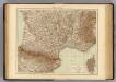
France S., Corsica.
1 : 1750000 Andree, Richard; Times (London, England)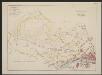
Aquitania australis Regnum Arelatense cum confiniis [Karte], in: Gerardi Mercatoris et I. Hondii Newer Atlas, oder, Grosses Weltbuch, Bd. 2, S. 125.
1 Karte aus Atlas Mercator, Gerhard und Hondius, Jodocus Jansson, Jan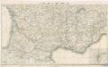
Reisekarte von Süd - Frankreich

Vorstellvng des Weges den Hannibal genom[m]en durch Gallien und über die Alpen bis in Italien
1 : 2650000 Alpy Baumgarten, Siegmund Jakob Glasser, I. F. Johann Justinus Gebauer
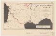
Carcassonne-Rhone fixing chart
Carcassonne-Rhone fixing chart (Bomber Command), Series GSGS 4603. Great Britain. War Office. General Staff. Geographical Section. [London] : [Air Ministry]
France.
1 : 4400000 Vivien de St Martin, L.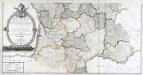
Carte générale des fleuves, des rivieres, et des principaux ruisseaux de la France, 2
1 Blatt : chez l'auteur Dupain-Triel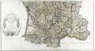
Carte de la France suivant sa nouvelle division en departements et disricts, 2
2 Blätter : 63 x 117 cm s.n.
Partie, la France. Europe 19.
1 : 1641836 Vandermaelen, Philippe, 1795-1869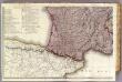
France 3.
1 : 1170000 Brue, Adrien Hubert, 1786-1832; Herisson, Eustache, b. 1759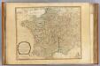
France, governments.
1 : 2250000 Robert Laurie & James Whittle
[Kaart], uit: Frankreich : Autokarte = France : carte automobile
1 : 1000000 titelvariant: France; Annotatie: Met aansluitende inzetten van het westelijk deel van Bretagne en van Corsica; Annotatie geografische gegevens: Legenda in het Frans, Engels, Duits, Nederlands, Italiaans en Spaans Bern : Kümmerly + Frey
Feuille 30 (B V), uit: Carte géologique internationale de l'Europe : la carte, votée au congrès géologique international de Bologne en 1881, est exécutée conformément aux décisions d'une commission internationale, avec le concours des gouvernements, sous le dir. de M.M. Beyrich et Hauchecorne
Annotatie: Blad 48 gamme des couleurs; blad 49: bladwijzer en titelblad Heinrich Ernst Beyrich 1815-1896; Wi. Hauchecorne Berlin : Reimer / (Berlin: Institut lithographique)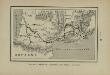
Marche des Visigoths en Gaule
Frankreich Gallien Westgoten Völkerwanderungszeit Völkerwanderung
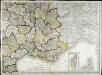
[Frankreich in 4 Blättern, Südöstliches Frankreich]
Hand-Atlas über alle Theile der Erde und über das Weltgebäude Stieler, Adolf Justus Perthes
France II.
1 : 1770000 Society for the Diffusion of Useful Knowledge (Great Britain)
Aqvitania australis regnv[m] Arelatense cum confinijs
1 Karte : Kupferdruck ; 33 x 45 cm Mercator; Hondius Henricus Hondius
Aqvitania australis regnv[m] Arelatense cum confinijs
1 Karte : Kupferdruck ; 34 x 45 cm Hondius; Mercator Jodocus Hondius
Aqvitania australis regnv[m] Arelatense cum confinijs
1 Karte : Kupferdruck ; 33 x 45 cm Mercator s.n.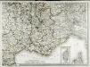
Carte de la France, 4
1 Blatt : 61 x 83 cm de Belleyme
Der Südliche Theil von Frankreich nebst einem Theile von Spanien
Hand-Atlas über alle Theile der Erde nach dem neuesten Zustande und über das Weltgebäude Stieler, Adolf bei Justus Perthes
Der südliche Theil von Frankreich nebst einem Theile von Spanien
Carte de la France, 4
1 Blatt : mehrfarbig ; 61 x 82 cm de Belleyme
Der Südliche Theil von Frankreich nebst einem Theile von Spanien
Stieler's Hand-Atlas Stieler, Adolf bei Justus Perthes
Der Südliche Theil von Frankreich nebst einem Theile von Spanien
Hand-Atlas über alle Theile der Erde nach dem neuesten Zustande und über das Weltgebäude Stieler, Adolf bei Justus Perthes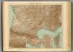
35-36. Francia sud.
1 : 1500000 Touring club italiano