Maps of Auvergne-Rhône-Alpes

France.
1 : 4400000 Vivien de St Martin, L.
Carte de la France, 4
1 Blatt : 61 x 83 cm de Belleyme
Carte de la France, 4
1 Blatt : mehrfarbig ; 61 x 82 cm de Belleyme
Southern France : agricultural regions
1 : 3900000 "Restricted."Dated: 15 April 1943."Map no. 2304." United States. Office of Strategic Services. Research and Analysis Branch [Washington, D.C.] : R & A, OSS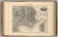
France S.E.
1 : 1615000 Migeon, J.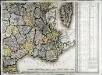
Carte de la France, 4
1 Blatt : 61 x 83 cm de Belleyme

Carte de la République française, 4
1 Blatt : 42 x 51 cm P.G. Chanlaire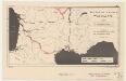
Southern France, waterways
1 : 3400000 Provisional ed. "Map no. 2344." "18 May 1943." United States. Office of Strategic Services. Research and Analysis Branch [Washington, D.C.] : R & A, OSS
Vorstellvng des Weges den Hannibal genom[m]en durch Gallien und über die Alpen bis in Italien
1 : 2650000 Alpy Baumgarten, Siegmund Jakob Glasser, I. F. Johann Justinus Gebauer
[Frankreich in 4 Blättern, Südöstliches Frankreich]
Hand-Atlas über alle Theile der Erde und über das Weltgebäude Stieler, Adolf Justus Perthes
Les royau.mes de Bourgogne, et d'Arles
1 Karte : Kupferdruck ; 39 x 49 cm, Bildgrösse 40 x 56 cm Duval chez l'auteur en l'isle du Palais sur le quay de l'Orloge au coin de la rüe de Harlay
Frankreich SO.
1 : 1700000 Handtke, Friedrich H.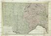
Kriegstheater oder Graenzkarte zwischen Frankreich und Italien
1 : 1025000 Francie jihovýchodní Müller, Franz Artaria
[Frankreich in 4 Blättern, Blatt 4]
Handatlas über alle Theile der Erde und über das Weltgebäude Stieler, Adolf Justus Perthes
Frankreich In 4 Blattern, Blatt 4.
1 : 1500000 Vogel, C.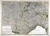
Kriegstheater oder Grænzkarte zwischen Frankreich und Italien
1 Karte : Kupferdruck ; 47 x 68 cm Müller; Artaria zufinden bey Artaria Compagnie
[Frankreich, Blatt 4]
Adolf Stieler's Handatlas über alle Theile der Erde und über das Weltgebäude Stieler, Adolf Justus Perthes
France

IX, uit: General-Karte von Mittel-Europa in 12 Blättern, im Masse 1:1.200.000 / entworfen, bearb. und hrsg. von Josef Schlacher
1 : 1200000 Annotatie: Blad 6 ontbreekt; Annotatie geografische gegevens: 21 maatstokken op blad 9; Legenda op blad 9 Wien : K.K. Militär Geografisches Institut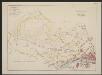
Aquitania australis Regnum Arelatense cum confiniis [Karte], in: Gerardi Mercatoris et I. Hondii Newer Atlas, oder, Grosses Weltbuch, Bd. 2, S. 125.
1 Karte aus Atlas Mercator, Gerhard und Hondius, Jodocus Jansson, Jan
Bonaparte's Route from Elba to Paris.
1 : 2500000 Melish, John
[Helvetien]
1 : 3100000 1 Karte entworfen von F.L. Güssefeld ; gestochen von C. Westermayr [im Verlage des Industrie Comptoirs], [Weimar]
Partie, la France. Europe 19.
1 : 1641836 Vandermaelen, Philippe, 1795-1869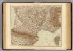
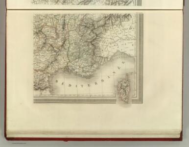
France S., Corsica.
1 : 1750000 Andree, Richard; Times (London, England)
Carte de la Haute Italie
1 : 1008000 Itálie střední Sagansan, L. Imprimerie de la Librairie Nouvelle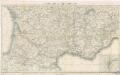
Reisekarte von Süd - Frankreich

[Helvetien]
1 : 3100000 1 Karte entworfen von F.L. Güssefeld ; gestochen von J.C. Müller [im Verlage des Industrie Comptoirs], [Weimar]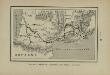
Marche des Visigoths en Gaule
Frankreich Gallien Westgoten Völkerwanderungszeit Völkerwanderung