Maps of France

Feuille 30 (B V), uit: Carte géologique internationale de l'Europe : la carte, votée au congrès géologique international de Bologne en 1881, est exécutée conformément aux décisions d'une commission internationale, avec le concours des gouvernements, sous le dir. de M.M. Beyrich et Hauchecorne
Annotatie: Blad 48 gamme des couleurs; blad 49: bladwijzer en titelblad Heinrich Ernst Beyrich 1815-1896; Wi. Hauchecorne Berlin : Reimer / (Berlin: Institut lithographique)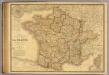
France, Suisse.
1 : 2040000 Picquet, C.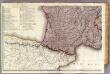
France 3.
1 : 1170000 Brue, Adrien Hubert, 1786-1832; Herisson, Eustache, b. 1759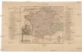
Kriegs Schauplatz zwischen Franckreich u. Ostreich 1792
1 : 2845000 Francie
Frankreich
Plastischer Schul-Atlas über alle Theile der Erde : in 24 Karten Woldermann, G Verlag von P. Eckerlein
Géographie et statistique de la République française
1 : 1500000 par H. Langlois Paris : au Bureau Géographique
France.
1 : 4815360 Tallis, J. & F.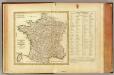
La France, departemens.
1 : 3500000 Bonne, Rigobert, 1727-1794
Frankreich
1 : 3300000 Francie Mollo, Tranquillo Tranquillo Mollo
Frankreich
1 : 3220000 Francie Mollo, Tranquillo Tranquillo Mollo
Jak vzniká mapa

Nouvelle carte de France
Francie Audin Audin
Frankreich
Volksschul-Atlas über alle Teile der Erde Lange, Henry Druck und Verlag von Georg Westermann
Frankreich
1 : 2360000 Francie Weiland, Karl Ferdinand Mädel im Verlage des Geographischen Institut
Frankreich
1 : 2400000 Francie Weiland, Karl Ferdinand Mädel Verlage des Geographischen Institut
France.
1 : 3350000 Mitchell, Samuel Augustus
France.
1 : 3350000 Mitchell, Samuel Augustus
France.
1 : 3350000 Mitchell, Samuel Augustus Jr.
France provinces.
1 : 5000000 Bowen, Frances
France departments.
1 : 5000000 Bowen, Frances
Frankreich's aeltere kirchliche Eintheilung bus zum Jahre 1322.
1 : 3800000 Spruner von Merz, Karl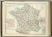
France in Departments.
1 : 2232000 Johnston, Alexander Keith
Carte des postes de France
1 Karte : Kupferdruck ; 64 x 54 cm Jean; Mondhare chez Mondhare et Jean rue St. Jean de Beauvais n.o 4
Regnum Galliae moderna
1 : 8760000 Francie
Frankreich von 1180 bis 1461, Zeitraum der Albigenser- und englischen Kriege.
1 : 3800000 Spruner von Merz, Karl
France, departments.
1 : 10000000 Fenner, Rest.
France, provinces.
1 : 10000000 Fenner, Rest.
France.
1 : 5000000 Moll, Herman, d. 1732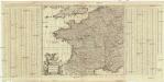
Accuratissima Galliae tabula vulgo royaume de France
1 : 2400000 Francie Danckerts, Justus I. Danckerts
Confins (de la France)
1 : 2900000 Dangeau, abbe de, 1643-1723


