Maps of Metropolitan France
Géographie et statistique de la République française
1 : 1500000 par H. Langlois Paris : au Bureau Géographique
France in Departments.
1 : 2232000 Johnston, Alexander Keith
France.
1 : 3150000 Teesdale, Henry
Kriegs Schauplatz zwischen Franckreich u. Ostreich 1792
1 : 2845000 Francie
Composite: Frankreich.
1 : 1700000 Handtke, Friedrich H.
Nouvelle carte de France
Francie Audin Audin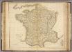
France.
1 : 2300000 Playfair, Principal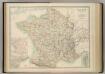
France in Departments.
1 : 2232000 Johnston, W. & A.K.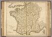
France.
1 : 1220000 Playfair, Principal
Frankreich.
1 : 3700000 Berghaus, Heinrich; Flemming, Carl; Sohr, Karl
Frankreich
1 : 3300000 Francie Mollo, Tranquillo Tranquillo Mollo
Frankreich
1 : 3220000 Francie Mollo, Tranquillo Tranquillo Mollo
France.
Andriveau-Goujon, J.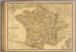
France, Suisse.
1 : 2040000 Picquet, C.
Frankreich 1841
1 : 5290000 Francie Radefeld Stich, Druck und Verlag der geographischen Anstalt des Bibliographischen Instituts
France.
1 : 4815360 Tallis, J. & F.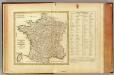
La France, departemens.
1 : 3500000 Bonne, Rigobert, 1727-1794
France in Provinces.
1 : 4100000 Hughes, William
Frankreich und die Schweiz.
1 : 3700000 Berghaus, Hermann
Totius regni Galliæ, sive Franciæ et Navarræ novissima tabula
1 Karte : Kupferdruck ; 47 x 55 cm Homann edita à Io. Bapt. Homann
Sprechkarte von Frankreich
Zweiter Band, enthaltend in vier Abtheilungen die Vertheilung der Organismen: 5. Pflanzen-Geographie, 6. Thier-Geographie, 7. Anthropographie, 8. Ethnographie Humboldt, Alexander von Verlag von Justus Perthes
Frankreich
Schul-Atlas in 36 Karten Völter, Daniel Verlag der J.M. Dannheimer'schen Buchhandlung
Frankreich und die Schweiz
Handatlas über alle Theile der Erde und über das Weltgebäude Stieler, Adolf Justus Perthes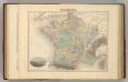
France en 1789.
1 : 3300000 Migeon, J.
Frankrijk
1 : 4650000 Den Haag : Kompas
Frankreich und die Schweiz
Hand-Atlas über alle Theile der Erde und über das Weltgebäude Stieler, Adolf Justus Perthes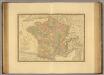
France en 1789.
1 : 2950000 Picquet, C.
Carte itinéraire de la république française
1 Karte : Kupferdruck ; 49 x 53 cm Blondeau; Chanlaire; Bartholomé au depôt de géographie rue Geoffroy-Langevin n.o 328
Carte de la France
1 Karte : Kupferdruck ; 48 x 51 cm Weis chez I. George Treuttel libraire


