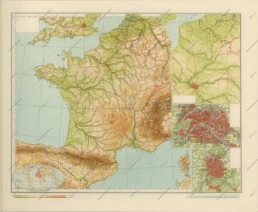
Maps of Metropolitan France

Jak vzniká mapa

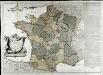
Confins (de la France)
1 : 2900000 Dangeau, abbe de, 1643-1723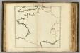
Confins (de la France - outline)
1 : 2900000 Dangeau, abbe de, 1643-1723
Totius regni Galliæ, sive Franciæ et Navarræ novissima tabula
1 Karte : Kupferdruck ; 47 x 55 cm Homann edita à Io. Bapt. Homann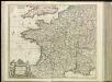
[13][13] Accuratissima Galliae tabula, uit: Atlas sive Descriptio terrarum orbis
Annotatie: Gedigitaliseerde versie. Amsterdam. Heiloo : Picturae (vervaardiger), 2015. tiff-bestand. Gedigitaliseerd: 07-01-2015; Origineel: Universiteitsbibliotheek Vrije Universiteit (XL.05127.-) ; Netherlands; Titelpagina ontbreekt Wit, Frederik de Amsterdam : Frederick de Wit
GALLIA | LE | ROYAVME | DE | FRANCE.
I. vanden Ende fec. Amsterodami | Excudebat Guilielmus | Blaeuw Sub Signo Solarii
Jak vzniká mapa

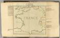
France.
1 : 5000000 Carey, Mathew
France.
1 : 4900000 Carey, Mathew
Gallia concinnata ad magnum numerum mapparum particularium manu scriptarum vel impreßarum juxta genuinum situm locorum et collatarum cum itinerariis veteribus et recentioribus
1 : 3600000 Francie Delisle, Guillaume Seutter, Matthäus Matth. Seutter
La France
1 Karte auf 2 Blättern : Kupferdruck ; 70 x 81 cm Janvier; Lattré; Arrivet chez Lattré graveur ruë St. Jacques près la fontaine S. Severin à la ville de Bordeaux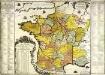
La France
1 Karte : Kupferdruck ; 48 x 49 cm Fer; Danet chez le Sr. Danet gendre de l'auteur sur le Pont N. Dame a la sphere royale
Landtaflen
1 Atlas [von Johannes Stumpf] Christoffel Froschower, Zürych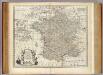
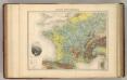
Map of France.
1 : 3300000 Bowen, Emanuel
France in Provinces.
1 : 4100000 Hughes, William
Le royaume de France
1 : 2670000 Francie Seutter, Matthäus Matthieu Seutter
Frankreich's aeltere kirchliche Eintheilung bus zum Jahre 1322.
1 : 3800000 Spruner von Merz, Karl
Galliae supra omnes in hac forma editiones locupletißima et exatißima descriptio. [Karte], in: Gerardi Mercatoris et I. Hondii Newer Atlas, oder, Grosses Weltbuch, Bd. 2, S. 16.
1 Karte aus Atlas Mercator, Gerhard und Hondius, Jodocus Jansson, Jan
Carte du royaume de France
1 Karte : Kupferdruck ; 32 x 40 cm Bourgoin chez Bourgoin graveur rue de la Harpe vis-a-vis le passage des Jacobins a côté du caffé de Condé
Frankreich nach der alten und neuen Eintheilung
1 Karte : Kupferdruck ; 28 x 24 cm Sotzmann; Jättnig s.n.
Carte Physique de la Region Francaise.
1 : 2550000 Jouvet et Cie.
France Hypsometrique.
1 : 3700000 Migeon, J.
Frankreich von 1180 bis 1461, Zeitraum der Albigenser- und englischen Kriege.
1 : 3800000 Spruner von Merz, Karl
Jak vzniká mapa

Sprachkarte von Frankreich.
1 : 3700000 Berghaus, Heinrich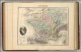
France Physique.
1 : 3700000 Migeon, J.
France.
1 : 3484800 Letts, Son & Co.