Maps of Metropolitan France
Kriegs Schauplatz zwischen Franckreich u. Ostreich 1792
1 : 2845000 Francie
France.
1 : 2300000 Playfair, Principal
France.
1 : 3150000 Teesdale, Henry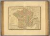
France en 1789.
1 : 2950000 Picquet, C.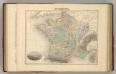
France en 1789.
1 : 3300000 Migeon, J.
Frankreich und die Schweiz.
1 : 3700000 Berghaus, Hermann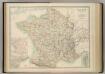
France in Departments.
1 : 2232000 Johnston, W. & A.K.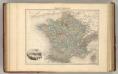
France Politique.
1 : 3700000 Migeon, J.
France en Relief.
Vivien St Martin, L.
Frankreich.
1 : 3700000 Berghaus, Heinrich; Flemming, Carl; Sohr, Karl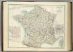
France in Departments.
1 : 2232000 Johnston, Alexander Keith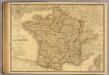
France, Suisse.
1 : 2040000 Picquet, C.
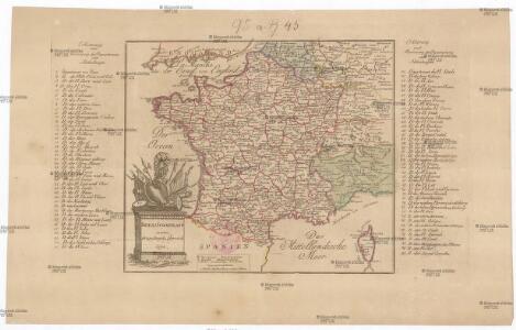
Frankreich
Schul-Atlas in 36 Karten Völter, Daniel Verlag der J.M. Dannheimer'schen Buchhandlung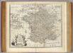
Map of France.
1 : 3300000 Bowen, Emanuel
Frankreich
Geographischer Atlas über alle Theile der Erde Ziegler, Jakob Melchior Verlag von Joh. Wurster um Comp.
Composite: Frankreich.
1 : 1700000 Handtke, Friedrich H.
France.
Andriveau-Goujon, J.
Frankreich 1841
1 : 5290000 Francie Radefeld Stich, Druck und Verlag der geographischen Anstalt des Bibliographischen Instituts
Sprechkarte von Frankreich
Zweiter Band, enthaltend in vier Abtheilungen die Vertheilung der Organismen: 5. Pflanzen-Geographie, 6. Thier-Geographie, 7. Anthropographie, 8. Ethnographie Humboldt, Alexander von Verlag von Justus Perthes
Frankreich und die Schweiz
Handatlas über alle Theile der Erde und über das Weltgebäude Stieler, Adolf Justus Perthes
Frankreich
[Allgemeiner Atlas über alle Theile der Erde in 29 Blättern] Ziegler, Jakob Melchior Top. Anstalt v. J. Wurster u. Comp.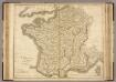
France.
1 : 1220000 Playfair, Principal
France.
1 : 4815360 Tallis, J. & F.
La France, departemens.
1 : 3500000 Bonne, Rigobert, 1727-1794
Frankreich und die Schweiz
Hand-Atlas über alle Theile der Erde und über das Weltgebäude Stieler, Adolf Justus Perthes
Carte itinéraire de la république française
1 Karte : Kupferdruck ; 49 x 53 cm Blondeau; Chanlaire; Bartholomé au depôt de géographie rue Geoffroy-Langevin n.o 328
Carte de la France
1 Karte : Kupferdruck ; 48 x 51 cm Weis chez I. George Treuttel libraire
France.
1 : 3000000 Andree, Richard; Times (London, England)
Frankreich
Schul-Atlas über alle Theile der Erde nach dem neuesten Zustande, und über das Weltgebäude Stieler, Adolf bei Justus Perthes