Maps of Occitania

France 3.
1 : 1774080 Letts, Son & Co.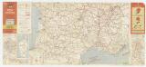
Etat des routes : hôtels, bonnes tables, mécaniciens, routes enneigées
1 : 1000000 Annotatie: Met aansluitende bijkaart van Corsica Paris : Services de Tourisme Michelin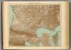
35-36. Francia sud.
1 : 1500000 Touring club italiano
France II.
1 : 1770000 Society for the Diffusion of Useful Knowledge (Great Britain)
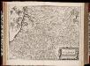
Aqvitania australis regnv[m] Arelatense cum confinijs
1 Karte : Kupferdruck ; 33 x 45 cm Mercator; Hondius Henricus Hondius
Aqvitania australis regnv[m] Arelatense cum confinijs
1 Karte : Kupferdruck ; 34 x 45 cm Hondius; Mercator Jodocus Hondius
Aqvitania australis regnv[m] Arelatense cum confinijs
1 Karte : Kupferdruck ; 33 x 45 cm Mercator s.n.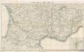
Reisekarte von Süd - Frankreich
Carte Michelin – Les Grandes Routes de France
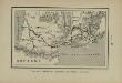
Marche des Visigoths en Gaule
Frankreich Gallien Westgoten Völkerwanderungszeit Völkerwanderung
Partie, la France. Europe 19.
1 : 1641836 Vandermaelen, Philippe, 1795-1869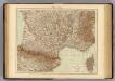
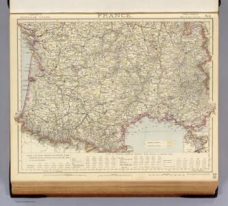
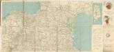
France S., Corsica.
1 : 1750000 Andree, Richard; Times (London, England)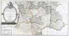
Carte générale des fleuves, des rivieres, et des principaux ruisseaux de la France, 2
1 Blatt : chez l'auteur Dupain-Triel
Der südliche Theil von Frankreich nebst einem Theile von Spanien

Der Südliche Theil von Frankreich nebst einem Theile von Spanien
Hand-Atlas über alle Theile der Erde nach dem neuesten Zustande und über das Weltgebäude Stieler, Adolf bei Justus Perthes

Der Südliche Theil von Frankreich nebst einem Theile von Spanien
Stieler's Hand-Atlas Stieler, Adolf bei Justus Perthes
Der Südliche Theil von Frankreich nebst einem Theile von Spanien
Hand-Atlas über alle Theile der Erde nach dem neuesten Zustande und über das Weltgebäude Stieler, Adolf bei Justus Perthes
France Régionale Bassin d’Aquitaine Massif Central - Pyrénées carte physique
Gallois, Lucien
Postkarte von Frankreichs südwestlichen Departements oder von Gasconien und Poitou
Gaskoňsko (Francie) Engelmann, Johann Wenzel im von Reillyschen Landkarten und Kunstwerke Verschleiss Komptoir
Carte de la France (SE)
1 : 345600 Cassini family
France Régionale Bassin d’Aquitaine Massif Central - Pyrénées carte politique
Gallois, Lucien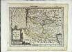
Aqvitaniæ descriptio
1 Karte : Kupferdruck ; 17 x 23 cm Mercator Cloppenburgh
Le royaume de France, 5
1 Blatt : 48 x 42 cm Jaillot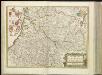
[14][14] Gouvernement de la Guienne & Gascogne, uit: Atlas sive Descriptio terrarum orbis
Annotatie: Gedigitaliseerde versie. Amsterdam. Heiloo : Picturae (vervaardiger), 2015. tiff-bestand. Gedigitaliseerd: 07-01-2015; Origineel: Universiteitsbibliotheek Vrije Universiteit (XL.05127.-) ; Netherlands; Titelpagina ontbreekt Wit, Frederik de Amsterdam : Frederick de Wit
Govvernement general de Gvienne et Gvascogne et pays circonvoisins
1 Karte : Kupferdruck ; 39 x 53 cm Sanson; Peyrounin chez l'auteur

Tabula Aquitaniae complectens gubernationem Guiennae et Vasconiae
1 : 800000 exhibita a Joh. Bapt. Homanno Norimbergae : [Johann Baptist Homann]