Maps of Poland
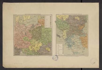
Atlas Niox ; Atlas Niox. No. 31, Populations de l'Europe centrale. No. 31 bis, Populations de la péninsule des Balkans
1 : 6000000 Niox, Gustave-Léon 1840-1921 Paris : Ch. Delagrave
Große Sprachenkarte von Mitteleuropa
1 : 2000000 Lange, Friedrich Reimer
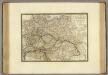
Empire d'Allemagne, Hongrie, Gallicie, Prusse, Provinces-Unies de Pays-Bas en 1789.
1 : 3500000 Picquet, C.
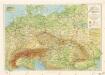
Oostelijk operatietooneel
1 : 2250000 Annotatie geografische gegevens: Legenda Den Haag : J. Smulders & Co.
Übersichtskarte der Verbreitung der Deutschen in Europa
Evropa Kiepert, Heinrich Haas, František Dietrich Reimer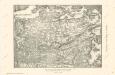
Die Ältesten Karten von Deutschland
German Empire.
1 : 6200000 Lavoisne, M.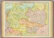
Central European states - political.
1 : 3000000 John Bartholomew and Son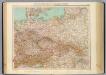
51-52. Germania, Polonia, Cecoslovacchia, Austria, Ungheria.
1 : 3000000 Touring club italiano
Sbírka map a diagramů použitých na mírových konferencích v Paříži v letech 1919 - 1920
L'Allemagne, l'Europe centrale.
1 : 3460000 Andriveau-Goujon, J.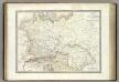
Germanie Ancienne.
1 : 3300000 Lapie, M. (Pierre), 1779-1850
Polska za Mieczyslawa I
Polsko
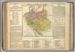
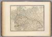
Prussia, and the German States.
from New general atlas.
Közép-Európa
1 : 5000000 Evropa střední Állami kiadóhivatal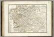
Allemagne.
1 : 3300000 Lapie, M. (Pierre), 1779-1850
Soubor němých map pro střední školy
Příruční mapa střední Evropy

Ostdeutsche Kolonisation
1 : 10000000 Ostmitteleuropa Deutsche Ostsiedlung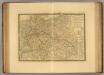
Europe Centrale.
1 : 3500000 Picquet, C.
Germany, Austria, and Switzerland.
1 : 4092000 Gray, Frank Arnold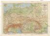
Grossdeutsches Reich und angrenzende Gebiete
1 : 4000000 Evropa střední Leixner, František Zentral-Lehrerverlag und Buchhandlung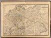
Composite: Allemagne.
1 : 2000000 Andriveau-Goujon, J.
Carta generale della Germania ossia Confederazione Germanica.
1 : 3500000 Marzolla, Benedetto
Central states Europe.
1 : 9000000 Fenner, Rest.
Tabula Europae IIII. [Karte], in: Geographia universalis vetus et nova complectens Claudii Ptolemaei Alexandrini enarrationis libros VIII, S. 231.
1 Karte aus Atlas Münster, Sebastian [und Ptolemaeus, Claudius]
Das neue politische Gesicht Mitteleuropas
1 : 2000000 Evropa střední Velhagen & Klafing
Das neue politische Gesicht Mitteleuropas
1 : 2000000 Evropa střední Velhagen & Klafing
Das neue politische Gesicht Mitteleuropas
1 : 2000000 Evropa střední Velhagen & Klafing