Maps of Germany
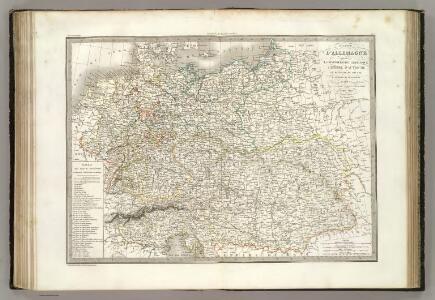
Allemagne.
1 : 3300000 Lapie, M. (Pierre), 1779-1850
Composite: Allemagne.
1 : 2000000 Andriveau-Goujon, J.
L'Allemagne, l'Europe centrale.
1 : 3460000 Andriveau-Goujon, J.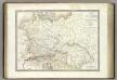
Germanie Ancienne.
1 : 3300000 Lapie, M. (Pierre), 1779-1850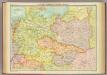
Central European states - political.
1 : 3000000 John Bartholomew and Son
Deutschlands geschichtlich geographischer Zeitraum von 158 v. Chr. bis 260 n. Chr
Evropa střední Ehrenkreutz, I. V.
Carte Generale D'Allemagne.
1 : 4600000 Vivien de St Martin, L.
Europe Centrale.
1 : 4100000 Montemont, A.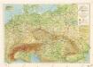
Příruční mapa střední Evropy
l'Allemagne par Cercles in 1789.
1 : 6300000 Malte-Brun, Conrad, 1775-1826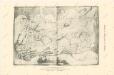
Die Ältesten Karten von Deutschland

Közép-Európa
1 : 5000000 Evropa střední Állami kiadóhivatal
Carte élémentaire et statistique de l'Allemagne
1 : 2700000 Brion de La Tour, Louis Brion & Maire
Karte des Deutschen Reichs
Schmidt, Johann Marius Friedrich; Jäck Schropp
Fluss- u. Gebirgs-Karte, Mittel-Europa.
1 : 4500000 Flemming, Carl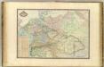
Europe Centrale.
1 : 3000000 Garnier, F. A., 1803-1863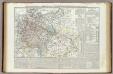
Carta generale della Germania ossia Confederazione Germanica.
1 : 3500000 Marzolla, Benedetto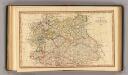
Central states Europe.
1 : 9000000 Fenner, Rest.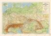
Grossdeutsches Reich und angrenzende Gebiete
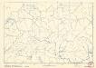
Soubor němých map pro střední školy
Empire d'Allemagne, Hongrie, Gallicie, Prusse, Provinces-Unies de Pays-Bas en 1789.
1 : 3500000 Picquet, C.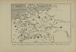
Peuples de la Germanie au 1er siècle de notre ère, selon Tacite
Mitteleuropa Germanien ethnische Gruppe Germanen Tacitus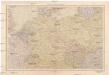
Střední Evropa
1 : 4500000 Evropa střední V. Neubert a synové
R.A. Schulz's neue praktische Reise-Karte mit Angabe der Distanzen
Anglie Schulz, R. A. Biller, Dominik Artaria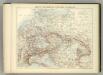
Carte Politique de L'Europe Centrale.
1 : 3600000 Jouvet et Cie.
Die Deutschen Bundesstaaten, das Kaiserthum Oesterreich, das Königreich Preussen, die Schweiz, das Kgr. Belgien, das Kgr. der Niederlande u. die angrenzenden Länder von 1792 bis zur Gegenwart
1 : 7350000 Mitteleuropa
Große Sprachenkarte von Mitteleuropa
1 : 2000000 Lange, Friedrich Reimer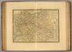
Europe Centrale.
1 : 3500000 Picquet, C.
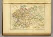
Prussia, and the German States.
from New general atlas.