Maps of Poland

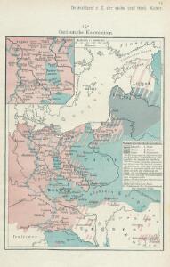
Ostdeutsche Kolonisation
1 : 10000000 Ostmitteleuropa Deutsche Ostsiedlung
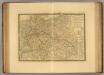
Die Ältesten Karten von Deutschland

Téatre De La Guerre Des Couronnes du Nord. [Karte], in: Atlas nouveau, contenant toutes les parties du monde [...], Bd. 1, S. 67.
1 Karte aus Atlas Sanson, Nicolas Jaillot, Alexis Hubert und Mortier, Pieter
Oostelijk operatietooneel
1 : 2250000 Annotatie geografische gegevens: Legenda Den Haag : J. Smulders & Co.
Das neue politische Gesicht Mitteleuropas
1 : 2000000 Evropa střední Velhagen & Klafing
Das neue politische Gesicht Mitteleuropas
1 : 2000000 Evropa střední Velhagen & Klafing
Das neue politische Gesicht Mitteleuropas
1 : 2000000 Evropa střední Velhagen & Klafing
Tabula Europae IIII. [Karte], in: Geographia universalis vetus et nova complectens Claudii Ptolemaei Alexandrini enarrationis libros VIII, S. 231.
1 Karte aus Atlas Münster, Sebastian [und Ptolemaeus, Claudius]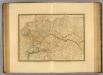
Empire d'Allemagne, Hongrie, Gallicie, Prusse, Provinces-Unies de Pays-Bas en 1789.
1 : 3500000 Picquet, C.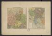
Atlas Niox ; Atlas Niox. No. 31, Populations de l'Europe centrale. No. 31 bis, Populations de la péninsule des Balkans
1 : 6000000 Niox, Gustave-Léon 1840-1921 Paris : Ch. Delagrave
Polska za Mieczyslawa I
Polsko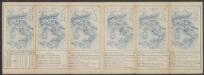
Tabula Europae IIII. [Karte], in: Claud. Ptolemaeus. Geographia lat. cum mappis [...], S. 263.
1 Karte aus Atlas Münster, Sebastian [und Ptolemaeus, Claudius]
Germaniae Antiquae
1 : 5100000 Mollova mapová sbírka Weigel, Christoph Weigel, Christoph I.
Germanie Ancienne.
1 : 5300000 Monin, C.V.
Kirchenprovinzen Gnesen, Riga u. Lemberg XV. Jahrh.
1 : 24000000 Ostmitteleuropa Kirchenprovinz
Große Sprachenkarte von Mitteleuropa
1 : 2000000 Lange, Friedrich Reimer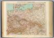
51-52. Germania, Polonia, Cecoslovacchia, Austria, Ungheria.
1 : 3000000 Touring club italiano
[Ost-Europa, Blatt 3]
Adolf Stieler's Handatlas über alle Theile der Erde und über das Weltgebäude Stieler, Adolf Justus Perthes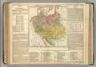
German Empire.
1 : 6200000 Lavoisne, M.
Carte du Théâtre de la Guerre en Russie et en Allemagne pendant 1812 et 1813
Russland, Deutschland, Befreiungskriege <1813-1815>
Germany, Austria, and Switzerland.
1 : 4092000 Gray, Frank Arnold
[Ost-Europa in 6 Blättern, Enthaltend: Norwegen, Schweden, Russland, Kaukasien und die Türkei, Blatt 3]
Hand-Atlas über alle Theile der Erde und über das Weltgebäude Stieler, Adolf Justus Perthes
[Ost-Europa in 6 Blättern, Blatt 3]
Handatlas über alle Theile der Erde und über das Weltgebäude Stieler, Adolf Justus Perthes
Střední Evropa
1 : 4500000 Evropa střední
Střední Evropa
1 : 4500000 Evropa střední
[Deutschland]
Historisch-genealogisch-geographischer Atlas von Le Sage Las Cases, Emmanuel Auguste Dieudonné Marius Joseph de Johann Velten, Kunsthändler
Übersichtskarte der Verbreitung der Deutschen in Europa
Evropa Kiepert, Heinrich Haas, František Dietrich Reimer
Germany
1 : 4200000 Německo
Sprachkarte von Deutschland
1 : 3000000 Evropa střední Bernhardt, Karl Bohné, J. J. von J.J. Bohné