Maps of Burlington County

A mapp of New Jersey in America.
from Charts and maps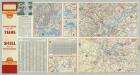
Various Regions and Cities in Pennsylvania.
Shell Oil Company
New Jersey.
1 : 1077120 Scott, Joseph
A New and accurate map of the present seat of war in North America, comprehending New Jersey, Philadelphia, Pensylvania, New-York, &c.
1 : 550000
[Map of the vicinity of City Hall, Brooklyn.]
From Brooklyn
Various Regions and Cities in the Middle Atlantic States.
Shell Oil Company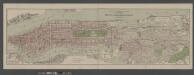
Boroughs of Manhattan and Bronx, showing the electric service of the New York Edison Co.
From Manhattan
Armees Americaine et Britannique en 1776 et 1777 dans le Maryland.
1 : 450000 Marshall, John
Topographical Map of Monmouth Co., New Jersey.
from Atlas of Monmouth co., New Jersey. From recent and actual surveys and records, under the superintendence of F.W. Beers.
Map no. III : [to accompany A bill in the chancery of New-Jersey, at the suit of John, Earl of Stair ... against Benjamin Bond].
from A bill in the chancery of New-Jersey, at the suit of John earl of Stair, and others, proprietors of the eastern-division of New-Jersey; against Benjamin Bond. and some other persons of Elizabeth-Town, distinguished by the name of the Clinker lot right men. With three large maps, done from copper-plates. To which is added; the publications of the Council of proprietors of East New-Jersey, and Mr. Nevill's speeches to the General assembly, concerning the riots committed in New-Jersey, and the pretences of the rioters, and their seducers. These papers will give a better light into the history and constitution of New-Jersey, than any thing hitherto published, the matters whereof have been chiefly collected from records. Published by subscription:
General map of the city of New York, consisting of boroughs of Manhattan, Brooklyn, Bronx, Queens and Richmond : consolidated into one municipality by act of the legislature of the state of New York (Chapter 378 of the laws of 1897) : showing in addit...
From Whole
A plan of the northern part of New Jersey : shewing the positions of the American and British armies after crossing the North River in 1776 / drawn by S. Lewis from surveys by order of Gen. Washington ; engrav'd by Fs. Shallus.
from Revolutionary War, 1775-1783
Septentrionale du New Jersey, et Positions des Armees Americaine et Britannique en 1776.
1 : 300000 Marshall, John
Northern Part of New Jersey, shewing the the American and British Armies after crossing the North River in 1776.
1 : 290000 Marshall, John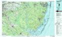
Hammonton
1 : 100000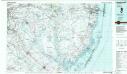
Hammonton
1 : 100000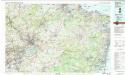
Trenton
1 : 100000
Plan of the operations of General Washington against the Kings troops in New Jersey : from the 26th of December, 1776, to the 3d January, 1777 / by William Faden.
from Cartographic materials from the Emmet Collection of Manuscripts Etc. Relating to American History.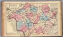
Hunterdon, Somerset Cos., N.J.
1 : 126720 Beers, F. W. (Frederick W.)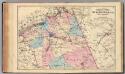
N. Burlington Co., N.J.
1 : 126720 Beers, F. W. (Frederick W.)
Ocean Co., N.J.
1 : 126720 Beers, F. W. (Frederick W.)
Chart of the entrance of Hudson's River, from Sandy Hook to New York : with the banks, depths of water, sailing-marks, & ca
1 : 70000 Printed for Robt. Sayer & John Bennett, sea chart & map-sellers ...
Bay and harbor of New York.
from U.S. Coast and Geodetic Survey. Nautical chart ; no. 369.
Hammods Atlas of New York City and the metropolitan district

Chart and plan of the harbour of New York & the couny. adjacent, from Sandy Hook to Kingsbridge : comprehending the whole of New York and Staten Islands, and part of Long Island & the Jersey shore, and shewing the defences of New York both by land and se
from Whole
Map of New-York Bay and Harbor and the environs
1 : 30000 United States Coast Survey Survey of the Coast of the United States
Map of New-York Bay And Harbor And The Environs.
1 : 30600 United States Coast Survey
Rancocas
1 : 125000
Rancocas
1 : 125000
Trenton
1 : 125000
Trenton
1 : 125000
Trenton
1 : 125000
Navesink
1 : 125000
Navesink
1 : 125000


