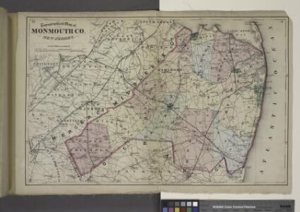
Maps of Monmouth County
Topographical Map of Monmouth Co., New Jersey.
from Atlas of Monmouth co., New Jersey. From recent and actual surveys and records, under the superintendence of F.W. Beers.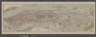
Boroughs of Manhattan and Bronx, showing the electric service of the New York Edison Co.
From Manhattan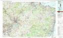
Trenton
1 : 100000
Hammods Atlas of New York City and the metropolitan district

Navesink
1 : 125000
Navesink
1 : 125000
Navesink
1 : 125000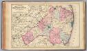
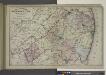
Monmouth Co., N.J.
1 : 126720 Beers, F. W. (Frederick W.)
8 Trenton.
1 : 63360 Vermeule, C. C. (Cornelius Clarkson), 1858-1950
9 Monmouth shore.
1 : 63360 Vermeule, C. C. (Cornelius Clarkson), 1858-1950
Chart of the entrance of Hudson's River, from Sandy Hook to New York : with the banks, depths of water, sailing-marks, & ca
1 : 70000 Printed for Robt. Sayer & John Bennett, sea chart & map-sellers ...
Map of New-York Bay and Harbor and the environs / founded upon a trigonometrical survey under the direction of F. R. Hassler, superintendent of the Survey of the Coast of the United States ; triangulation by James Ferguson and Edmund Blunt, assistants ;
from New York harbor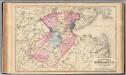
Middlesex Co., N.J.
1 : 126720 Beers, F. W. (Frederick W.)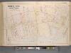
Monmouth County, Double Page Plate No. 6 [Map of Rumson Rd., and Adjaining Properties]
From Wolverton's atlas of Monmouth County, New Jersey : compiled from actual surveys, state and county official records and private plans.
Map of the Hudson ... from Sandy Hook to New York Harbor
from Map of the Hudson between Sandy Hook & Sandy Hill : with the post road between New York and Albany / Bridges delt. ; Rollinson sct.
General map of the city of New York, consisting of boroughs of Manhattan, Brooklyn, Bronx, Queens and Richmond : consolidated into one municipality by act of the legislature of the state of New York (Chapter 378 of the laws of 1897) : showing in addition
from Whole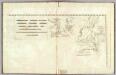
The harbour of New York, Entrance to Chesapeake Bay, coastal views.
1 : 900000 Blunt, Edmund M. (Edmund March), 1770-1862
Bordentown
1 : 62500
Bordentown
1 : 62500
Lakehurst
1 : 62500
Lakehurst
1 : 62500
Bordentown
1 : 62500
Bordentown
1 : 62500
Bordentown
1 : 62500
Bordentown
1 : 62500
Bordentown
1 : 62500
Bordentown
1 : 62500
Asbury Park
1 : 62500
Asbury Park
1 : 62500
Asbury Park
1 : 62500
Asbury Park
1 : 62500
Asbury Park
1 : 62500
Cassville
1 : 62500
Cassville
1 : 62500
Cassville
1 : 62500
Cassville
1 : 62500
Bordentown
1 : 62500
Bordentown
1 : 62500
Bordentown
1 : 62500
Asbury Park
1 : 62500
Asbury Park
1 : 62500
Bordentown
1 : 62500
Cassville
1 : 62500