Maps of Monmouth County

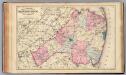
Navesink
1 : 125000
Navesink
1 : 125000
Navesink
1 : 125000
Hammods Atlas of New York City and the metropolitan district
Monmouth Co., N.J.
1 : 126720 Beers, F. W. (Frederick W.)
9 Monmouth shore.
1 : 63360 Vermeule, C. C. (Cornelius Clarkson), 1858-1950
Lakehurst
1 : 62500
Lakehurst
1 : 62500
Asbury Park
1 : 62500
Asbury Park
1 : 62500
Asbury Park
1 : 62500
Asbury Park
1 : 62500
Asbury Park
1 : 62500
Cassville
1 : 62500
Cassville
1 : 62500
Cassville
1 : 62500
Cassville
1 : 62500
Asbury Park
1 : 62500
Asbury Park
1 : 62500
Cassville
1 : 62500
Asbury Park
1 : 62500
New Brunswick
1 : 62500
New Brunswick
1 : 62500
New Brunswick
1 : 62500
New Brunswick
1 : 62500
Sandy Hook
1 : 62500
Sandy Hook
1 : 62500
Sandy Hook
1 : 62500
Sandy Hook
1 : 62500
Sandy Hook
1 : 62500
Sandy Hook
1 : 62500
New Brunswick
1 : 62500
New Brunswick
1 : 62500
Sandy Hook
1 : 62500
Sandy Hook
1 : 62500
New Brunswick
1 : 62500

