Maps of Connecticut

Patroonships, manors and seigniories in New York recognized by the Order of Colonial Lords of Manors / Max Mayer, Thornwood, N.Y.
Max Mayer, Thornwood,
Map of Hudson's River, with the adjacent country.
from Hudson River for D. Henry: [London],
A map of the Province of New York, with part of Pensilvania, and New England.
from Charts and maps
[Kaart], uit: Travellers' guide of the Hudson River
1 : 650000 Annotatie: Met beknopte beschrijving van de belangrijkste aan de Hudson gelegen plaatsen [S.l. : H.B. Kirkham]
New York (eastern section).
1 : 570000 Rand McNally and Company
Various Regions and Cities in New England.
Shell Oil Company
Plate 5: Map of New York and vicinity, accompanying Atlas of New York and vicinity.
from Atlas of New York and vicinity : from actual surveys / by and under the direction of F. W. Beers, assisted by A. B. Prindle & others
New York & vicinity.
1 : 253440 Beers, F. W. (Frederick W.)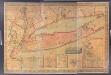
Map of Long Island with the environs of New-York and the southern part of Connecticut / compiled from various surveys & documents by J. Calvin Smith ; engraved & printed by S. Stiles & Co., N. York.
from Long Island
Map of the Southern part of the State of New York.
1 : 330000 Damerum, William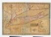
Map of Long Island with the environs of New-York and the southern part of Connecticut / compiled from various surveys & documents by J. Calvin Smith ; engraved & printed by S. Stiles & Co., N. York.
from Long Island
New York.
1 : 614000 Hammond, C.S.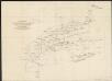
A diagram of the triangulation for the survey of the coast of the United States, made in 1817 and 1833, and the secondary triangles made in 1833 & 1834 in Connecticut & upon Long Island
1 : 412000 United States Coast Survey United States Coast Survey
An improved map of the Hudson River : with the post roads between N. York & Albany / drawn & engraved expressly for the tourist [by] W. Chapin, sc.
from Hudson River
Connecticut and parts adjacent
1 : 375000 Covens et Mortier et Covens, junior
An accurate map of Staten Island : with that part of New York, Long Island and the Jerseys which is the rendesvous of the two grand armies and the supposed present seat of action / by a mercht. who resided in America 15 years.
from Whole
Massachusetts, Rhode Island, And Connecticut.
1 : 1020000 Greenleaf, Jeremiah
Massachusetts. Rhode Island. And Connecticut.
1 : 1013760 Greenleaf, Jeremiah
New York (City) & Vicinity.
1 : 400000 Asher & Adams
Connecticut, from the best authorities.
from Carey's general atlas, improved and enlarged : being a collection of maps of the world and quarters, their principal empires, kingdoms, &c.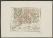
Connecticut
1 : 371000 Sotzmann, D. F Bey Carl Ernst Bohn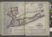
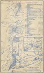
Putman, Rockland, Westchester, New York, Richmond, Kings, Queens, and Suffolk Counties
from New topographical atlas and gazetteer of New York, comprising a topographical view of the several counties of the state, ... including ... map of the United States and territories ... Compiled from the latest astronomical observations, official surveys and records of the United States and territories ...
Hudson River and Vicinity
Disturnell, John
A New and accurate map of the province of Pennsylvania in North America, from the best authorities.
from Whole Hinton, John,
A map of Connecticut.
from The American geography; or, A view of the present situation of the United States of America: containing astronomical geography; geographical definitions, discovery, and general description ... By Jedidiah Morse, A.M.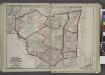
"Delaware, Sullivan, Greene, Ulster, Orange, Columbia, Dutchess, and Putman Counties"
from New topographical atlas and gazetteer of New York, comprising a topographical view of the several counties of the state, ... including ... map of the United States and territories ... Compiled from the latest astronomical observations, official surveys and records of the United States and territories ...
Connecticut : from the best authorities
1 : 460000 Doolittle, Amos, 1754-1832 Mathew Carey
Connecticut with Portions of New York and Rhode Island.
1 : 610000 Colton, G.W.
Connecticut.
1 : 604000 Gray, Ormando Willis