Maps of Banten

Kaart van Straat Soenda : overgenomen van de Zeekaart van 1870 / get[ekend door] J.G. de Groot
Bruxelles : Institut National de Géographie
To Captain Krusenstern, of the Imperial Russian Navy, as a tribute for his laudable exertions to benefit navigation and maritime science
1 : 443750 this chart of the Strait of Sunda is inscribed by [...] James Horsburgh [London] : by James Horsburgh, hydrographer to the Hon.ble East India Co.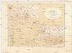
Kaart van Het Gedeelte Java en Sumatra
1 : 500000 Jáva (Indonésie) Eckstein, G. A. Gebroeders Van Cleef
West-Java / Reproductiebedrijf Top. dienst (Reproduced by Topographical Service)
Officieële Vereeniging voor Toeristenverkeer in Nederlandsch-Indië Batavia Batavia : Travellers Official Information Bureau
Caart eeniger ryken gelegen op het eyland Groot-Java bestaande in het koningrijk Jaccatra, de Regentschappen Tjandjoer, Bandong, Timbanganten en Batoe Lejan als mede een gedeelte van Parrakkanmoentjang en Crawang
[S.l. : s.n.]
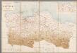
Overzichtskaart van de residentie Bantam / Topogr[afische] Inrichting
Topografische Inrichting Batavia Batavia : Topogr[afische] Inrichting
Kaart van de Residentie Bantam : op de schaal van 1:20.000 (gedeeltelijk ook op schaal van 1:40.000) opgenomen ingevolge Gouvernements Besluit d.d. 6 juli 1866, No. 8, in de jaren 1878 t/m 1885 / Topographisch Bureau van de Generale Staf, Batavia
Topographisch Bureau van de Generale Staf Batavia [Batavia : Topographisch Bureau van de Generale Staf]
Overzichtskaart van de residentie Batavia / [door het] Topographisch Bureau
Topographisch Bureau Batavia Batavia : Topographisch Bureau
Batavia
Overzichtskaart van de Residentie Batavia / [Topographische Inrichting]
1 : 250000 Annotatie: Met een overzicht van de bestuurlijke indeling; Kaartrand afgesneden Topographische Inrichting, Nederlands-Indië [Batavia : Topographische Inrichting]
Overzichtskaart van den ontworpen spoorweg van Batavia naar Anjer : met zijtakken van Doerie naar Tangerang en van Tanahabang naar Weltevreden
Bataviaasch Nieuwsblad Batavia ; Weltevreden : G. Kolff & Co.
Batavia / prepared under the direction of the Chief of Engineers U.S. Army by the Army Map Service
Army Map Service Washington D.C. Washington D.C. : Army Map Service
Laboehan / prepared under the direction of the Chief of Engineers U.S. Army by the Army Map Service
Army Map Service Washington D.C. Washington D.C. : Army Map Service
Overzichtskaart van de Residentie Batavia / Topographische Inrichting
Topografische Inrichting Batavia Batavia : Topographische Inrichting
Kaart van de Residentie Batavia

Kota-Agoeng / published by War Office = uitgegeven door War Office ; revised and photolithographed by War Office
War Office Washington D.C. [Washington D.C.] : War Office
Teloekbetoeng / published by War Office = uitgegeven door War Office ; revised and photolithographed by War Office
War Office Washington D.C. [Washington D.C.] : War Office
[Sukabumi]
1 : 200000 Joh. C. Stemler Cz.
[Sundastrasse]
1 : 200000 Joh. C. Stemler Cz.
[Tugu]
1 : 200000 Joh. C. Stemler Cz.
[Jakarta]
1 : 200000 Joh. C. Stemler Cz.
[Teloekbetoeng]
Topografische Dienst Batavia Batavia : Reproductiebedrijf Topografische Dienst
[Purwakarta]
1 : 200000 Joh. C. Stemler Cz.
[Cimahi]
1 : 200000 Joh. C. Stemler Cz.
Bandoeng / prepared under the direction of the Chief of Engineers, U.S. Army by the Army Map Service
Army Map Service Washington D.C. Washington D.C. : Army Map Service
Bandoeng / prepared under the direction of the Chief of Engineers, U.S. Army by the Army Map Service
Army Map Service Washington D.C. Washington D.C. : Army Map Service
Soekaboemi / prepared under the direction of the Chief of Engineers, U.S. Army by the Army Map Service
Army Map Service Washington D.C. Washington D.C. : Army Map Service
Kota·agoeng / [bew. door J. Zwierzycki]
Dienst van den Mijnbouw in Nederlandsch-Indië Batavia [Batavia] : Dienst van den Mijnbouw in Nederlandsch-Indië
Tjitaroemwerken : overzichtskaart / opgemaakt [door] Soekrawinata, Poerwakarta den 300 1930
Poerwakarta : [s.n.]
![Kaart van Straat Soenda : overgenomen van de Zeekaart van 1870 / get[ekend door] J.G. de Groot](https://images-2.georeferencer.com/images/iiif/109380393684/full/,300/0/native.jpg)

