Maps of Tangerang

Kaart van de Residentie Batavia

Batavia

Overzichtskaart van de residentie Batavia / [door het] Topographisch Bureau
Topographisch Bureau Batavia Batavia : Topographisch Bureau
Batavia / prepared under the direction of the Chief of Engineers U.S. Army by the Army Map Service
Army Map Service Washington D.C. Washington D.C. : Army Map Service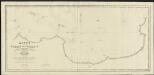
Kaart van de Reede van Batavia met de verschillende vaarwaters
1 : 50000 naar dezelve trigonometrisch opgenomen op last van den Schout Bijnacht E. Lucas door de Luitenants ter Zee B.G. Escher. L.A.C. Eschauzier, B.H. Staring, E.H. Boom en andere officieren van Z.M. Zeemagt uitg. door Jacob Swart ; gegraveerd door J.C. Zurcher ; getekend door G. A. Günther Amsterdam : Wed. G. Hulst van Keulen
Kaart van de Baai van Batavia en aangrenzende kuststrook
[Breda : Koninklijke Militaire Academie]
Garnizoenskaart Batavia en Omstreken / Topografische Dienst
Topografische Dienst Batavia Batavia : Reproductiebedrijf Topografische Dienst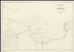
Kaart van het vaarwater uit Straat Sunda naar en op de reede van Batavia : bevattende het gedeelte tusschen het eiland Menschen-eeter en den hoek van Krawang verbeterd bij de herstelling der zeebaken [...] 1832
1 : 85000 Gecopieerd door Zecha den 25/10 1833 Lith. Ch. Motte [S.l.] : [s.n.]
Poerwakarta / bewerkt door O. Ludwig
[Batavia : Topografische Dienst]
Buitenzorg-Soekaboemi-Tjiandjoer / Topografische Inrichting = Topographical Service
Topografische Inrichting Batavia Batavia : Topografische Inrichting = Topographical Service
Buitenzorg-Soekaboemi-Tjiandjoer / Topografische Inrichting, Batavia
Topografische Inrichting Batavia Batavia : Officieële Vereeniging voor Toeristen Verkeer
Batavia en Omstreken / Topographische Inrichting
Topographische Inrichting Batavia : Topographische Inrichting
Batavia en Omstreken / Topografische Dienst
Topografische Dienst Weltevreden (Batavia) Weltevreden (Batavia) : Reproductiebedrijf Topografische Dienst
Batavia en Omstreken / Topographische Inrichting, Batavia 1914
Topographische Inrichting Batavia Batavia : Topographische Inrichting
Overzichtskaart van het bestaande Spoor- en Tramwegnet te Batavia en Omstreken
Den Haag : J. Smulders & Co.
Platte grond van Batavia / uitgaaf van G. Kolff & Co.
G.Kolff & Co. Batavia [Batavia] : G. Kolff & Co.
Kaart van Batavia en Omstreken / Topographisch Bureau
Topographisch Bureau Batavia Batavia : Topographisch Bureau
Town plan of Batavia / revised and drawn by H[ead] Q[uarters] Survey Production Centre South East Asia ; reproduced by 110 Map Production Company R.E.
Head Quarters Survey Production Centre South East Asia [S.l.] : Survey Production Centre South East Asia
[Kaart], uit: Plattegrond van Batavia / G. Kolff & Co
1 : 20000 G. Kolff & Co., Amsterdam Batavia : G. Kolff & Co
Plattegrond van Batavia / Komiti Matawa Yokotyo Wa Syoeyaku Su (TYUI)
Komiti Matawa Yokotyo Wa Syoeyaku Su (TYUI) [S.l.] : Komiti Matawa Yokotyo Wa Syoeyaku Su (TYUI)
Batavia military guide map
AFNEI Headquarters Survey Department [S.l.] : Svy.Dte.H.Q.AFNEI
Plattegrond van Batavia
Kolff, G. en Co. Batavia [Batavia] : G. Kolff & Co.
Plan of Batavia
Officieële Vereeniging voor Toeristenverkeer in Nederlandsch Indië Batavia Weltevreden : Official Tourist Bureau
Plattegrond van Batavia / Het Woningbureau Versluis N.V.
Het Woningbureau Versluis N.V. Soerabaja : E. Fuhri & Co.
Kaart van Buitenzorg en omstreken / Topographisch Bureau
Topographisch Bureau Batavia Batavia : Topographisch Bureau
[Kalangsari] : hermeten in 1908-1909 / Topografische Dienst, herdruk 1929
Topografische Dienst Batavia Weltevreden (Batavia) : Reproductiebedrijf Topografische Dienst
Platte grond van Batavia
Batavia : Boekhandel Visser & Co.
[Teloekambeloe] : herzien in het jaar 1904 / Topographisch Bureau
Topographisch Bureau Batavia Batavia : Topographisch Bureau
[Tjilintjing] : herzien in het jaar 1901 / Topographisch Bureau
Topographisch Bureau Batavia Batavia : Topographisch Bureau


