Maps of Sukabumi

Soekaboemi / prepared under the direction of the Chief of Engineers, U.S. Army by the Army Map Service
Army Map Service Washington D.C. Washington D.C. : Army Map Service
[Sukabumi]
1 : 200000 Joh. C. Stemler Cz.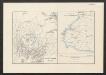
[Java und Madoera, geologische Detailkarten und Profile]
Blatt 16 Verbeek, R. D. M. Joh. C. Stemler Cz.
Java, Bie Winkoups (1867)
Bie Winkoups, d'après, le Lieutt. Hampt ... 1837. Paris
[Geologische Kaart van de omstreken der Tjiletoe-Baai]
[Java und Madoera, geologische Detailkarten und Profile] Verbeek, R. D. M. Joh. C. Stemler Cz.
Geologische Kaart van het Bajah-Kolenveld
[Java und Madoera, geologische Detailkarten und Profile] Verbeek, R. D. M. Joh. C. Stemler Cz.
Sukabumi / Direktorat Tata Guna Tanah, Departemen Dalam Negeri
Departemen Dalam Negeri Jakarta . Direktorat Tata Guna Tanah [Jakarta] : Direktorat Tata Guna Tanah, Departemen Dalam Negeri
Nyalindung / Direktorat Tata Guna Tanah, Departemen Dalam Negeri
Departemen Dalam Negeri Jakarta . Direktorat Tata Guna Tanah [Jakarta] : Direktorat Tata Guna Tanah, Departemen Dalam Negeri
[Djampang Tengah] / photolithographed and reprinted from a Dutch map dated 1925 by the Army Map Service
Army Map Service U.S. Army Washington D.C. Washington D.C. : Army Map Service
[Bajoh] : bijgewerkt t/m april 1894 / [Topographisch Bureau]
Topographisch Bureau Batavia [Batavia : Topographisch Bureau]
[Bajah] / [Topographisch Bureau van de Generale Staf]
Topographisch Bureau van de Generale Staf Batavia [Batavia : Topographisch Bureau van de Generale Staf]
[Tjidjengkol] : bijgewerkt t/m april 1894 / [Topographisch Bureau]
Topographisch Bureau Batavia [Batavia : Topographisch Bureau]
[Tjilong Krang] / [Topographisch Bureau van de Generale Staf]
Topographisch Bureau van de Generale Staf Batavia [Batavia : Topographisch Bureau van de Generale Staf]
[Tjikaso] / [Topographisch Bureau]
Topographisch Bureau Batavia [Batavia : Topographisch Bureau]
[Tjikoeroeloeg] / [Topographisch Bureau]
Topographisch Bureau Batavia [Batavia : Topographisch Bureau]
[Tjitjoeroeg] / [Topographisch Bureau]
Topographisch Bureau Batavia [Batavia : Topographisch Bureau]
[Tjimanggoe] / [Topographisch Bureau]
Topographisch Bureau Batavia [Batavia : Topographisch Bureau]
[Lengkong] / [Topographisch Bureau]
Topographisch Bureau Batavia [Batavia : Topographisch Bureau]
[Tjaoe Mangala] / Topographisch Bureau
Topographisch Bureau Batavia Batavia : Topographisch Bureau
[Nangka] / Topographisch Bureau
Topographisch Bureau Batavia Batavia : Topographisch Bureau
[Tjipitjoeng] / [Topographisch Bureau]
Topographisch Bureau Batavia [Batavia : Topographisch Bureau]
[Tjinanka] / [Topographisch Bureau]
Topographisch Bureau Batavia [Batavia : Topographisch Bureau]
[Karang Tengah] / Topographisch Bureau, herzien in het jaar 1898
Topographisch Bureau Batavia Batavia : Topographisch Bureau
[Tjikidang] / Topographisch Bureau
Topographisch Bureau Batavia Batavia : Topographisch Bureau
[Tjiboetoen] / Topographisch Bureau
Topographisch Bureau Batavia Batavia : Topographisch Bureau
[Tjibaregbeg] / [Topographisch Bureau]
Topographisch Bureau Batavia [Batavia : Topographisch Bureau]
[Bantarsari] / [Topographisch Bureau]
Topographisch Bureau Batavia [Batavia : Topographisch Bureau]
[Tjiboentjoe] / Topographisch Bureau
Topographisch Bureau Batavia Batavia : Topographisch Bureau
[Panoembang] / Topographisch Bureau
Topographisch Bureau Batavia Batavia : Topographisch Bureau


