Maps of United Kingdom
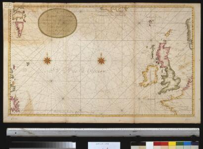
Afteekening van de Noord Occiaan strekkende van Tessel agter Irlant om tot aen de Bancq van Terra Neuf seer dienstig voor de Westindise schipvaert
Atlantic Ocean Gerard van Keulen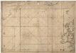
Museumskart 15 Nieuwe Wassende kaart van een Gedeelte der Noorder Atlantische Oceaan
1 : 3000000 Gerard Hulst van Keulen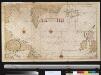
Pascaert om van Texel na de Straet Davids en Hutson te zijlen zijnde ook seer dienstig voor de gene die agterom koomen voornamentlijk voor de Westindise en Guneese schipvaert
Atlantic Ocean Gerard van Keulen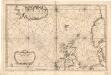
Museumskart 155: Carte Réduite De Partie De La Mer Du Nord
1 : 3000000 S. Bellin
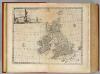
Grossbritanien und Ireland
Neuester Schul-Atlas Walch, Johann im Verlag bei Joh. Walch
Die Britischen Inseln
[Allgemeiner Atlas über alle Theile der Erde in 29 Blättern] Ziegler, Jakob Melchior Top. Anstalt v. J. Wurster u. Comp.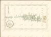
Great Britain & Ireland.
1 : 4250000 Bowen, Emanuel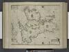
Paskaert, de Kusten van't Kanael, vertoonende alle, de Kusten van Engelandt, Schotlant, en Yerlandt, en een gedeelte van Vranckrijck.
from De zee-atlas ofte water-wereld : waer in vertoont werden alle de zee-kusten van het bekende des aerd-bodems : seer dienstigh voor alle heeren en kooplieden, als oock voor alle schippers en stuurlieden / by Pieter Goos.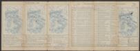
Tabula Europae I. [Karte], in: Claud. Ptolemaeus. Geographia lat. cum mappis [...], S. 254.
1 Karte aus Atlas Münster, Sebastian [und Ptolemaeus, Claudius]
Prima Europe Tabula [Karte], in: [Clavdii Ptholomei Cosmographi ...], S. 245.
1 Karte aus Atlas Nicolaus Germanus [und Ptolemaeus, Claudius]
Carte generale de toute l'Europe, 1
1 Blatt : 57 x 48 cm J.M. Will
Tabula Europae I. [Karte], in: Geographia universalis vetus et nova complectens Claudii Ptolemaei Alexandrini enarrationis libros VIII, S. 222.
1 Karte aus Atlas Münster, Sebastian [und Ptolemaeus, Claudius]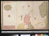
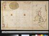
Nieuwe paskaert vant Noorderdeel der Noord Zee als meede een gedeelte van de West cust van Schotlant en Irland seer dienstigh voor de kruijsers op de Oostindise scheepen
Scotland Gerard van Keulen
Tabula Nova Hibernie Anglie Et Scotie [Karte], in: Claudii Ptolemei viri Alexandrini mathematice discipline philosophi doctissimi geographie opus [...], S. 236.
1 Karte aus Atlas Waldseemüller, Martin [und Ptolemaeus, Claudius] Übelin, Georg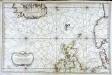
Carte réduite de partie de la mer du Nord comprise entre l'Ecosse, le Dannemark, la Norwege et l'Islande
1 Karte : Kupferdruck ; 55 x 83 cm Bellin s.n.
Les Isles Britanniques ou sont le royaumes d'Angleterre
1 : 2534400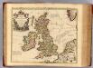
Isles Britanniques.
1 : 2500000 L'Isle, Guillaume de, 1675-1726
Die Britischen Inseln und das Umliegende Meer
Handatlas über alle Theile der Erde und über das Weltgebäude Stieler, Adolf Justus Perthes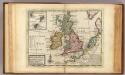
A general map of Great Britain and Ireland.
1 : 7500000 Moll, Herman, d. 1732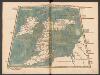
Tabula Prima Europae [Hibernia und Albion Insula Britanica] [Karte], in: Claudii Ptolemei viri Alexandrini mathematice discipline philosophi doctissimi geographie opus [...], S. 151.
1 Karte aus Atlas Waldseemüller, Martin [und Ptolemaeus, Claudius] Übelin, Georg
[123][126] Pascaert vande Noort-Zee om achter Yrland en Schotland om te seylen, uit: Atlas sive Descriptio terrarum orbis
Annotatie: Gedigitaliseerde versie. Amsterdam. Heiloo : Picturae (vervaardiger), 2015. tiff-bestand. Gedigitaliseerd: 07-01-2015; Origineel: Universiteitsbibliotheek Vrije Universiteit (XL.05127.-) ; Netherlands; Titelpagina ontbreekt Wit, Frederik de Amsterdam : Frederick de Wit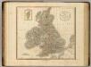
British Isles.
1 : 2550000 Cary, John, ca. 1754-1835
Les isles Britanniques comprenant les royaumes d'Angleterre, Ecosse et Irlande
1 Karte : Kupferdruck ; 51 x 67 cm Crépy; Crépy chez Crepy rue S. Jacques à l'Image Saint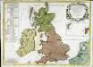
Les isles Britannicques ou sont le royaume d'Angleterre diuisé en ses quatre roy.mes des Saxons
1 Karte : Kupferdruck ; 52 x 71 cm Speed; Gordon; Pont s.n.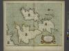
A new and correct chart of the sea coast of ENGLAND, SCOTLAND and IRELAND
from The sea-atlas : containing an hydrographical description of most of the sea-coasts of the known parts of the world.
Great Britain and Ireland.
1 : 4100000 Gray, Ormando Willis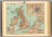
45-46. Gran Bretagna.
1 : 3000000 Touring club italiano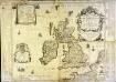
Les isles britaniques ou sont les royaumes d'Angleterre et d'Escosse que nous appellons la Grande Bretagne et celui d'Irlande
1 Karte auf 4 Blättern : Kupferdruck ; 72 x 86 cm Duval; Duval chez Mad.lle Du-Val fille de l'auteur sur le quay de l'Horloge du Palays pres la rue de Harlay a la couronne d'or
Carte des isles britaniques, où sont les royaumes d'Angleterre, et d'Escosse, que nous appellons Grande Bretagne
1 Karte : Kupferdruck ; 46 x 33 cm Duval chez l'auteur en l'isle du Palais sur le quay de l'Horloge