Maps of United Kingdom

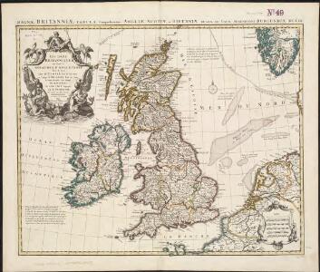
Les Isles Britanniques ou sont le royaumes d'Angleterre
1 : 2534400
Die Britischen Inseln
[Allgemeiner Atlas über alle Theile der Erde in 29 Blättern] Ziegler, Jakob Melchior Top. Anstalt v. J. Wurster u. Comp.
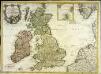
Prima Europe Tabula [Karte], in: [Clavdii Ptholomei Cosmographi ...], S. 245.
1 Karte aus Atlas Nicolaus Germanus [und Ptolemaeus, Claudius]
Westeuropa 1848
Westeuropa Kunz, Andreas ; Röss, Wolf ; Johnen, Bettina ; Moeschl, Joachim Robert
Westeuropa 1922
Westeuropa Kunz, Andreas ; Treiling, Thomas
Westeuropa 1797
Westeuropa Kunz, Andreas ; Treiling, Thomas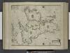
Paskaert, de Kusten van't Kanael, vertoonende alle, de Kusten van Engelandt, Schotlant, en Yerlandt, en een gedeelte van Vranckrijck.
from De zee-atlas ofte water-wereld : waer in vertoont werden alle de zee-kusten van het bekende des aerd-bodems : seer dienstigh voor alle heeren en kooplieden, als oock voor alle schippers en stuurlieden / by Pieter Goos.
Westeuropa 1789
Westeuropa Kunz, Andreas ; Treiling, Thomas
Westeuropa 1812
Westeuropa Kunz, Andreas ; Treiling, Thomas
Grossbritanien und Ireland
Neuester Schul-Atlas Walch, Johann im Verlag bei Joh. Walch
Westeuropa 1957
Westeuropa Kunz, Andreas ; Treiling, Thomas
Westeuropa 1830
Westeuropa Kunz, Andreas ; Röss, Wolf ; Johnen, Bettina ; Moeschl, Joachim Robert
Westeuropa 1914
Westeuropa Kunz, Andreas ; Röss, Wolf ; Johnen, Bettina ; Moeschl, Joachim Robert
Westeuropa 1820
Westeuropa Kunz, Andreas ; Röss, Wolf ; Johnen, Bettina ; Moeschl, Joachim Robert
Westeuropa 1937
Westeuropa Kunz, Andreas ; Treiling, Thomas
Westeuropa 1890
Westeuropa Kunz, Andreas ; Röss, Wolf ; Johnen, Bettina ; Moeschl, Joachim Robert
Westeuropa 1839
Westeuropa Kunz, Andreas ; Röss, Wolf ; Johnen, Bettina ; Moeschl, Joachim Robert
Westeuropa 1867
Westeuropa Kunz, Andreas ; Röss, Wolf ; Johnen, Bettina ; Moeschl, Joachim Robert
Westeuropa 1949
Westeuropa Kunz, Andreas ; Treiling, Thomas
Westeuropa 1871
Westeuropa Kunz, Andreas ; Röss, Wolf ; Johnen, Bettina ; Moeschl, Joachim Robert
Westeuropa 1861
Westeuropa Kunz, Andreas ; Röss, Wolf ; Johnen, Bettina ; Moeschl, Joachim Robert
Westeuropa 1990
Westeuropa Kunz, Andreas ; Treiling, Thomas
Karte von dem Deutschen Meere und den Angranzenden Theilen Des Atlantischen Oceans.
1 : 5500000 Berghaus, Heinrich
[Karte von dem Deutschen Meere und den ängränzenden Theilen des Atlantischen Oceans. Zur Übersicht der Fluthwellen und der Beschaffenheit des Seebodens]
Erster Band, enthaltend in vier Abtheilungen die Erscheinungen der anorganischen Natur: 1. Meteorologie und Klimatographie. 2. Hydrologie und Hydrographie. 3. Geologie. 4. Tellurischer Magnetismus Humboldt, Alexander von Verlag von Justus Perthes
Westeuropa 1935
Westeuropa Kunz, Andreas ; Treiling, Thomas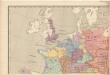
Evropa raného středověku: do konce VI. století po Kr.
Kašpar, Jan
Westeuropa 2003
Westeuropa Kunz, Andreas ; Treiling, Thomas
Tabula Europae I. [Karte], in: Claud. Ptolemaeus. Geographia lat. cum mappis [...], S. 254.
1 Karte aus Atlas Münster, Sebastian [und Ptolemaeus, Claudius]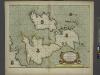
A new and correct chart of the sea coast of ENGLAND, SCOTLAND and IRELAND
from The sea-atlas : containing an hydrographical description of most of the sea-coasts of the known parts of the world.