Maps of United Kingdom

Museumskart 155: Carte Réduite De Partie De La Mer Du Nord
1 : 3000000 S. Bellin
Western part of the northern states including the British Islands Norway Denmark and part of Sweden
1 Blatt : 53 x 68 cm Sayer
Evropa, 1
1 Blatt : mehrfarbig ; 49 x 57 cm Homännische Erben
Karte von Europa, 1
4 Blätter : 53 x 70 cm Verlag der Königlich-Preussischen Academie-Kunst- und Buchhandlung
Europe 1.
1 : 3850000 Brue, Adrien Hubert, 1786-1832
Carte réduite de partie de la mer du Nord comprise entre l'Ecosse, le Dannemark, la Norwege et l'Islande
1 Karte : Kupferdruck ; 55 x 83 cm Bellin s.n.
Evropa XIX. století: od vídeňského kongresu r. 1815, do rozhodnutí na frontách světové války r. 1918
Kašpar, Jan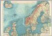
Northern Europe. Pergamon World Atlas.
1 : 5000000 Polish Army Topography Service
[Ethnographische Karte von Europa]
Zweiter Band, enthaltend in vier Abtheilungen die Vertheilung der Organismen: 5. Pflanzen-Geographie, 6. Thier-Geographie, 7. Anthropographie, 8. Ethnographie Humboldt, Alexander von Verlag von Justus Perthes
Schweden, Norwegen, Daenemark.
1 : 4000000 Ziegler, J. M.
North Sea, Baltic cables, wireless stations.
1 : 12500000 Philip, George
Länder der Nord- und Ostsee
1 : 10000000 Nordeuropa
Museumskart 15 Nieuwe Wassende kaart van een Gedeelte der Noorder Atlantische Oceaan
1 : 3000000 Gerard Hulst van Keulen
Carte generale de toute l'Europe, 1
1 Blatt : 57 x 48 cm J.M. Will
Pas Caart van de Noort Zee .. Verthoonende in zich alle de Custen en Havens daer rontom gelegen. [Karte], in: De Nieuwe Groote Vermeerderde Zee-Atlas ofte Water-Werelt, S. 15.
1 Karte aus Atlas Doncker, Hendrick
Nieuwe paskaert vant Noorderdeel der Noord Zee als meede een gedeelte van de West cust van Schotlant en Irland seer dienstigh voor de kruijsers op de Oostindise scheepen
Scotland Gerard van Keulen

Mare Germanicum ac tractus maritimus retro Hiberniam et Scotiam
1 Karte : Kupferdruck ; 47 x 56 cm Renard apud L. Renard
[123][126] Pascaert vande Noort-Zee om achter Yrland en Schotland om te seylen, uit: Atlas sive Descriptio terrarum orbis
Annotatie: Gedigitaliseerde versie. Amsterdam. Heiloo : Picturae (vervaardiger), 2015. tiff-bestand. Gedigitaliseerd: 07-01-2015; Origineel: Universiteitsbibliotheek Vrije Universiteit (XL.05127.-) ; Netherlands; Titelpagina ontbreekt Wit, Frederik de Amsterdam : Frederick de Wit
Tabula Europae I. [Karte], in: Claud. Ptolemaeus. Geographia lat. cum mappis [...], S. 254.
1 Karte aus Atlas Münster, Sebastian [und Ptolemaeus, Claudius]
British Isles - Physical Geography..
Milner, Thomas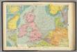
North Sea.
1 : 5000000 Philip, George
Pas caart van de Noort Zee
1 Karte : Kupferdruck ; 43 x 53 cm Doncker by Hendrick Doncker boeckverkooper en graadbooghmaker in de nieuwbrugh steegh in 't Stuurmans gereedschap
Tabula Europae I. [Karte], in: Geographia universalis vetus et nova complectens Claudii Ptolemaei Alexandrini enarrationis libros VIII, S. 222.
1 Karte aus Atlas Münster, Sebastian [und Ptolemaeus, Claudius]
Prémière partie de la carte d'Europe contenant la France, l'Alemagne, l'Italie, l'Espagne & les isles britanniq.s, 1
1 Blatt : 53 x 84 cm s.n.
Isles Britanniques.
1 : 2500000 L'Isle, Guillaume de, 1675-1726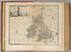
Great Britain & Ireland.
1 : 4250000 Bowen, Emanuel
Prima Europe Tabula [Karte], in: [Clavdii Ptholomei Cosmographi ...], S. 245.
1 Karte aus Atlas Nicolaus Germanus [und Ptolemaeus, Claudius]
[VII], uit: Geognostische Karte des Oesterreichischen Kaiserstaates mit einem grossen Theile Deutschland's u. Italien / hauptsachlich nach ... Haidinger's geognostischer Karte dieses Staates bearb. von Josef Scheda
1 : 3000000 titelvariant: General-Karte von Europa in 25 Blättern; Annotatie: Bijlage bij: General-Karte von Europa in 25 Blättern. - 1:2.592.000. - 1845-1847 Scheda, Joseph Wien : K.K. Militär. Geografisch. Institut


