Maps of Nordrhein-Westfalen

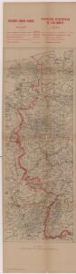
Zachodnie granice Niemiec
Deutschland Frankreich Deutsches Reich Grenze Wierzbicki, B.
Totius FLUMINIS RHENI Novissima DESCRIPTIO
1 : 910000 Nizozemsko Visscher, Nicolaes Jansz. ex officina N. Visscher
Totius fluminis Rheni novissima descriptio
1 : 820000 Evropa západní Danckerts, Justus I. Danckerts
Totius Fluminis Rheni Novissima Descriptio
1 : 820000 Mollova mapová sbírka Danckerts, Justus Danckerts, Justus
Totius Fluminis Rheni Novissima Descriptio
1 : 790000 Mollova mapová sbírka Visscher, Nicolaes Jansz. Schenk, Peter I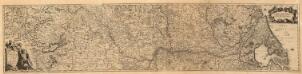
Totius Rheni â fontibus usque ad Ostia Novissima Descriptio
1 : 530000 Mollova mapová sbírka Bodenehr, Johann Georg Neureutter, Augustin
Totius Rheni, ab eius capitibus ad oceanum usque Germanicum in quem se exonerat novißima descriptio
1 : 1025000 Belgie Hondius, Henricus Keere, Pieter van den sumptibus Henrici Hondii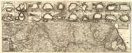
Totius Fluminis Rheni Accvratissima Delineatio Das ist
1 : 930000 Mollova mapová sbírka Hipschmann, Sigmund Gabriel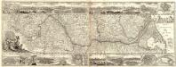
Totius Flumini Rheni Novissima Descriptio
1 : 930000 Mollova mapová sbírka Sandrart, Jakob von Strada, Jacob
Baden.
1 : 670000 Flemming, Carl
Martis Area et Alea per Tractum Rheni, Mosellae, ac Mosae, in qua per plurimos annorum tractus variante eventu saepius certatum, Curatißime designata caelo et studio
1 : 11100000 Mollova mapová sbírka Seutter, Matthäus Seutter, Matthäus
Smulders' kompas van het westelijk front
1 : 570000 Annotatie: Met informatie over o.a. inwoneraantal en productiegoederen van een aantal landen in de wereld; Annotatie geografische gegevens: De kaart toont de Maginotlinie en de Siegfriedlinie 's-Gravenhage : Smulders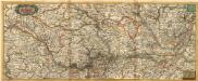
Nova Tractus Totius Rheni T.
1 : 740000 Mollova mapová sbírka Funck, David Funck, David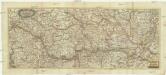
Nova tractus totius Rheni.T
1 : 740000 Evropa západní Funck, David David Funck
Der Rhein, die Maass und Mosel mit den anliegenden Ländern des Ober-Chur und Nieder-Rhein. wie auch des Burgundischen Kreises ing. Elsass ünd Lothringen &cc
1 : 902000 Alsasko (Francie) Güssefeld, Franz L. bey denen Homaen[n]ischen Erben
Théatre de la guerre, ou carte des frontières de la république française et de l'empire d'Allemagne, 2
1 Teil : Delamarche
Der gantze Rhein Strom Von Seinem Ursprung biß zu seinem Ausfluß
1 : 1100000 Mollova mapová sbírka Haupt, Gottfried Jacob Haupt, Gottfried Jacob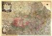
Theatrum Belli Serenissimae Domus Austriacae, Contra Gallos, Confine Limitibus Sacri Romani Imperii et Belgii
1 : 400000 Mollova mapová sbírka Oettinger, Johann Friedrich Lotter, Tobias Conrad Seutter, Matthäus
Secunda Rheni Et IX. Nova Tabula. [Karte], in: Claud. Ptolemaeus. Geographia lat. cum mappis [...], S. 362.
1 Karte aus Atlas Münster, Sebastian [und Ptolemaeus, Claudius]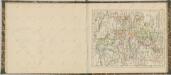

Rhenish Prussia, Westphalia, Hesse-Nassau, Waldeck, Lippe, Hesse.
1 : 1000000 Andree, Richard; Times (London, England)
Rheinprovinz, Westfalen, Hessen-Nassau, Waldeck, Grossherzogthum Hessen.
1 : 1000000 Andree, Richard
Westphalia.
1 : 2000000 Bowen, Frances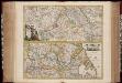
Totius fluminis Rheni : novissima descriptio / ex. officina N. Visscher
1 : 950000 Annotatie: Origineel is Blad 116 in atlas factice; Annotatie geografische gegevens: 2 schaalstokken op kaart met de schaalaanduidingen: Milliaria Germanica com:, Gemeene Duytsche Mylen, en: Milliaria Gallica communia, en: Uren gaans; Zuidwest boven Nicolaes Jansz. Visscher jr. 1649-1702 [Amsterdam : Nicolaes Visscher]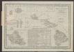
Le Cercle Eslectorial Du Rhein subdivié entous les Estats qui le composent [Karte], in: Atlas nouveau, contenant toutes les parties du monde [...], Bd. 1, S. 290.
1 Karte aus Atlas Sanson, Nicolas Jaillot, Alexis Hubert und Mortier, Pieter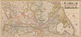
Totius Fluminis Rheni Novissima Descriptio [Karte, Teil 2], in: Novus atlas absolutissimus, Bd. 2, S. 150.
1 Karte aus Atlas Janssonius Offizin
Charte von den Grosherzogthümern Berg und Hessen, den Fürstlich-Primatischen Laendern; dem Herzogthume Nassau und den übrigen darinne begränzten, zum Theil noch uneingetheilten Laendern
1 : 820000 Streit, Friedrich Wilhelm Verl. des Geograph. Inst.
[Southwest Germany]
1 : 1400000 [S.l. : s.n.]
Charte über die sæmtlichen zum Westphælischen Kreis gehörige Lænder
1 Karte : Kupferdruck ; 52 x 47 cm Güssefeld bey den Homænnischen Erben