Maps of Niedersachsen

Operationen der alliirten und französischen Armee 1759


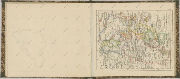
[Nordwestliches Deutschland und Kgr. Der Niederlande]
Stieler's Hand-Atlas Stieler, Adolf bei Justus Perthes
Circulus Westphaliae cum omnibus suis subjacentibus provinciis novissima delineatio
1 : 1000000 1 Karte : Kupferdruck ; 49 x 56 cm Danckerts, Justus [Danckerts]
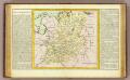
Nordwestliches Deutschland, Niederlande und Belgien
1 : 3441000 Belgie Justus Perthes
Eisenbahnkarte von Nordwest-Deutschland
1 : 2000000 Německo severozápadní Geograph. Anstalt von Wagner & Debes
[Nordwestliches Deutschland, Kgr. der Niederlande, Kgr. Belgien]
Hand-Atlas über alle Theile der Erde nach dem neuesten Zustande und über das Weltgebäude Stieler, Adolf bei Justus Perthes
Circulus Westphalicus
1 : 1000000 Mollova mapová sbírka Seutter, Matthäus Seutter, Matthäus
Circulus Westphaliae cum Omnibus Suis Subjacentibus Provinciis Novissima Delineatio
1 : 1000000 Mollova mapová sbírka Ottens, Josua Ottens, Josua
Demarcations-Linie welche Kraft dem am 17. May 1795 zwischen Frankreich und Preussen geschlossenen Vergleich bestimmt : wie weit die Franzosen disseits des Rheins in Deutschland vordringen dürffen
1 : 1300000 Augsburg : Johann Walch
[Nordwestliches Deutschland, Kgr. Der Niederlande, Kgr. Belgien]
Hand-Atlas über alle Theile der Erde nach dem neuesten Zustande und über das Weltgebäude Stieler, Adolf bei Justus Perthes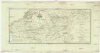
Charte von dem Schiefer Gebirge des nordwestlichen Deutschlands Belgiens und des nordöstlichen Frankreichs
1 : 1150000 Ardeny Raumer, Carl von Guimpel, F.
Circulus Westphalicus in suas provincias et ditiones accurate distinctus et recentissime delineat
1 : 1000000 cura et caelo Matth. Seutteri S.C.M.G. G. Matthaeus Seüter jun. sculpsit. Aug. Vind : [Matthäus Seutter]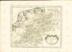
Westphalie.
1 : 1400000 Clouet, J. B. L. (Jean-Baptiste Louis), b. 1730
The north west part of Germany.
1 : 2500000 Moll, Herman, d. 1732
NW pt. of Germany.
1 : 2150000 Bowen, Emanuel
CIRCULUS WESTPHALICUS IN SUAS PROVINCIAS ET DITIONES accurate distinctus et recentissime delineat
1 : 1100000 Vestfálsko (Německo) Seutter, Matthäus cura et caelo Matth. Seutteri
Circulus Westphalicus in suas provincias et dittiones
1 : 1040000 Vestfálsko (Německo) Seutter, Matthäus cura et caelo Matth. Seutteri
Circulus Westphalicus in suas provincias et dittiones
1 : 1040000 Vestfálsko (Německo) Seutter, Matthäus cura et caelo Matth. Seutteri
Operationen der alliirten und französischen Armee 1759

The North West Part of Germany
1 : 2500000 Mollova mapová sbírka Moll, Herman Moll, Hermann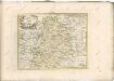

Postkarte von dem Westphaelischen und Burgundischen Kreise
Burgundsko (Francie) Kühn, Ignaz im von Reilly'schen Landkarten und Kunstwerke Verschleiss Komptoir
Le Cours de la Riviere du Rhein
1 : 1100000 Mollova mapová sbírka Sanson, Guillaume Schenk, Peter I
Nordwest-Deutschland
1 : 2000000 Německo severozápadní Kocen, Blaž E. Hölzel
Westphalen, Rhein-Privinz, Hessen.
1 : 700000 Weiland, C. F. (Carl Ferdinand), d. 1847
Charte von den Grosherzogthümern Berg und Hessen, den Fürstlich-Primatischen Laendern; dem Herzogthume Nassau und den übrigen darinne begränzten, zum Theil noch uneingetheilten Laendern
1 : 820000 Streit, Friedrich Wilhelm Verl. des Geograph. Inst.