Maps of Grand Est
Secunda Rheni Et IX. Nova Tabula. [Karte], in: Claud. Ptolemaeus. Geographia lat. cum mappis [...], S. 362.
1 Karte aus Atlas Münster, Sebastian [und Ptolemaeus, Claudius]
Land Charte zum Schau Platz des Kriegs der Röm Kaiserl Maje und dero hohen Alliirten am Rhein
1 : 840000 Mollova mapová sbírka Riegel, Christoph Riegel, Christoph
Théatre de la guerre, ou carte des frontières de la république française et de l'empire d'Allemagne, 2
1 Teil : Delamarche
Accurate Land Charte des Rheins Mossel und Neckar-Stroms
1 : 845700 Mosela, řeka-oblast Christoph Riegel
Nova tractus totius Rheni.T
1 : 740000 Evropa západní Funck, David David Funck
Nova Tractus Totius Rheni T.
1 : 740000 Mollova mapová sbírka Funck, David Funck, David
Landskarte zum Schauplatz des Kriegs der Röm. Kaisers. Maje. und dero hohen alliirten am Rhein
1 : 840000 Německo Christoph Kriegel
Smulders' kompas van het westelijk front
1 : 570000 Annotatie: Met informatie over o.a. inwoneraantal en productiegoederen van een aantal landen in de wereld; Annotatie geografische gegevens: De kaart toont de Maginotlinie en de Siegfriedlinie 's-Gravenhage : Smulders
Rhenus Bicornis hoc est Totius Rheni tractus delineatio
Mollova mapová sbírka Vopel, Caspar Tscherning, Johann
Teatre de la Guerre sur le Rhein, Moessele, Mayn & Necker
1 : 420000 Mollova mapová sbírka Sanson, Guillaume Covens, Johannes I
[Southwest Germany]
1 : 1400000 [S.l. : s.n.]
Martis Area et Alea per Tractum Rheni, Mosellae, ac Mosae, in qua per plurimos annorum tractus variante eventu saepius certatum, Curatißime designata caelo et studio
1 : 11100000 Mollova mapová sbírka Seutter, Matthäus Seutter, Matthäus
Der Rhein, die Maass und Mosel mit den anliegenden Ländern des Ober-Chur und Nieder-Rhein. wie auch des Burgundischen Kreises ing. Elsass ünd Lothringen &cc
1 : 902000 Alsasko (Francie) Güssefeld, Franz L. bey denen Homaen[n]ischen Erben
Mappa in qua Armisonum Martis Theatrum, ad Rhenum et Mosellam geographico stilo Exacte delineatur
1 : 1200000 Mollova mapová sbírka
SW pt. of Germany.
1 : 2300000 Bowen, Emanuel
Baden.
1 : 670000 Flemming, Carl
The South West Part of Germany
1 : 2400000 Mollova mapová sbírka Moll, Herman Moll, Hermann
Der gantze Rhein Strom Von Seinem Ursprung biß zu seinem Ausfluß
1 : 1100000 Mollova mapová sbírka Haupt, Gottfried Jacob Haupt, Gottfried Jacob
Charte Von Mosel Saar Neccar-Rhein- und Mayn-Strom
1 : 780000 Mollova mapová sbírka Riegel, Christoph Riegel, Christoph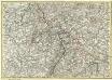
Mappa Geographica summo labore, accurate et novissime exarata, exhibens Circulos aliquot Germaniae, praesertim illos ubi Bellum nunc Geritur
1 : 1300000 Mollova mapová sbírka Lotter, Tobias Conrad Lotter, Tobias Conrad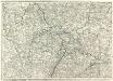
Carte Generale d'Allemagne
1 : 1300000 Mollova mapová sbírka Eisenschmidt, Johann Caspar Julien, Roch Joseph
Carte de France, 4
2 Blätter : Kupferdruck ; 54 x 45 cm Crepy
Le Cercle Eslectorial Du Rhein subdivié entous les Estats qui le composent [Karte], in: Atlas nouveau, contenant toutes les parties du monde [...], Bd. 1, S. 290.
1 Karte aus Atlas Sanson, Nicolas Jaillot, Alexis Hubert und Mortier, Pieter
Zachodnie granice Niemiec
Deutschland Frankreich Deutsches Reich Grenze Wierzbicki, B.
Teatre De La Guerre sur le Rhein, Moessele, Mayn, &c le Necker [Karte], in: Atlas nouveau, contenant toutes les parties du monde [...], Bd. 1, S. 229.
1 Karte aus Atlas Sanson, Nicolas Jaillot, Alexis Hubert und Mortier, Pieter
Pars summa, seu Australis Superioris Rheni Circuli;
1 : 650000 Mollova mapová sbírka Valk, Gerhard Valck, Gerard
Abriss des Reinstroms
1 : 870000 Mollova mapová sbírka
Synopsis Circuli Rhenani Inferioris, Sive Electorum Rheni
1 : 620000 Mollova mapová sbírka Seutter, Matthäus Seutter, Matthäus
Sud-West Deutschland Und Schweiz.
1 : 925000 Vogel, C.
![Secunda Rheni Et IX. Nova Tabula. [Karte], in: Claud. Ptolemaeus. Geographia lat. cum mappis [...], S. 362.](https://images-2.georeferencer.com/images/iiif/627642118826/full/,300/0/native.jpg)

