Maps of North Rhine-Westphalia
Le Cercle Eslectorial Du Rhein subdivié entous les Estats qui le composent [Karte], in: Atlas nouveau, contenant toutes les parties du monde [...], Bd. 1, S. 290.
1 Karte aus Atlas Sanson, Nicolas Jaillot, Alexis Hubert und Mortier, Pieter
Nova tractus totius Rheni.T
1 : 740000 Evropa západní Funck, David David Funck
Nova Tractus Totius Rheni T.
1 : 740000 Mollova mapová sbírka Funck, David Funck, David
Le Cercle Eslectoral du Rhein subdivisé et touts les Estats qui le composent sur les Memoires le plus Nouveaux
1 : 560000 Mollova mapová sbírka Sanson, Guillaume Cordier, Louis Jaillot, Alexis Hubert
Westdeutschland
Volksschul-Atlas über alle Teile der Erde Lange, Henry Druck und Verlag von Georg Westermann

Geographisch-statistische Post- und Resekarte zu den besuchtesten Rhein- und Main-Gegenden
1 : 831500 Mohan (Německo) Bauerkeller, Georg J.P. Streng
Martis Area et Alea per Tractum Rheni, Mosellae, ac Mosae, in qua per plurimos annorum tractus variante eventu saepius certatum, Curatißime designata caelo et studio
1 : 11100000 Mollova mapová sbírka Seutter, Matthäus Seutter, Matthäus
Circolo Elettorale del Reno
1 : 730000 Mollova mapová sbírka Mariotti, Vincenzo De Rossi, Giovanni Giacomo
Théatre de la guerre, ou carte des frontières de la république française et de l'empire d'Allemagne, 2
1 Teil : Delamarche
Haut, Bas Rhin.
1 : 640000 Robert de Vaugondy, Gilles, 1688-1766
Tabula Nova Circuli Electoralis Rheni, ad Usum Serenissimi Burgundae Ducis
1 : 670000 Mollova mapová sbírka Jaillot, Alexis-Hubert Ottens, Josua
Tabula Nova Circuli Electoralis Rheni, ad Usum Serenissimi Burgundae Ducis
1 : 670000 Mollova mapová sbírka Jaillot, Alexis-Hubert Jaillot, Alexis Hubert
[Southwest Germany]
1 : 1400000 [S.l. : s.n.]
Teutschlands Nieder Rheinischer Creiss mit seinen abgetheilten Provintzen
1 : 2600000 Mollova mapová sbírka Weigel, Christoph Weigel, Christoph I.
Smulders' kompas van het westelijk front
1 : 570000 Annotatie: Met informatie over o.a. inwoneraantal en productiegoederen van een aantal landen in de wereld; Annotatie geografische gegevens: De kaart toont de Maginotlinie en de Siegfriedlinie 's-Gravenhage : Smulders
Le Cercle Eslectoral du Rhein subdivisé et touts les Estats qui le composent
1 : 560000 Mollova mapová sbírka Sanson, Guillaume Jaillot, Alexis Hubert
S. R. I. Rhenanus Inferior sive Electorum Rheni

S.R.I. circulus Rhenanus inferior sive electorum Rheni
1 : 640000 Dolní Porýní (Německo) Homann, Johann Baptist a Ioh. Baptista Homanno
S.R.I. circulus Rhenanus inferior sive electorum Rheni
1 : 640000 Dolní Porýní (Německo) Homann, Johann Baptist a Ioh. Baptista Homanno
S.R.I. circulus Rhenanus inferior sive electorum Rheni
1 : 640000 Dolní Porýní (Německo) Homann, Johann Baptist a Ioh. Baptista Homanno
S. R. I. circulus Rhenanus inferior sive electorum Rheni
1 : 660000 Kolín nad Rýnem (Německo) Homann, Johann Baptist J.B. Homann
S.R.I. circulus Rhenanus inferior sive electorum Rheni
1 : 640000 Dolní Porýní (Německo) Homann, Johann Baptist á Ioh. Baptista Homanno
Uterque Rheni Circulus, Superior, et Inferior Electoralis, cum Palatinatu :
1 : 620000 Mollova mapová sbírka Valk, Gerhard Valck, Gerard
Landskarte zum Schauplatz des Kriegs der Röm. Kaisers. Maje. und dero hohen alliirten am Rhein
1 : 840000 Německo Christoph Kriegel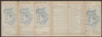
Secunda Rheni Et IX. Nova Tabula. [Karte], in: Claud. Ptolemaeus. Geographia lat. cum mappis [...], S. 362.
1 Karte aus Atlas Münster, Sebastian [und Ptolemaeus, Claudius]
S. R. I. circulus Rhenanus inferior sive electorum Rheni
1 : 624000 Kolín nad Rýnem (Německo) Homann, Johann Baptist I. B. Homann
Die Preussische Provinz Sachsen
1 : 600000 Geographisches Institut (Weimar, Germany)
Mappa in qua Armisonum Martis Theatrum, ad Rhenum et Mosellam geographico stilo Exacte delineatur
1 : 1200000 Mollova mapová sbírka
![Le Cercle Eslectorial Du Rhein subdivié entous les Estats qui le composent [Karte], in: Atlas nouveau, contenant toutes les parties du monde [...], Bd. 1, S. 290.](https://images-2.georeferencer.com/images/iiif/333099769597/full/,300/0/native.jpg)

