Maps of Netherlands
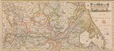
Totius Fluminis Rheni Novissima Descriptio [Karte, Teil 2], in: Novus atlas absolutissimus, Bd. 2, S. 150.
1 Karte aus Atlas Janssonius Offizin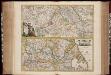
Totius fluminis Rheni : novissima descriptio / ex. officina N. Visscher
1 : 950000 Annotatie: Origineel is Blad 116 in atlas factice; Annotatie geografische gegevens: 2 schaalstokken op kaart met de schaalaanduidingen: Milliaria Germanica com:, Gemeene Duytsche Mylen, en: Milliaria Gallica communia, en: Uren gaans; Zuidwest boven Nicolaes Jansz. Visscher jr. 1649-1702 [Amsterdam : Nicolaes Visscher]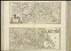
[37][37] Totius fluminis Rheni novissima descriptio, uit: Atlas sive Descriptio terrarum orbis
Annotatie: Gedigitaliseerde versie. Amsterdam. Heiloo : Picturae (vervaardiger), 2015. tiff-bestand. Gedigitaliseerd: 07-01-2015; Origineel: Universiteitsbibliotheek Vrije Universiteit (XL.05127.-) ; Netherlands; Titelpagina ontbreekt Wit, Frederik de Amsterdam : Frederick de Wit
Holland And Belgium.
1 : 2100000 Tanner, Henry S.
Holland And Belgium.
1 : 2050000 Tanner, Henry S.
Holland and Belgium.
1 : 2080000 Tanner, Henry S.
Brabantia III. Rheni Et X. Nova Tabula. [Karte], in: Claud. Ptolemaeus. Geographia lat. cum mappis [...], S. 371.
1 Karte aus Atlas Münster, Sebastian [und Ptolemaeus, Claudius]
[Kaart], uit: Kaart der bevaarbare waterloopen van België, Nederland, N.-Frankrijk, W.-Duitschland, en den Rijn van Rotterdam tot Basel = Carte des voies navigables de la Belgique, la Hollande, N. de la France, Allemagne Est, et le Rhin de Rotterdam à Bâle = Wasserstrassen Karte von Belgien, Holland, N. Frankreich, W. Deutschland und der Rhein von Rotterdam bis Basel
1 : 800000 Antwerpen : Seghers
Rheinprovinz, Westphalen, Holland und Belgien
Schul-Atlas in 36 Karten Völter, Daniel Verlag der J.M. Dannheimer'schen Buchhandlung
Carte du Royaume des Pays-Bas, comprenant les routes de poste et relais depuis Paris jusqu'aux frontières septentrionales de la Hollande, avec un Itinéraire des communications de Strasbourg à Amsterdam et Hambourg
1 : 1280000 [par] Hocquart. Paris : Audin
Holand and Belgium.
1 : 1290000 Colton, G.W.
Patriae Antique Inter Iuly et Caroli Magni Caesarum Romanorum Tempora Descriptio
1 : 1100000 Mollova mapová sbírka Ewich, Hermann Saevry, S.
Leo Belgicus / Johan van Doetechum fecit
1 : 350000 Annotatie: Facs. van de uitg.: [Amsterdam] : C.J. Visscher excudit, 1650. - Het betreft de 3e staat van de kaart van J. van Doetechum uit 1598, bijgewerkt door C.J. Visscher; Uitg. t.g.v. de tentoonstelling "De wereld op papier", in het Amsterdams Historisch Museum, april 1967 Joannes van Doetecum de Oudere -1605; Visscher, Claes Jansz. [S.l. : s.n.]
Niederlande und Belgien
Plastischer Schul-Atlas über alle Theile der Erde : in 24 Karten Woldermann, G Verlag von P. Eckerlein
Kaart van de Nederlanden, Belgie, Luxemburg, Noordelijk Frankrijk en Westelijk Duitschland : ten gebruike van algemeene besturen, touristen, handelsreizigers, kantoren, instituten, enz. / vervaardigd ... onder toezicht en met medew. van J.A. van Voorthuijsen ; door A.A. en A.C. Nunnink
1 : 400000 J.A. van Voorthuijsen 1869 fl.; Albertus Anthonius Nunnink; Adolf Carel Nunnink 1813-1894 Brussel [etc.] : C. Muquardt
Holland and Belgium.
1 : 2060000 Mitchell, Samuel Augustus
Holland and Belgium.
1 : 2060000 Mitchell, Samuel Augustus
Niederlande und Belgien
Geographischer Atlas über alle Theile der Erde Ziegler, Jakob Melchior Verlag von Dietrich Reimer
Niederland und Belgien
Geographischer Atlas über alle Theile der Erde Ziegler, Jakob Melchior Verlag von Joh. Wurster um Comp.
[Nordwestliches Deutschland und Kgr. Der Niederlande]
Stieler's Hand-Atlas Stieler, Adolf bei Justus Perthes
Galliæ antiquæ descriptio geographica, 2
1 Blatt : 44 x 57 cm s.n.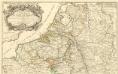
Theatre de la Guerre en Allemagne et dans les Pays Bas.
1 : 1100000 Mollova mapová sbírka Nolin, Jean-Baptiste Nolin, Jean-Baptiste I.
[Nordwestliches Deutschland, Kgr. der Niederlande, Kgr. Belgien]
Hand-Atlas über alle Theile der Erde nach dem neuesten Zustande und über das Weltgebäude Stieler, Adolf bei Justus Perthes
Novus XVII Inferioris Germaniae Provinciarum Typus [Karte], in: Le théâtre du monde, ou, Nouvel atlas contenant les chartes et descriptions de tous les païs de la terre, Bd. 1, S. 329.
1 Karte aus Atlas Blaeu, Willem Janszoon und Blaeu, Joan Blaeu, Willem Janszoon
Novus XVII Inferioris Germaniae Provinciarum Typus [...] [Karte], in: Novus Atlas, das ist, Weltbeschreibung, Bd. 1, S. 298.
1 Karte aus Atlas Blaeu, Joan Blaeu, Willem Janszoon
Carte routière du Royaume des Pays-Bas, comprenant la Hollande et la Belgique, aux quelles on a joint le grand Duché de Luxembourg : avec l'indication des archevêchés et evêcheés, ainsi que les batailles et les distances d'un lieu à un autre en lieues de poste de 281⁄2 au degré
1 : 650000 par Hérisson, géographe gravé par Berthe. Paris : Basset
Niederland u. Belgien
1 : 2220000 Belgie Stein, Carl
[Nordwestliches Deutschland, Kgr. Der Niederlande, Kgr. Belgien]
Hand-Atlas über alle Theile der Erde nach dem neuesten Zustande und über das Weltgebäude Stieler, Adolf bei Justus Perthes
Nova Totius Belgii Sive Germaniae Inferioris accuratissima Delineatio. [Karte], in: Novus atlas absolutissimus, Bd. 3, S. 11.
1 Karte aus Atlas Janssonius Offizin
![Totius Fluminis Rheni Novissima Descriptio [Karte, Teil 2], in: Novus atlas absolutissimus, Bd. 2, S. 150.](https://images-2.georeferencer.com/images/iiif/555432946318/full/,300/0/native.jpg)

