Maps of Niedersachsen

[Nordwestliches Deutschland, Kgr. der Niederlande, Kgr. Belgien]
Hand-Atlas über alle Theile der Erde nach dem neuesten Zustande und über das Weltgebäude Stieler, Adolf bei Justus Perthes
[Nordwestliches Deutschland, Kgr. Der Niederlande, Kgr. Belgien]
Hand-Atlas über alle Theile der Erde nach dem neuesten Zustande und über das Weltgebäude Stieler, Adolf bei Justus Perthes
Nord-Westliches Deutschland, Niederlande und Belgien
Hand-Atlas über alle Theile der Erde und über das Weltgebäude Stieler, Adolf Justus Perthes
Nord-Westliches Deutschland, Niederlande Und Belgien.
1 : 1850000 Vogel, C.
Nord-Westliches Deutschland, Niederlande und Belgien
Handatlas über alle Theile der Erde und über das Weltgebäude Stieler, Adolf Justus Perthes
NW Deutschland, Niederlande, Belgien.
1 : 5500000 Brudin, J. L.; Stieler, Adolf
[Nordwestliches Deutschland und Kgr. Der Niederlande]
Stieler's Hand-Atlas Stieler, Adolf bei Justus Perthes
Nordwestliches Deutschland, Niederlande und Belgien
Schul-Atlas über alle Theile der Erde nach dem neuesten Zustande, und über das Weltgebäude Stieler, Adolf Justus Perthes
Nordwestliches Deutschland, Niederlande und Belgien
Schul-Atlas über alle Theile der Erde nach dem neuesten Zustande, und über das Weltgebäude Stieler, Adolf bei Justus Perthes
Galliæ antiquæ descriptio geographica, 2
1 Blatt : 44 x 57 cm s.n.
Charte von dem Schiefer Gebirge des nordwestlichen Deutschlands Belgiens und des nordöstlichen Frankreichs
1 : 1150000 Ardeny Raumer, Carl von Guimpel, F.
Royaume des Pays-Bas. Europe 13.
1 : 1641836 Vandermaelen, Philippe, 1795-1869
Kaart van de Nederlandsche Noorder- en Zuider spoorwegen
1 : 2000000 [S.l.] : [s.n.]
Nordwestliches Deutschland, Niederlande und Belgien

Nouvelle carte geographique des postes des Pais Bas, de la Westphalie, & des provinces limitrophes
1 : 1
Atlas für Handel und Industrie: Für Kaufleute, Fabrikante u. Gewerbetreibende, Handlungs- u. Gewerbe-Schulen

Tabula generalis totius Belgii
1 : 1000000 Belgie Homann, Johann Baptist á Iohanne Baptista Homanno
TABULA GENERALIS TOTIUS BELGII qua PROVINCIAE XVII. INFER. GERMANIAE olim sub S.R.I. CIRCULO BURGUNDIAE
1 : 1100000 Belgie Homann, Johann Baptist â Iohanne Baptista Homanno
Tabula generalis totius Belgii
1 : 1000000 Belgie Homann, Johann Baptist á Iohanne Baptista Homanno
Tabula generalis totius Belgii
1 : 1000000 Belgie Homann, Johann Baptist â Iohanne Baptista Homanno
Nouvelle Carte du Royaume des Pays - Bas et Pays Limithropes...

Possessions du roi de Prusse a l'ouest du Weser
1 : 1730000 Neuchâtel (Švýcarsko) Mentelle, Edme Tardieu, Pierre François
Nordwestliches Deutschland, Niederlande und Belgien
1 : 3441000 Belgie Justus Perthes
Grossdeutsches Reich und angrenzende Gebiete

Die Herzogthuemer Saxonia und Lotharingia inferior; dann Thuringia, Osterland, Massia &c.
1 : 1900000 Spruner von Merz, Karl
D.O.M. Carte Generale Des Dixsept Provinces des Pays-Bas avec les Frontieres de France, d'Allemagne et Partie de l'Angleterre Nouvellement dreßée sur plusieur Momoires tirés sur les Lieux pendant les Guerres
1 : 750000 Mollova mapová sbírka Sengre, Henri Misson, François Maximilien
Naauwkeurige kaart van het oude Nederland en eenige aangrenzende gewesten.
1 : 2000000 Isaak Tirion. Te Amsterdam : by Isaak Tirion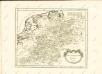

Bez titulu: Severozápadní Evropa

![[Nordwestliches Deutschland, Kgr. der Niederlande, Kgr. Belgien]](https://images-2.georeferencer.com/images/iiif/826591010858/full/,300/0/native.jpg)

