Maps of powiat olsztyński

28 Lötzen, uit: Special-Karte von Mittel-Europa / nach amtlichen Quellen bearbeitet von W. Liebenow
1 : 300000 titelvariant: W. Liebenow's Mittel-Europa; Annotatie: Titel boven de bladen: W. Liebenow's Mittel-Europa Johannes Wilhelm Liebenow 1822-1897 Frankfurt a. M. : Ludwig Ravenstein
Karte vom Kreise Rössel, Reg. Bez. Königsberg
Karte vom Kreise Rössel, Reg. Bez. Königsberg, gefestigt und herausgegeben von G. Schamberg's lithographischer Anstalt. Königsberg
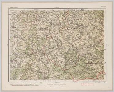
168. Ortelsburg. (Germany)
1 : 100000 Reichsamt fur Landesaufnahme
Composite: 168. Ortelsburg. (Germany)
1 : 100000 Reichsamt fur Landesaufnahme
Composite: 135. Sensburg. (Germany)
1 : 100000 Reichsamt fur Landesaufnahme
Composite: 169. Johannisburg. (Germany)
1 : 100000 Reichsamt fur Landesaufnahme
136. Nikolaiken. (Germany)
1 : 100000 Reichsamt fur Landesaufnahme
169. Johannisburg. (Germany)
1 : 100000 Reichsamt fur Landesaufnahme
105. Rastenburg. (Germany)
1 : 100000 Reichsamt fur Landesaufnahme
Composite: 136. Nikolaiken. (Germany)
1 : 100000 Reichsamt fur Landesaufnahme
Composite: 104. Rossel. (Germany)
1 : 100000 Reichsamt fur Landesaufnahme
Composite: 105. Rastenburg. (Germany)
1 : 100000 Reichsamt fur Landesaufnahme
104. Rossel. (Germany)
1 : 100000 Reichsamt fur Landesaufnahme
Composite: 103. Heilsberg. (Germany)
1 : 100000 Reichsamt fur Landesaufnahme
103. Heilsberg. (Germany)
1 : 100000 Reichsamt fur Landesaufnahme
Composite: 167. Passenheim. (Germany)
1 : 100000 Reichsamt fur Landesaufnahme
167. Passenheim. (Germany)
1 : 100000 Reichsamt fur Landesaufnahme
134. Allenstein. (Germany)
1 : 100000 Reichsamt fur Landesaufnahme
Composite: 134. Allenstein. (Germany)
1 : 100000 Reichsamt fur Landesaufnahme
170. Bialla (202. Gehsen). (Germany)
1 : 100000 Reichsamt fur Landesaufnahme
Composite: 170.1. Bialla (202. Gehsen) (Germany)
1 : 100000 Reichsamt fur Landesaufnahme
137. Arys. (Germany)
1 : 100000 Reichsamt fur Landesaufnahme
Composite: 137. Arys. (Germany)
1 : 100000 Reichsamt fur Landesaufnahme
Composite: 202.1. (170. Bialla). Gehsen. (Germany)
1 : 100000 Reichsamt fur Landesaufnahme
202.1. (170. Bialla). Gehsen. (Germany)
1 : 100000 Reichsamt fur Landesaufnahme
170.1. Bialla (202. Gehsen). (Germany)
1 : 100000 Reichsamt fur Landesaufnahme
Composite: 106. Grabowen. (Germany)
1 : 100000 Reichsamt fur Landesaufnahme
135. Sensburg. (Germany)
1 : 100000 Reichsamt fur Landesaufnahme
Plan zur Schlacht bei Heilsberg am 10. Juni 1807
1 : 25000 Annotatie: Uit Bd. 4 van: Der Krieg von 1806 und 1807 / O. von Lettow-Vorbeck. - Berlin : Mittler, 1896; Fotogr. reprod. van origineel uit: Der Krieg von 1806 und 1807 ... / E. von Höpfner. - Berlin : Schropp, 1850 Berlin : Mittler