Maps of gmina Węgorzewo

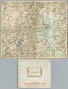
105. Rastenburg. (Germany)
1 : 100000 Reichsamt fur Landesaufnahme
Composite: 105. Rastenburg. (Germany)
1 : 100000 Reichsamt fur Landesaufnahme
Meßtischblatt 1995 : Groß Stürlack, 1938
1 : 250000 Groß Stürlack. - Aufgen. 1914/19, hrsg. 1923, einz. Nachtr. 1926,. - 1:25000. - [Berlin]: Reichsamt für Landesaufnahme, 1938. - 1 Kt.
Meßtischblatt 1994 : Rastenburg, 1938
1 : 250000 Rastenburg. - Hrsg. 1927, einz. Nachtr. 1928, redakt. Änd. 193. - 1:25000. - [Berlin]: Reichsamt für Landesaufnahme, 1938. - 1 Kt.
Meßtischblatt 1996 : Lötzen, 1938
1 : 250000 Lötzen. - Aufgen. 1914/19, hrsg. 1921, einz. Nachtr. 1926,. - 1:25000. - [Berlin]: Reichsamt für Landesaufnahme, 1938. - 1 Kt.
Meßtischblatt 1895 : Rosengarten, 1938
1 : 250000 Rosengarten. - Hrsg. 1921, einz. Nachtr. 1928, redakt. Änd. 193. - 1:25000. - [Berlin]: Reichsamt für Landesaufnahme, 1938. - 1 Kt.
Meßtischblatt 1894 : Wenden (i. Ostpr.), 1936
1 : 250000 Wenden (i. Ostpr.). - Hrsg. 1923, einz. Nachtr. 1928. - 1:25000. - [Berlin]: Reichsamt für Landesaufnahme, 1936. - 1 Kt.
Meßtischblatt 1896 : Groß Steinort, 1938
1 : 250000 Groß Steinort. - Hrsg. 1921, kleine Nachtr. 1926, redakt. Änd. 19. - 1:25000. - [Berlin]: Reichsamt für Landesaufnahme, 1938. - 1 Kt.
Meßtischblatt 1794 : Barten, 1936
1 : 250000 Barten. - Hrsg. 1926. - 1:25000. - [Berlin]: Reichsamt für Landesaufnahme, 1936. - 1 Kt.
Meßtischblatt 1795 : Drengfurth, 1938
1 : 250000 Drengfurth. - Aufn. 1914/1924, hrsg. 1927, redakt. Änd. 1938. - 1:25000. - [Berlin]: Reichsamt für Landesaufnahme, 1938. - 1 Kt.
Meßtischblatt 1796 : Angerburg, 1938
1 : 250000 Angerburg. - Aufn. 1923, hrsg. 1927, redakt. Änd. 1938. - 1:25000. - [Berlin]: Reichsamt für Landesaufnahme, 1938. - 1 Kt.
28 Lötzen, uit: Special-Karte von Mittel-Europa / nach amtlichen Quellen bearbeitet von W. Liebenow
1 : 300000 titelvariant: W. Liebenow's Mittel-Europa; Annotatie: Titel boven de bladen: W. Liebenow's Mittel-Europa Johannes Wilhelm Liebenow 1822-1897 Frankfurt a. M. : Ludwig Ravenstein
Schlacht an den Masurischen Seen
1 : 1000000 Masuren Schlacht, Weltkrieg <1914-1918>
136. Nikolaiken. (Germany)
1 : 100000 Reichsamt fur Landesaufnahme
Composite: 136. Nikolaiken. (Germany)
1 : 100000 Reichsamt fur Landesaufnahme
Meßtischblatt 2096 : Goldensee, 1938
1 : 250000 Goldensee. - Hrsg. 1921, kl. Nachtr. 1926, redakt. Änd. 1938. - 1:25000. - [Berlin]: Reichsamt für Landesaufnahme, 1938. - 1 Kt.
Meßtischblatt 2095 : Rhein, 1938
1 : 250000 Rhein. - Hrsg. 1926, einz. Nachtr. 1928, redakt. Änd. 193. - 1:25000. - [Berlin]: Reichsamt für Landesaufnahme, 1938. - 1 Kt.
Meßtischblatt 2094 : Weißenburg, 1938
1 : 250000 Weißenburg. - Hrsg. 1927, einz. Nachtr. 1928, redakt. Änd. 193. - 1:25000. - [Berlin]: Reichsamt für Landesaufnahme, 1938. - 1 Kt.
Nr. 21a. Weitere Ergebnisse der Winterschlacht in Masuren
Masuren Weltkrieg <1914-1918>, Ostfront
Sect. 5: Königsberg, uit: Geologische Karte des Deutschen Reichs in 27 Blaettern / [von] Richard Lepsius ; Red. von C. Vogel
1 : 500000 Annotatie: Blad 18 ontbreekt; Een aantal bladen op linnen; Een aantal bladen gereviseerd 1913-1914; Annotatie geografische gegevens: Met schaalstokken o.a. in kilometers; Legenda Carl Vogel 1828-1897 Gotha : Justus Perthes
Provinz Ostpreussen
1 : 1250000 Ostpreußen
Litauisch und Masurisch
Ostpreußen Litauisch, Masurisch
Prvssia
1 Karte : Kupferdruck ; 35 x 47 cm Mercator; Hondius Henricus Hondius
Königsberg, Guttstadt, Biełostok, Suwałki
1 : 750000 Białystok (Polsko : oblast) Konrad, Adalbert K. u. k. Militärgeographisches Institut
Königsberg, Guttstadt, Bielostok, Suwalki
1 : 750000 Białystok (Polsko : oblast) K. k. militär-geographisches Institut
Ost-Preussen.
1 : 935000 Flemming, Carl
Übersichtskarte von Mittel - Europa

Übersichtskarte von Mittel - Europa

Schema Teatra kampanīi 1806-7 gg.
Polen Napoleonische Kriege