Maps of Metropolitan France

[XII], uit: Geognostische Karte des Oesterreichischen Kaiserstaates mit einem grossen Theile Deutschland's u. Italien / hauptsachlich nach ... Haidinger's geognostischer Karte dieses Staates bearb. von Josef Scheda
1 : 3000000 titelvariant: General-Karte von Europa in 25 Blättern; Annotatie: Bijlage bij: General-Karte von Europa in 25 Blättern. - 1:2.592.000. - 1845-1847 Scheda, Joseph Wien : K.K. Militär. Geografisch. Institut
Geognostische Karte von Central-und West-Europa einschlieslich der Britischen Inseln, Frankreich, Deutschland und der Nachbarländer
Grosser Hand-Atlas über alle Theile der Erde in 170 Karten Meyer, J. Verlag des Bibliographischen Instituts
30-31. Francia, France.
1 : 3000000 Touring club italiano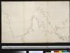
De Westkust van Europa van Texel tot Kaap Finisterre
Europe Gerard van Keulen
Gallia Antiqua.
1 : 5500000 Anville, Jean Baptiste Bourguignon d, 1697-1782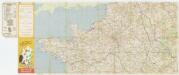
[Kaart], uit: Grandes routes : la France en 2 cartes
1 : 1000000 Annotatie: De zuidelijke helft ontbreekt Paris : Services de Tourisme Michelin
Neue Orientierungkarte [von] Frankreich u[nd] Mittelmeerlä[nder]
Francie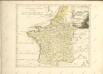

Nouvelle carte de poste de tout l'empire Français, de l'Anglettere, de l'Italie, d'une partie de l'Espagne et de l'Allemagne etc
Anglie Hinrichs, Johann Conrad J.C. Hinrichs
Gallia transalpina in suas quatuor provincias, Narbonensem, Aqvitaniam, Lvgvdensem et Belgicam descripta
1 Karte : Kupferdruck ; 30 x 37 cm Weigel excudit C. Weigelius
Gallia vetus
1 Karte : Kupferdruck ; 30 x 38 cm Weigel ap. Chri. Weigel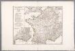
Gallia Antiqua ex aevi Romani monumentis eruta, et serenissimi Carnutum ducis munificentia publici juris facta / auctor d'Anville ; [gravé par] De-la-Haye
1 : 2500000 Annotatie: Met lijst van Romeinse provincies: I-XVII; In: [Atlas du Sr. d'Anville], bl. 7; Annotatie geografische gegevens: Met schaalstokken Jean-Baptiste Bourguignon d' Anville 1697-1782; Guillaume Nicolas Delahaye 1727-1802 [Paris : apud auctorem]

A new and accurate map of France with its aquisitions / composed from the latest surveys assited by the most approved maps & charts & regulated by astrol. Observations by Eman. Bowen
Bowen, Emmanuel
Carte vom Canal zwischen dem Atlantischen Meere und der Nord=See
1 Karte : Kupferdruck ; 47 x 49 cm Saltzenberg s.n.
Regnum Galliæ
1 Karte : Kupferdruck ; 46 x 58 cm Valck; Valck G. und L. Valck
Gallia Antiqua. (1826)
1 : 5200000 Tanner, Henry S.
Regnum Galliae divisum in duodecim gubernationes Piccardiae, Normandiae, Insulae Franciae, Britanniae, Aureliae, Burgundiae, Lugdini, Aquitaniae, Languedoci, Delphinatus et Provintiae
1 : 250000 [...] et hac tabula expressum a Gerardo et Leonardo Valk [Amsterdam] : [Gerardus et Leonardus Valk]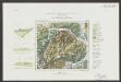
Gallia Le Royaume De France. [Karte], in: Le théâtre du monde, ou, Nouvel atlas contenant les chartes et descriptions de tous les païs de la terre, Bd. 2, S. 10.
1 Karte aus Atlas Blaeu, Willem Janszoon und Blaeu, Joan Blaeu, Willem Janszoon
France.
1 : 4550000 Darton, William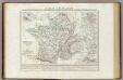
Gallia Transalpina e le sue successive divisioni.
1 : 3030000 Picquet, C.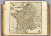
France, departments.
1 : 2300000 Robert Laurie & James Whittle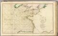
British Channel, Bay of Biscay.
1 : 3100000 Faden, William, 1750?-1836
Le Royaume De France. [Karte], in: Novus Atlas, das ist, Weltbeschreibung, Bd. 2, S. 18.
1 Karte aus Atlas Blaeu, Joan Blaeu, Willem Janszoon
Outline Europe.
1 : 4600000 Wauthier, J. M.
Europe.
1 : 4600000 Wauthier, J. M.
Gallia Le Royaume De France. [Karte], in: Theatrum orbis terrarum, sive, Atlas novus, Bd. 2, S. 10.
1 Karte aus Atlas Blaeu, Joan Blaeu, Willem Janszoon
Frankreich nach der alten und neuen Eintheilung
1 Karte : Kupferdruck ; 28 x 24 cm Sotzmann; Jättnig s.n.

![[XII], uit: Geognostische Karte des Oesterreichischen Kaiserstaates mit einem grossen Theile Deutschland's u. Italien / hauptsachlich nach ... Haidinger's geognostischer Karte dieses Staates bearb. von Josef Scheda](https://images-2.georeferencer.com/images/iiif/649525302588/full/,300/0/native.jpg)

