Maps of France
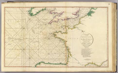
British Channel, Bay of Biscay.
1 : 3100000 Faden, William, 1750?-1836
Tabula Moderna Gallie [Karte], in: Claudii Ptolemei viri Alexandrini mathematice discipline philosophi doctissimi geographie opus [...], S. 242.
1 Karte aus Atlas Waldseemüller, Martin [und Ptolemaeus, Claudius] Übelin, Georg
Nieuwe aardrijkskundige kaart van Frankrijk met geschiedkundig overzicht van den Duitsch-Franschen oorlog 1870-71 en aanteekening der Duitsche legerbewegingen, benevens de plannen der slagvelden om Weissenburg, Wörth, Saarbruggen, Metz, Sedan en Parijs / bewerkt door F.E.L.A. Abel ...
1 : 2400000 Annotatie: Met omringende tekst en tabellen; Annotatie geografische gegevens: Legenda F.E.L.A. Abel 's Hage : lithographie en uitgave van J. Smulders & Co ...
France physique.
1 : 4400000 Vincent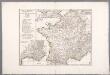
Gallia Antiqua ex aevi Romani monumentis eruta, et serenissimi Carnutum ducis munificentia publici juris facta / auctor d'Anville ; [gravé par] De-la-Haye
1 : 2500000 Annotatie: Met lijst van Romeinse provincies: I-XVII; In: [Atlas du Sr. d'Anville], bl. 7; Annotatie geografische gegevens: Met schaalstokken Jean-Baptiste Bourguignon d' Anville 1697-1782; Guillaume Nicolas Delahaye 1727-1802 [Paris : apud auctorem]
Gallia Antiqua.
1 : 5500000 Anville, Jean Baptiste Bourguignon d, 1697-1782
A new and accurate map of France with its aquisitions / composed from the latest surveys assited by the most approved maps & charts & regulated by astrol. Observations by Eman. Bowen
Bowen, Emmanuel
Regnum Galliæ
1 Karte : Kupferdruck ; 46 x 58 cm Valck; Valck G. und L. Valck
Regnum Galliae divisum in duodecim gubernationes Piccardiae, Normandiae, Insulae Franciae, Britanniae, Aureliae, Burgundiae, Lugdini, Aquitaniae, Languedoci, Delphinatus et Provintiae
1 : 250000 [...] et hac tabula expressum a Gerardo et Leonardo Valk [Amsterdam] : [Gerardus et Leonardus Valk]

Landtaflen
1 Atlas [von Johannes Stumpf] Christoffel Froschower, Zürych


Homannův atlas světa
1 : 2350000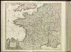
[13][13] Accuratissima Galliae tabula, uit: Atlas sive Descriptio terrarum orbis
Annotatie: Gedigitaliseerde versie. Amsterdam. Heiloo : Picturae (vervaardiger), 2015. tiff-bestand. Gedigitaliseerd: 07-01-2015; Origineel: Universiteitsbibliotheek Vrije Universiteit (XL.05127.-) ; Netherlands; Titelpagina ontbreekt Wit, Frederik de Amsterdam : Frederick de Wit
France postes.
1 : 2400000 Robert de Vaugondy, Gilles, 1688-1766
Geognostische Karte von Central-und West-Europa einschlieslich der Britischen Inseln, Frankreich, Deutschland und der Nachbarländer
Grosser Hand-Atlas über alle Theile der Erde in 170 Karten Meyer, J. Verlag des Bibliographischen Instituts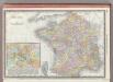
France.
1 : 3040000 Rand McNally and Company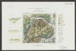
Gallia Le Royaume De France. [Karte], in: Le théâtre du monde, ou, Nouvel atlas contenant les chartes et descriptions de tous les païs de la terre, Bd. 2, S. 10.
1 Karte aus Atlas Blaeu, Willem Janszoon und Blaeu, Joan Blaeu, Willem Janszoon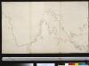
De Westkust van Europa van Texel tot Kaap Finisterre
Europe Gerard van Keulen
Die Reiche der Franken in Gallien unter den Merovingern.
1 : 3800000 Spruner von Merz, Karl
Gallia Le Royaume De France. [Karte], in: Theatrum orbis terrarum, sive, Atlas novus, Bd. 2, S. 10.
1 Karte aus Atlas Blaeu, Joan Blaeu, Willem Janszoon
Gallia transalpina in suas quatuor provincias, Narbonensem, Aqvitaniam, Lvgvdensem et Belgicam descripta
1 Karte : Kupferdruck ; 30 x 37 cm Weigel excudit C. Weigelius
Gallia vetus
1 Karte : Kupferdruck ; 30 x 38 cm Weigel ap. Chri. Weigel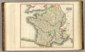
France.
1 : 2300000 Thomson, John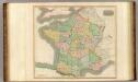
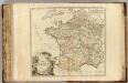
France, provinces.
1 : 2300000 Thomson, John
Carte de la France protestante / dressée sous la dir. de la Commission des Publications de la Fédération Protestante de France ; dressée par L. Hermann
1 : 1500000 Hermann, L.; Fédération Protestante de France. Commission des Publications Paris : Fischbacher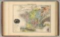
France Geologique.
1 : 3700000 Migeon, J.