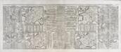
Maps of Metropolitan France

Outline Europe.
1 : 4600000 Wauthier, J. M.
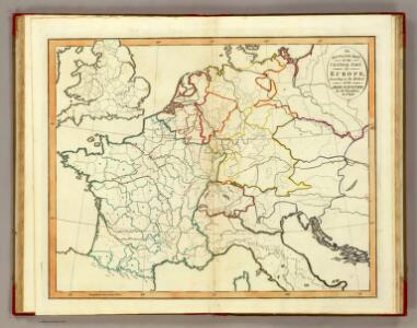
Europe.
1 : 4600000 Wauthier, J. M.
France, Germany, Netherlands, Switzerland &c.
1 : 6750000 Worcester, J. E.
[Frankreich]
Historisch-genealogisch-geographischer Atlas von Le Sage Las Cases, Emmanuel Auguste Dieudonné Marius Joseph de Johann Velten, Kunsthändler
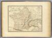
Carte de la France : divisée en 133 départements et en arrondissements communaux ... / par J.B. Poirson
1 : 1750000 titelvariant: Carte de l'empire Français; Annotatie: Omslagtitel: Carte de l'empire Français Poirson, J. B. Paris : Jean
Carte générale de l'Empire Français et du Royaume d'Italie suivant les nouvelles divisions : avec les chefs-lieux de préfecture et l'indication des principales routes
1 : 2000000 par C.F. Delamarche Barriere sculpsit. À Paris : chez l'auteur
Die Reiche der Carolinger
1 : 8400000 Evropa západní
Karte von Frankreich
1 : 4500000 Belgie Mollo, Tranquillo Tranquillo Mollo
Nouvelle carte de poste de tout l'empire Français, de l'Angleterre, de l'Italie, d'une partie de l'Espagne et de l'Allemagne, etc. = Neueste Post Karte vom ganzen Französischen Reiche, England, Italien, und einem Theile von Spanien und Deutschland uzw. / hrsg. und verlegt von J.C. Hinrichs
1 : 2800000 Hinrichs, J. C. Leipzig : Hinrichs
Gaule, Italie septentrionale, Germanie.
1 : 3200000 Andriveau-Goujon, J.
Tableau l'historie de France.
1 : 8250000 Duval, Henri
Die Reiche der Karolinger.
1 : 5300000 Spruner von Merz, Karl
Die Verbreitung des Kropfes in Mittel-Europa
1 : 8000000 Bircher, Heinrich Benno Schwabe, Schweighauserische Verlagsbuchhandlung
Napoleon's Kaiserreich im Jahre 1812
Evropa západní
Gallia et Germania ultimorum Romani Imperii temporum aequalis
1 : 4000000 Mollova mapová sbírka Liebe, Christian Sigismund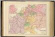
Central Europe with the Railways.
1 : 3168000 Fullarton, A. & Co.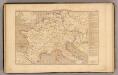
L'Empre. de Charlemagne de 768 a 814.
1 : 5800000 Houze, Antoine Philippe
[Geschichtlich-geographischer Atlas von Europa :] X. Karte von Mittel-Europa mit der Provinzial-Eintheilung der verschiedenen Staaten
entworfen und gezeichnet durch Ferd. Aug. v. Witzleben [Berlin etc.] : [Mittler]
[Historisch-geographischer Atlas zu den allgemeinen Geschichtswerken von C. v. Rotteck, Pölitz u. Becker] : Napoleon's Kaiserreich mit Angabe der Hauptbegebenheiten und der Vergrösserungen Frankreichs
von Julius Loewenberg Lithographie v. B. Herder in Freiburg im Breisgau [Freiburg im Breisgau] : [Herder]
Neueste Eisenbahn-Karte von Central-Europa
1 : 4000000 Evropa střední Issleib & Rietzschel
Die Republik und das Kaiserthum Frankreich mit seinen Bundes-Staaten.
1 : 5200000 Spruner von Merz, Karl
[Historisch-geographischer Atlas zu den allgemeinen Geschichtswerken von C. v. Rotteck, Pölitz u. Becker] : Deutschland und Frankreich während und nach der Reformation
von Julius Loewenberg Lithographie von B. Herder in Freiburg im Breisgau [Freiburg im Breisgau] : [Herder]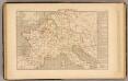
Demembrement de l'Empre. de Charlemagne.
1 : 5800000 Houze, Antoine Philippe
Nouvelle carte de poste de tout l'empire Français, de l'Anglettere, de l'Italie, d'une partie de l'Espagne et de l'Allemagne etc
Anglie Hinrichs, Johann Conrad J.C. Hinrichs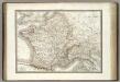
Gaules.
1 : 3000000 Lapie, M. (Pierre), 1779-1850
Gallia Germania Britannia
Schul-Atlas der alten Welt bei Justus Perthes
Die Zeit der ersten franz. Republik
Frankreich, Deutschland, Französische Revolution