Maps of Metropolitan France
L'Empre. de Charlemagne de 768 a 814.
1 : 5800000 Houze, Antoine Philippe
Demembrement de l'Empre. de Charlemagne.
1 : 5800000 Houze, Antoine Philippe
Die Zeit der ersten franz. Republik
Frankreich, Deutschland, Französische Revolution
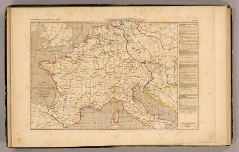
Die Republik und das Kaiserthum Frankreich mit seinen Bundes-Staaten.
1 : 5200000 Spruner von Merz, Karl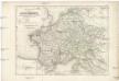
Die Reiche der Carolinger
1 : 8400000 Evropa západní

Gallia et Germania ultimorum Romani Imperii temporum aequalis
1 : 4000000 Mollova mapová sbírka Liebe, Christian Sigismund
Die Reiche der Karolinger.
1 : 5300000 Spruner von Merz, Karl

[Historisch-geographischer Atlas zu den allgemeinen Geschichtswerken von C. v. Rotteck, Pölitz u. Becker] : Das Reich Karls des Grossen nach der Theilung seiner Enkel zu Verdun 843
von Julius Loewenberg Lithographie von B. Herder in Freiburg im Breisgau [Freiburg im Breisgau] : [Herder]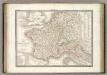
France 1789, 1813.
1 : 3700000 Lapie, M. (Pierre), 1779-1850
Tableau l'historie de France.
1 : 8250000 Duval, Henri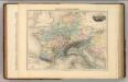
Empire de Charlemagne.
1 : 5000000 Migeon, J.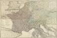
Carte géographique et administrative du Royaume de France comprenant en outre le Royaume des Pays-Bas, l'Allemagne, l'Empire d'Autriche, la Suisse, les Etats du Roi de Sardaigne sur le continent, les duchés de Parme et de Toscane, l'Etat de l'Eglise, l'Ile d'Elbe, les Sept-Iles Ioniennes en supplement et une partie de l'Empire Turc, des Royaumes de Prusse, de Naples, d'Angleterre, d'Espagne jusqu'à Madrid
1 : 1200000 dessinée par Hérisson Paris : chez Desray, J. Goujon
France, Germany, Netherlands, Switzerland &c.
1 : 6750000 Worcester, J. E.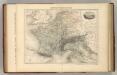
Empire Francais en 1811.
1 : 4840000 Migeon, J.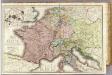
France &c.
1 : 2400000 Brue, Adrien Hubert, 1786-1832
Gaule, Italie Ancienne.
Andriveau-Goujon, J.
Říše Karla Velikého
Tercia Europe Tabula [Gallia] [Karte], in: Claudii Ptolemei viri Alexandrini mathematice discipline philosophi doctissimi geographie opus [...], S. 157.
1 Karte aus Atlas Waldseemüller, Martin [und Ptolemaeus, Claudius] Übelin, Georg
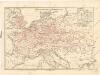
Napoleon's Kaiserreich im Jahre 1812
Evropa západní
France, and parts adjoining.
from A new sett of maps both of antient and present geography : wherein not only the latitude and longitude of many places are corrected according to the latest observations, but also the most remarkable differences of antient and present geography may be quickly discern'd by a bare inspection or comparing of correspondent maps, which seems to be the most natural and easy method to lead young students (for whose use the work is principally intended) unto a competent knowledge of the geographical science : together with a geographical treatise particularly adapted to the use and design of these maps / by Edward Wells, M.A. and student of Christ-Church, Oxon.
Neueste Eisenbahn-Karte von Central-Europa
1 : 4000000 Evropa střední Issleib & Rietzschel
Composite: France.
1 : 1170000 Herisson, Eustache, b. 1759
[Geschichtlich-geographischer Atlas von Europa :] X. Karte von Mittel-Europa mit der Provinzial-Eintheilung der verschiedenen Staaten
entworfen und gezeichnet durch Ferd. Aug. v. Witzleben [Berlin etc.] : [Mittler]
Napoleon's Kaiserreich im Jahre 1812
Frankreich, Mitteleuropa, Napoleon I., Frankreich, Kaiser
[Historisch-geographischer Atlas zu den allgemeinen Geschichtswerken von C. v. Rotteck, Pölitz u. Becker] : Deutschland und Frankreich während und nach der Reformation
von Julius Loewenberg Lithographie von B. Herder in Freiburg im Breisgau [Freiburg im Breisgau] : [Herder]
Imperivm Francicvm vel Romanvm Occidentale Posterivs sub ipso Carolo Magno
1 : 28000000 Mollova mapová sbírka Homann, Johann Baptist Homann, Johann Baptista - dědici
Tercia Europe Tabula [Karte], in: [Clavdii Ptholomei Cosmographi ...], S. 254.
1 Karte aus Atlas Nicolaus Germanus [und Ptolemaeus, Claudius]