Maps of Germany
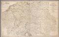
Map of Germany and the adjoining countries / by Ignatius Heymann
1 : 970000 Heymann, Ignatius London : John Stockdale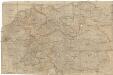
Neueste und vollstaendigste Post Karte von ganz Deutschland Niederlanden Schweiz Pohlen Ungarn und den angränzenden Theilen Frankreichs u Italien
Evropa střední Cappi, Jean Jean Cappi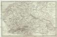
Post Karte von Deutschland in zwey Blättern
1 : 1920000 Německo Schindelmeyer, Karl Robert Ludwig Mairisch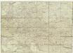
Neue und vollkomene Postkarte durch ganz Teutschland
Francie Artaria
L'Allemagne 911 a 1024.
1 : 6300000 Houze, Antoine Philippe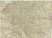
Postkarte durch ganz Deutschland, Italien, Frankreich, Niederland, Preussen, Polen und Ungarn
Florencie (Itálie) Mollo, Tranquillo T. Mollo
L'Allemagne 1437 a 1612.
1 : 6300000 Houze, Antoine Philippe
L'Allemagne 1373 a 1437.
1 : 6300000 Houze, Antoine Philippe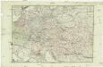
Neue und vollkomene Postkarte durch ganz Deutschland
Florencie (Itálie) Mansfeld, Johann Ernst Artaria & Co.
L'Allemagne 1137 a 1273.
1 : 6300000 Houze, Antoine Philippe
La Germanie a la fin du 5e. siecle.
1 : 6300000 Houze, Antoine Philippe
L'Allemagne, l'Autriche, la Prusse et la Pologne 1612 a 1788.
1 : 6300000 Houze, Antoine Philippe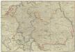
Postkarte durch ganz Teutschland, Italien, Frankreich, Niederland, Preussen, Polen und Ungarn
1 : 2100000 Evropa střední Mollo, Tranquillo T. Mollo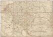
Postkarte durch ganz Teutschland, Italien, Frankreich, Niederland, Preussen, Polen und Ungarn
1 : 2100000 Evropa střední Mollo, Tranquillo T. Mollo & Comp.
Postkarte durch ganz Teutschland, Italien, Frankreich, Niederland, Preussen, Polen und Ungarn
1 : 2100000 Evropa jihovýchodní Mollo, Tranquillo chez T. Mollo
L'Allemagne 1024 a 1137.
1 : 6300000 Houze, Antoine Philippe
A New Map of Germany. Hungary Transilvania & the Suisse Cantons
1 : 1900000 Mollova mapová sbírka Moll, Herman Bowles, Thomas I
Autriche, Prusse, Confed. Germanique, Pologne 1788 a 1841.
1 : 6300000 Houze, Antoine Philippe
l'Allemagne par Cercles in 1789.
1 : 6300000 Malte-Brun, Conrad, 1775-1826
Karte des Deutschen Reichs
Schmidt, Johann Marius Friedrich; Jäck Schropp
Sbírka map a diagramů použitých na mírových konferencích v Paříži v letech 1919 - 1920

La Germanie 741 a 843.
1 : 6300000 Houze, Antoine Philippe
Allemagne.
1 : 3300000 Lapie, M. (Pierre), 1779-1850
Carte Generale D'Allemagne.
1 : 4600000 Vivien de St Martin, L.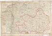
Neueste Post Karte von ganz Deutschland
1 : 1460000 Evropa střední Müller, Franz Artaria
Österreich
1 : 7500000 Rakousko F. Tempsky
Europe Centrale.
1 : 4100000 Montemont, A.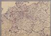
[Mitteleuropa]
1 : 2500000 [S.l. : s.n.]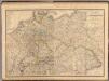
Composite: Allemagne.
1 : 2000000 Andriveau-Goujon, J.


