Maps of Allegheny Plat.
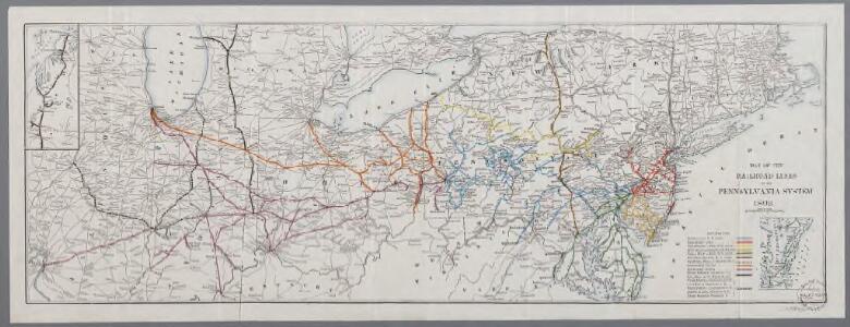
Map of the railroad lines in the Pennsylvania System
1 : 2200000 Annotatie: Met 2 aansluitende bijkrt. van Lake Michigan en Chesapeake Bay [S.l. : s.n.]
Map New York Central Lines.
1 : 4200000 New York Central Railroad Company
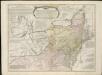
A General Map of the Middle British Colonies, in America.
1 : 2200000 Robert Sayer and John Bennett (Firm)
Cours de l'Ohio, Nlle. Angleterre, Nlle. York, Pensylvanie, Virginie, Caroline.
1 : 2900000 Robert de Vaugondy, Gilles, 1688-1766
Middle dominions U.S.
1 : 2200000 Robert Laurie & James Whittle
Nordoststaaten der Nordamerikanischen Union
1 : 3000000 New York (New York) Mielisch, H. Umbreit, E.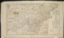
A map of the middle British colonies in North America, first published by Mr. Lewis Evans, of Philadelphia, in 1755; and since corrected and improved, as also extended, with the addition of New England, and bordering parts of Canada ...

Ohio.
1 : 1830000 Carey, Mathew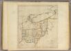
State of Ohio.
1 : 1750000 Carey, Mathew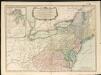
A new and general map of the middle dominions belonging to the United States of America, viz. Virginia, Maryland, the Delaware-counties, Pennsylvania, New Jersey &c. with the addition of New York & of the greatest part of New England

Lehigh Valley line.
1 : 4754200 Lehigh Valley Railroad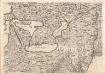
A Map of the British Empire in America. (Sheet 6).
1 : 2000000 Popple, Henry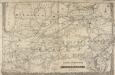
Railroad & Express Map of the Middle States
1 : 1267200 Railroad & Express Map of the Middle States. R. Blanchard.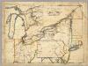
A New Map Of The Seat Of War.
1 : 2534400 Lewis, Samuel
Bowles's new pocket map of the following independent states of North America: viz. Virginia, Maryland, Delaware, Pensylvania, New Jersey, New York, Connecticut & Rhode Island: comprehending also the habitations & hunting countries of the confederate Indians / by Lewis Evans.
from Charts and maps Lewis Evans,
A GENERAL MAP OF THE MIDDLE BRITISH COLONIES IN AMERICA
1 : 2000000 Delaware Pownall, Thomas
Map Pittsburgh & Western Railway Co.
1 : 5844000 Pittsburgh & Western Railway Company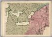
A Map of the British Empire in America. (Sheet 6).
1 : 2000000 Popple, Henry
The state of Virginia : from the best authorities / by Samuel Lewis, 1809 ; Smither, sculpt.
from Carey's American atlas.
Virginia / S. Lewis, del.
from Virginia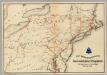
Lines and Metallic Circuit Connections.
1 : 2534400 American Telephone and Telegraph Company
County map of Ohio and Indiana.
from New general atlas.
Map of the middle states of North America : shewing the position of the Geneseo country comprehending the counties of Ontario & Steuben as laid off in townships of six miles squar[e] each
1 : 2250000 Maverick, Peter, 1780-1831 Printed by T. & J. Swords, no. 99 Pearl-Street.
Middle States.
1 : 5700000 Grigg, John
A general map of the middle British colonies, in America, containing Virginia, Maryland, the Delaware counties, Pennsylvania and New Jersey : with the addition of New York, and the greatest part of New England, as also of the bordering parts ...
A general map of the middle British colonies in America, viz. Virginia, Maryland, Delaware, Pensilvania, New-Jersey, New York, Connecticut & Rhode-Island, of Aquanishuonigy the country of the confederate Indians comprehending Aquanishuonigy proper ...

New York / drawn by S. Lewis ; Tanner, sc.
from Whole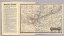
Map Wabash Railway.
1 : 6623200 Wabash Railway Company
United States of America, northern part / drawn under the direction of Mr. Pinkerton by L. Hebert; Neele sculpt. 352 Strand.
from Whole L. Hebert Neele; Mr. Pinkerton,