Maps of Allegheny Plat.
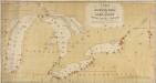
A New Map Of The Seat Of War.
1 : 2534400 Lewis, Samuel
A Map of the British Empire in America. (Sheet 6).
1 : 2000000 Popple, Henry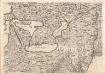
A Map of the British Empire in America. (Sheet 6).
1 : 2000000 Popple, Henry
Map New York Central Lines.
1 : 4200000 New York Central Railroad Company
Nordoststaaten der Nordamerikanischen Union
1 : 3000000 New York (New York) Mielisch, H. Umbreit, E.
Vereinigte Staaten von Nord-Amerika in 6 blattern, bl. 3

This map of Upper and Lower Canada and United States.
1 : 3700000 Tardieu, P.F.
Bowles's new one-sheet map of the independent states of Virginia, Maryland, Delaware, Pensylvania, New Jersey, New York, Connecticut, Rhode Island, &c. : comprehending also the habitations & hunting countries of the confederate Indians.
from Bowles's universal atlas. ...
Middle British colonies in America
from Parts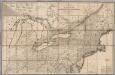
Map of the Canadas.
1 : 1267200 Taylor, David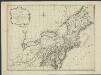
Nieuwe en nauwkeurige kaart van een gedeelte van Noord America, behelzende Nieuw England, New York, Pensylvania, New Jersey, Connecticut, Rhode Island, een stuck van Virginia, Kanda en Halifax, ter opheldering der reizen van den Heer P. Kalm
1 : 2000000 C.J. de Huyser direx. P. Mol geletterdt Te Utrecht : by de boekverkopers J. v. Schoonhoven & Comp. en G. v. d. Brink jz.
A GENERAL MAP OF THE MIDDLE BRITISH COLONIES IN AMERICA
1 : 2000000 Delaware Pownall, Thomas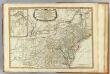
Middle dominions U.S.
1 : 2200000 Robert Laurie & James Whittle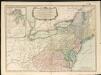
A new and general map of the middle dominions belonging to the United States of America, viz. Virginia, Maryland, the Delaware-counties, Pennsylvania, New Jersey &c. with the addition of New York & of the greatest part of New England

Bowles's new pocket map of the following independent states of North America: viz. Virginia, Maryland, Delaware, Pensylvania, New Jersey, New York, Connecticut & Rhode Island: comprehending also the habitations & hunting countries of the confederate Indians / by Lewis Evans.
from Charts and maps Lewis Evans,
Lehigh Valley line.
1 : 4754200 Lehigh Valley Railroad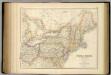
United States ... North Eastern States.
1 : 2851200 Fullarton, A. & Co.
Carte pour servir à l'itinéraire pittoresque du fleuve Hudson et des parties latérales de l'Amerique du Nord
1 : 4200000 Milbert, Jacques Gérard Gaugain, Henri
Nördlicher Theil der Vereinigten Staaten
Stieler's Hand-Atlas Stieler, Adolf bei Justus Perthes
United States.
1 : 3380000 Sharpe, J.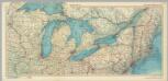
United States of America - Great Lakes. Pergamon World Atlas.
1 : 2500000 Polish Army Topography Service
Map of the Vermont Central Rail Road and its connections from Smith's map of the United States.
from Parts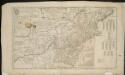
A map of the middle British colonies in North America, first published by Mr. Lewis Evans, of Philadelphia, in 1755; and since corrected and improved, as also extended, with the addition of New England, and bordering parts of Canada ...
Railroad & Express Map of the Middle States
1 : 1267200 Railroad & Express Map of the Middle States. R. Blanchard.
Map of the middle states of North America : shewing the position of the Geneseo country comprehending the counties of Ontario & Steuben as laid off in townships of six miles squar[e] each
1 : 2250000 Maverick, Peter, 1780-1831 Printed by T. & J. Swords, no. 99 Pearl-Street.
New York.
from Whole
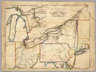
A new map of part of the United States of North America, containing those of New York, Vermont, New Hampshire, Massachusets [sic], Connecticut, Rhode Island, Pennsylvania, New Jersey, Delaware, Maryland and Virginia
United States of America, northern part.
1 : 2100000 Pinkerton, John, 1758-1826
New York / drawn by S. Lewis ; Tanner, sc.
from Whole