Maps of Allegheny Plat.

New York / drawn by S. Lewis ; Tanner, sc.
from Whole
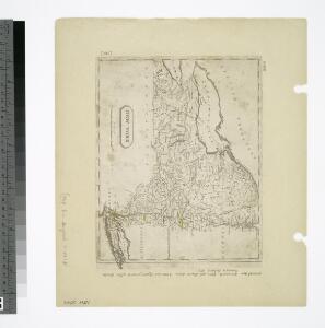
Map of the middle states of North America : shewing the position of the Geneseo country comprehending the counties of Ontario & Steuben as laid off in townships of six miles squar[e] each
1 : 2250000 Maverick, Peter, 1780-1831 Printed by T. & J. Swords, no. 99 Pearl-Street.
Sheet 2: United States of Nth. America.
1 : 1584000 Tardieu, P.F.
New York.
from Whole
United States of America, northern part.
1 : 2100000 Pinkerton, John, 1758-1826
United States.
1 : 3380000 Sharpe, J.
Nördlicher Theil der Vereinigten Staaten
Stieler's Hand-Atlas Stieler, Adolf bei Justus Perthes
United States ... North Eastern States.
1 : 2851200 Fullarton, A. & Co.
Map New York Central Lines.
1 : 4200000 New York Central Railroad Company
Nieuwe en nauwkeurige kaart van een gedeelte van Noord America, behelzende Nieuw England, New York, Pensylvania, New Jersey, Connecticut, Rhode Island, een stuck van Virginia, Kanda en Halifax, ter opheldering der reizen van den Heer P. Kalm
1 : 2000000 C.J. de Huyser direx. P. Mol geletterdt Te Utrecht : by de boekverkopers J. v. Schoonhoven & Comp. en G. v. d. Brink jz.
Nordost-Staaten der Union.
1 : 5000000 Andree, Richard
Northern provinces of the United States

Novi Belgii Novaeque Angliae nec non partis Virginiae tabula multis in locis emendata
1 : 2000000 a Nicolao Joannis Visschero [S.l.] : [s.n.]
Map of the interior travels through America, delineating the march of the army

Nordoststaaten der Nordamerikanischen Union
1 : 3000000 New York (New York) Mielisch, H. Umbreit, E.
Map shewing the rail roads between Lake Erie, New York & Boston : intended to illustrate the importance of the N. York & Erie Rail Road / J.F. Smith, del.
from Whole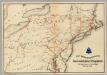
Lines and Metallic Circuit Connections.
1 : 2534400 American Telephone and Telegraph Company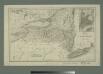
Map of the state of New York with part of Upper Canada / engraved & printed by Fenner Sears & Co.
from Whole
United States of America, northern part / drawn under the direction of Mr. Pinkerton by L. Hebert; Neele sculpt. 352 Strand.
from Whole L. Hebert Neele; Mr. Pinkerton,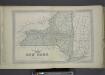
Plan of The State of New York.
from County atlas of Orange, New York / from actual surveys by and under the direction of F.W. Beers.
197-198. United States of America, North East. The World Atlas.
1 : 2500000 USSR (Union of Soviet Socialist Republics).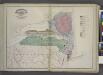
Geological Map
from New topographical atlas and gazetteer of New York, comprising a topographical view of the several counties of the state, ... including ... map of the United States and territories ... Compiled from the latest astronomical observations, official surveys and records of the United States and territories ...

A GENERAL MAP OF THE MIDDLE BRITISH COLONIES IN AMERICA
1 : 2000000 Delaware Pownall, Thomas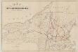
Map of the Troy & Greenfield Rail Road and its connections
Edwards, A. F B.W. Thayer & Co.'s Lith.
Belgii novi, angliae novae, et partis Virginiae : novissima delineatio
1 : 2450000 Jansson, Jan, 1588-1664 Prostant ... apud Petrum Schenk, et Gerardum Valk
Carte pour servir à l'itinéraire pittoresque du fleuve Hudson et des parties latérales de l'Amerique du Nord
1 : 4200000 Milbert, Jacques Gérard Gaugain, Henri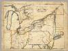
A New Map Of The Seat Of War.
1 : 2534400 Lewis, Samuel
Recens edita totius Novi Belgii, in America Septentrionali siti