Maps of Germany

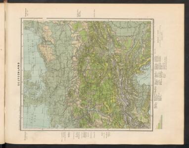
Deutschland
Hypsometrischer Atlas Ziegler, Jakob Melchior Topogr. Anstalt v. J. Wurster u. Comp.
Deutschland
[Allgemeiner Atlas über alle Theile der Erde in 29 Blättern] Ziegler, Jakob Melchior Top. Anstalt v. J. Wurster u. Comp.
Deutschland
1 : 3500000 Evropa střední Handtke, Friedrich Carl Flemming
Der Deutsche Bundesstaat in 23 Republiken nach Struve's Grundrechten des deutschen Volks
1 : 4500000 Lithogr. von F. Bruder in Basel Basel : [s.n.]
Empire of Germany.
1 : 2450000 Johnson, A.J.
Empire of Germany.
1 : 2450000 Johnson, A.J.
Empire of Germany.
1 : 2450000 Johnson, A.J.
Deutschland.
1 : 2300000 Weiland, C. F. (Carl Ferdinand), d. 1847
Deutschland
1 : 4500000 Německo Grimm, Johann Ludwig Scharrer Simon Schropp
Deutschland
1 : 2350000 Evropa střední Weiland, Karl Ferdinand Geographisches Institut
Deutsches Reich nebts Deutsch-Österreich und Schweiz
1 : 1825000 Evropa střední Handtke, Friedrich Carl Flemming
Deutschland.
1 : 3400000 Flemming, Carl
Mitteleuropa 1991
Mitteleuropa Kunz, Andreas ; Treiling, Thomas
Mitteleuropa 1848
Mitteleuropa Kunz, Andreas ; Moeschl, Joachim Robert
Mitteleuropa 1867
Mitteleuropa Kunz, Andreas ; Moeschl, Joachim Robert
Mitteleuropa 1957
Mitteleuropa Kunz, Andreas ; Treiling, Thomas
Mitteleuropa 1945
Mitteleuropa Kunz, Andreas ; Treiling, Thomas
Mitteleuropa 1922
Mitteleuropa Kunz, Andreas ; Moeschl, Joachim Robert
Mitteleuropa 1860
Mitteleuropa Kunz, Andreas ; Moeschl, Joachim Robert
Mitteleuropa 1956
Mitteleuropa Kunz, Andreas ; Treiling, Thomas
[Geognostische Karte von Mittel-Europa, II (Oestl.) Haelfte]
Grosser Hand-Atlas über alle Theile der Erde in 170 Karten Meyer, J. Verlag des Bibliographischen Instituts
Mitteleuropa 1871
Mitteleuropa Kunz, Andreas ; Moeschl, Joachim Robert
Mitteleuropa 2003
Mitteleuropa Kunz, Andreas ; Treiling, Thomas
Deutschland ́s Eisenbahnen und Strassen - Netz

Mitteleuropa 1820
Mitteleuropa Kunz, Andreas ; Moeschl, Joachim Robert
Mitteleuropa 1914
Mitteleuropa Kunz, Andreas ; Moeschl, Joachim Robert
Mitteleuropa 1839
Mitteleuropa Kunz, Andreas ; Moeschl, Joachim Robert
Mitteleuropa 1937
Mitteleuropa Kunz, Andreas ; Moeschl, Joachim Robert
Mitteleuropa 1993
Mitteleuropa Kunz, Andreas ; Treiling, Thomas