Maps of Germany

Deutsches Reich nebts Deutsch-Österreich und Schweiz
1 : 1825000 Evropa střední Handtke, Friedrich Carl Flemming
Deutschland
Hypsometrischer Atlas Ziegler, Jakob Melchior Topogr. Anstalt v. J. Wurster u. Comp.
Deutschland
[Allgemeiner Atlas über alle Theile der Erde in 29 Blättern] Ziegler, Jakob Melchior Top. Anstalt v. J. Wurster u. Comp.
Deutschland
1 : 3500000 Evropa střední Handtke, Friedrich Carl Flemming
Deutschland
1 : 4500000 Německo Grimm, Johann Ludwig Scharrer Simon Schropp
Deutschland
1 : 2350000 Evropa střední Weiland, Karl Ferdinand Geographisches Institut
Deutschland.
1 : 2300000 Weiland, C. F. (Carl Ferdinand), d. 1847
Deutschland
1 : 2350000 Evropa střední Weiland, Karl Ferdinand Geographisches Institut
Deutschland
1 : 2350000 Evropa střední Weiland, Karl Ferdinand Geographisches Institut
Deutschland
1 : 2350000 Evropa střední Weiland, Karl Ferdinand Geographisches Institut
Empire of Germany.
1 : 2450000 Johnson, A.J.
Empire of Germany.
1 : 2450000 Johnson, A.J.
Der Deutsche Bundesstaat in 23 Republiken nach Struve's Grundrechten des deutschen Volks
1 : 4500000 Lithogr. von F. Bruder in Basel Basel : [s.n.]
Empire of Germany.
1 : 2450000 Johnson, A.J.
Deutschland's Eisenbahnen und Strassen-Netz mit seinen Anschlüssen im Ausland nebst Angabe der wichtigsten Flussdampfschiff-Stationen und Häfen für Seedampfer
1 : 2080000 Evropa střední Gräf, Adolf Hensgen, C. Geographisches Institut
Deutschland nach seinen oro-hydrographischen Verhältnissen
1 : 2570000 Evropa střední Gräf, Adolf Eyb, O. B. Geographisches Institut
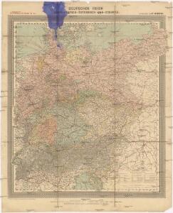
Karte der Bäder und Kurorte Deutschlands, Oesterreich-Ungarns und der Schweiz
1 : 2000000 Německo Liebenow, W. Bäder-Almanach
Karte der Bäder und Kurorte Deutschlands, Oesterreich-Ungarns und der Schweiz
1 : 2000000 Německo Liebenow, W. Bäder-Almanach
Mitteleuropa 1989
Mitteleuropa Kunz, Andreas ; Treiling, Thomas
Mitteleuropa 1949
Mitteleuropa Kunz, Andreas ; Treiling, Thomas
Mitteleuropa 1922
Mitteleuropa Kunz, Andreas ; Moeschl, Joachim Robert
Mitteleuropa 1956
Mitteleuropa Kunz, Andreas ; Treiling, Thomas
Mitteleuropa 1945
Mitteleuropa Kunz, Andreas ; Treiling, Thomas
Mitteleuropa 1990
Mitteleuropa Kunz, Andreas ; Treiling, Thomas
Deutschland.
1 : 3400000 Flemming, Carl

Deutschland ́s Eisenbahnen und Strassen - Netz

Mitteleuropa 1993
Mitteleuropa Kunz, Andreas ; Treiling, Thomas
Mitteleuropa 1820
Mitteleuropa Kunz, Andreas ; Moeschl, Joachim Robert