Maps of Germany

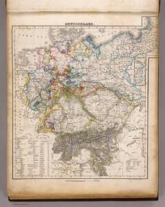
Deutschland.
1 : 3400000 Flemming, Carl
Deutschland ́s Eisenbahnen und Strassen - Netz

Mitteleuropa 1914
Mitteleuropa Kunz, Andreas ; Moeschl, Joachim Robert
Mitteleuropa 1871
Mitteleuropa Kunz, Andreas ; Moeschl, Joachim Robert
Nationalitäts-Karte von Deutschland
Německo Kiepert, Heinrich Homann, Johann Baptist Geograph. Institut
Á Német szövetség
1 : 4930000 Evropa střední Biller, Bernhard Bucsánszky Alajos'
Mitteleuropa 1812
Mitteleuropa Kunz, Andreas ; Moeschl, Joachim Robert
Mitteleuropa 1860
Mitteleuropa Kunz, Andreas ; Moeschl, Joachim Robert
Mitteleuropa 1867
Mitteleuropa Kunz, Andreas ; Moeschl, Joachim Robert
Der Deutsche Bundesstaat in 23 Republiken nach Struve's Grundrechten des deutschen Volks
1 : 4500000 Lithogr. von F. Bruder in Basel Basel : [s.n.]
Mitteleuropa 2003
Mitteleuropa Kunz, Andreas ; Treiling, Thomas
Deutschland 1803 nach dem Reichsdeputationshauptschluss
Deutschland Reichsdeputationshauptschluss Kunz, Andreas ; Moeschl, Joachim Robert
Mitteleuropa 1945
Mitteleuropa Kunz, Andreas ; Treiling, Thomas
Deutschland 1792
Deutschland Kunz, Andreas ; Moeschl, Joachim Robert
Deutschland um 1378
Deutschland Kunz, Andreas ; Moeschl, Joachim Robert
Mitteleuropa 1957
Mitteleuropa Kunz, Andreas ; Treiling, Thomas
Mitteleuropa 1922
Mitteleuropa Kunz, Andreas ; Moeschl, Joachim Robert
Deutschland 1648
Deutschland Kunz, Andreas ; Moeschl, Joachim Robert
Mitteleuropa 1848
Mitteleuropa Kunz, Andreas ; Moeschl, Joachim Robert
Deutschland Politische Uebersicht
Plastischer Schul-Atlas über alle Theile der Erde : in 24 Karten Woldermann, G Verlag von P. Eckerlein
Mitteleuropa 1993
Mitteleuropa Kunz, Andreas ; Treiling, Thomas
Mitteleuropa 1937
Mitteleuropa Kunz, Andreas ; Moeschl, Joachim Robert
Mitteleuropa 1956
Mitteleuropa Kunz, Andreas ; Treiling, Thomas
Mitteleuropa 1839
Mitteleuropa Kunz, Andreas ; Moeschl, Joachim Robert
Deutschland 1555
Deutschland Kunz, Andreas ; Moeschl, Joachim Robert
Mitteleuropa 1949
Mitteleuropa Kunz, Andreas ; Treiling, Thomas
Deutschland
mapa VKOL Petermann, August Justus Perthes
Deutschland
mapa VKOL Petermann, August Justus Perthes
Deutschland um 1500
Deutschland Kunz, Andreas ; Moeschl, Joachim Robert