Maps of Germany

Deutschland
1 : 2350000 Evropa střední Weiland, Karl Ferdinand Geographisches Institut
Der Deutsche Bundesstaat in 23 Republiken nach Struve's Grundrechten des deutschen Volks
1 : 4500000 Lithogr. von F. Bruder in Basel Basel : [s.n.]
Mitteleuropa 1949
Mitteleuropa Kunz, Andreas ; Treiling, Thomas
Mitteleuropa 1945
Mitteleuropa Kunz, Andreas ; Treiling, Thomas
Mitteleuropa 1922
Mitteleuropa Kunz, Andreas ; Moeschl, Joachim Robert
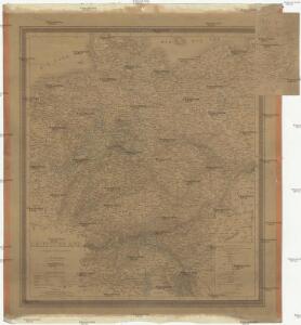
Deutschland.
1 : 3400000 Flemming, Carl
Deutschland ́s Eisenbahnen und Strassen - Netz

Mitteleuropa 1993
Mitteleuropa Kunz, Andreas ; Treiling, Thomas
Mitteleuropa 1956
Mitteleuropa Kunz, Andreas ; Treiling, Thomas
Á Német szövetség
1 : 4930000 Evropa střední Biller, Bernhard Bucsánszky Alajos'
Mitteleuropa 1990
Mitteleuropa Kunz, Andreas ; Treiling, Thomas
Mitteleuropa 1937
Mitteleuropa Kunz, Andreas ; Moeschl, Joachim Robert
Mitteleuropa 1957
Mitteleuropa Kunz, Andreas ; Treiling, Thomas
Mitteleuropa 1839
Mitteleuropa Kunz, Andreas ; Moeschl, Joachim Robert
Empire of Germany.
1 : 2450000 Johnson, A.J.
Mitteleuropa 1820
Mitteleuropa Kunz, Andreas ; Moeschl, Joachim Robert
Mitteleuropa 2003
Mitteleuropa Kunz, Andreas ; Treiling, Thomas
Mitteleuropa 1860
Mitteleuropa Kunz, Andreas ; Moeschl, Joachim Robert
Mitteleuropa 1867
Mitteleuropa Kunz, Andreas ; Moeschl, Joachim Robert
Mitteleuropa 1871
Mitteleuropa Kunz, Andreas ; Moeschl, Joachim Robert
Mitteleuropa 1914
Mitteleuropa Kunz, Andreas ; Moeschl, Joachim Robert
Mitteleuropa 1812
Mitteleuropa Kunz, Andreas ; Moeschl, Joachim Robert
Mitteleuropa 1989
Mitteleuropa Kunz, Andreas ; Treiling, Thomas
Die deutsche Bundesstaaten
1 : 3500000 Evropa střední Raffelsperger, Franz in Typographischen Landkarte-Verlage
Nationalitäts-Karte von Deutschland
Německo Kiepert, Heinrich Homann, Johann Baptist Geograph. Institut

Deutschland
[Allgemeiner Atlas über alle Theile der Erde in 29 Blättern] Ziegler, Jakob Melchior Top. Anstalt v. J. Wurster u. Comp.
Deutschland, Übersicht der Politischen Eintheilung
Hand-Atlas über alle Theile der Erde und über das Weltgebäude Stieler, Adolf Justus Perthes
Das Deutsche Reich und seine Nachbarländer. Zur Übersicht der Eisenbahnen und Dampfschiffahrten
Handatlas über alle Theile der Erde und über das Weltgebäude Stieler, Adolf Justus Perthes